
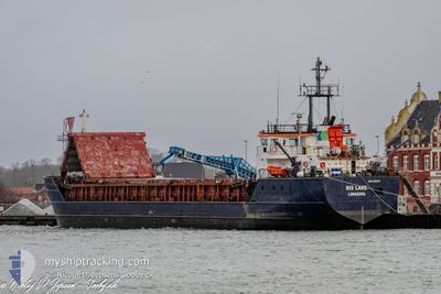
RIX LAKE
General Cargo
Current Trip
| Time Travelled | 20 h, 43 mins |
|---|---|
| Remaining Time | 2 h, 14 mins |
| Distance Travelled | 185.58 nm |
| Remaining Distance | 21.66 nm |
| AVG Speed | 8.7 Knopen |
| MAX Speed | 9.7 Knopen |
| AVG Wind | 16.2 knots |
| MAX Wind | 21 knots |
| MIN Temp | 5.9°C / 42.62°F |
| MAX Temp | 8°C / 46.4°F |
| Diepgang | 3.9 M |
| Positie ontvangen | 1 m geleden |
Current Position
| Lengtegraad | --- |
|---|---|
| Breedtegraat | --- |
| Status | Under way using engine |
| Snelheid | 9.2 Knopen |
| Koers | 97.9° |
| Gebied | Baltic Sea |
| Station | T-AIS |
| Positie ontvangen | 1 m geleden |
Info
Information
The current position of RIX LAKE is in Baltic Sea with coordinates 54.48809° / 15.81605° as reported on 2024-11-27 16:40 by AIS to our vessel tracker app. The vessel's current speed is 9.2 Knopen and is heading at the port of DARLOWO. The estimated time of arrival as calculated by MyShipTracking vessel tracking app is 2024-11-27 18:55 LT
The vessel RIX LAKE (IMO: 9109043, MMSI: 209313000) is a General Cargo that was built in 1995 ( 29 Jaar oud ). It's sailing under the flag of [CY] Cyprus.
In this page you can find informations about the vessels current position, last detected port calls, and current voyage information. If the vessels is not in coverage by AIS you will find the latest position.
The current position of RIX LAKE is detected by our AIS receivers and we are not responsible for the reliability of the data. The last position was recorded while the vessel was in Coverage by the Ais receivers of our vessel tracking app.
The current draught of RIX LAKE as reported by AIS is 3.9 meters
Weather
| Temperature | 7.1°C / 44.78°F |
|---|---|
| Wind Speed | 11 knots |
| Direction | 211° SSW |
| Pressure | 1018.8 hPa |
| Humidity | 80.2 % |
| Cloud Coverage | 78 % |
Featured Company
Last Port Calls
| Port | Arrival | Departure | Time In Port |
|---|---|---|---|
| 2024-11-26 00:53 | 2024-11-26 19:58 | 19 h | |
| 2024-11-23 17:40 | 2024-11-25 12:19 | 1 d | |
| 2024-11-18 08:20 | 2024-11-21 12:58 | 3 d | |
| 2024-11-13 12:30 | 2024-11-15 21:59 | 2 d | |
| 2024-11-11 23:29 | 2024-11-12 15:51 | 16 h | |
| 2024-11-10 07:31 | 2024-11-11 15:56 | 1 d | |
| 2024-11-09 03:52 | 2024-11-09 15:08 | 11 h | |
| 2024-11-07 06:54 | 2024-11-07 19:16 | 12 h | |
| 2024-11-04 14:00 | 2024-11-05 15:11 | 1 d | |
| 2024-10-29 12:00 | 2024-11-02 09:01 | 3 d |
Last Trips
| Origin | Departure | Destination | Arrival | Distance | |
|---|---|---|---|---|---|
| 2024-11-25 13:19 | 2024-11-26 01:53 | 109.99 nm | |||
| 2024-11-21 13:58 | 2024-11-23 18:40 | 261.53 nm | |||
| 2024-11-15 22:59 | 2024-11-18 09:20 | 359.27 nm | |||
| 2024-11-12 16:51 | 2024-11-13 13:30 | 137.73 nm | |||
| 2024-11-11 16:56 | 2024-11-12 00:29 | 59.10 nm | |||
| 2024-11-09 16:08 | 2024-11-10 08:31 | 142.69 nm | |||
| 2024-11-07 20:16 | 2024-11-09 04:52 | 274.00 nm | |||
| 2024-11-05 16:11 | 2024-11-07 07:54 | 382.23 nm | |||
| 2024-11-02 10:01 | 2024-11-04 15:00 | 384.26 nm | |||
| 2024-10-29 07:30 | 2024-10-29 13:00 | 9.69 nm |
Events
| Tijd | Evenement | Details | Positie / Bestemming | Info |
|---|---|---|---|---|
| 2024-11-27 12:27 | Gevonden in zee | Polish part of the Baltic Sea |
54.56970 / 14.73131
Baltic Sea
DARLOWO
|
Snelheid: 8.9 kn Koers: 98.2° |
| 2024-11-27 11:43 | Wijzig zee gebeid | Danish part of the Kattegat German part of the Baltic Sea |
54.58520 / 14.55008
Kattegat
DARLOWO
|
Snelheid: 8.6 kn Koers: 97.6° |
| 2024-11-27 08:16 | Status Changed | Under way using engine Default |
54.69267 / 13.67723
DARLOWO
|
Snelheid: 9.6 kn Koers: 102° |
| 2024-11-27 07:28 | Status Changed | Default Under way using engine |
54.71994 / 13.47088
DARLOWO
|
Snelheid: 8.8 kn Koers: 95.9° |
| 2024-11-27 04:43 | Wijzig zee gebeid | German part of the Baltic Sea Danish part of the Baltic Sea |
54.77014 / 12.78622
Baltic Sea
DARLOWO
|
Snelheid: 9 kn Koers: 152.3° |
| 2024-11-27 02:11 | Wijzig zee gebeid | Danish part of the Baltic Sea Danish part of the Kattegat |
54.83935 / 12.17624
Baltic Sea
DARLOWO
|
Snelheid: 7.7 kn Koers: 144° |
| 2024-11-26 19:58 | Vertrekhaven |
|
55.28350 / 10.82011
DARLOWO
|
Snelheid: 8.6 kn Koers: 121° |
| 2024-11-26 19:46 | Start beweging |
55.29707 / 10.80911
[DK] NYBORG
|
Snelheid: 3.1 kn Koers: 234° |
|
| 2024-11-26 19:31 | Draught Changed | 3.9 3.2 |
55.29905 / 10.80859
[DK] NYBORG
|
Snelheid: Koers: 295° |
| 2024-11-26 19:31 | Destination Changed | DARLOWO NYBORG |
55.29905 / 10.80859
[DK] NYBORG
|
Snelheid: Koers: 295° |