
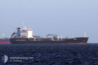
RINA
Oil/Chemical Tanker
Current Trip
| Time Travelled | 20 days |
|---|---|
| Remaining Time | --- |
| Distance Travelled | 489.83 nm |
| Remaining Distance | --- |
| AVG Speed | 7.3 Knopen |
| MAX Speed | 14 Knopen |
| AVG Wind | 13.2 knots |
| MAX Wind | 26.7 knots |
| MIN Temp | -3.2°C / 26.24°F |
| MAX Temp | 8.6°C / 47.48°F |
| Diepgang | 8.4 M |
| Positie ontvangen | 2 m geleden |
Current Position
| Lengtegraad | --- |
|---|---|
| Breedtegraat | --- |
| Status | At anchor |
| Snelheid | |
| Koers | 217° |
| Gebied | Kattegat |
| Station | T-AIS |
| Positie ontvangen | 2 m geleden |
Info
Information
The current position of RINA is in Kattegat with coordinates 57.67915° / 10.60194° as reported on 2025-02-17 19:17 by AIS to our vessel tracker app. The vessel's current speed is 0 Knopen
The vessel RINA (IMO: 9152820, MMSI: 210051000) is a Oil/Chemical Tanker that was built in 1997 ( 28 Jaar oud ). It's sailing under the flag of [CY] Cyprus.
In this page you can find informations about the vessels current position, last detected port calls, and current voyage information. If the vessels is not in coverage by AIS you will find the latest position.
The current position of RINA is detected by our AIS receivers and we are not responsible for the reliability of the data. The last position was recorded while the vessel was in Coverage by the Ais receivers of our vessel tracking app.
The current draught of RINA as reported by AIS is 8.4 meters
Weather
| Temperature | 3.2°C / 37.76°F |
|---|---|
| Wind Speed | 12 knots |
| Direction | 295° WNW |
| Pressure | 1024.4 hPa |
| Humidity | 51.6 % |
| Cloud Coverage | --- |
Featured Company
Last Port Calls
| Port | Arrival | Departure | Time In Port |
|---|---|---|---|
| 2025-01-27 11:36 | 2025-01-28 13:15 | 1 d | |
| 2025-01-11 10:45 | 2025-01-14 04:50 | 2 d |
Most Visited Ports (Last year)
| Port | Arrivals | |
|---|---|---|
| 10 | ||
| 5 | ||
| 3 | ||
| 2 | ||
| 2 | ||
| 1 |
Last Trips
| Origin | Departure | Destination | Arrival | Distance | |
|---|---|---|---|---|---|
| 2025-01-14 04:50 | 2025-01-27 11:36 | 954.80 nm | |||
| 2024-11-23 00:33 | 2025-01-11 10:45 | 746.56 nm |
Events
| Tijd | Evenement | Details | Positie / Bestemming | Info |
|---|---|---|---|---|
| 2025-02-16 21:50 | Status Changed | At anchor Default |
57.67886 / 10.60282
DKSKA
|
Snelheid: Koers: 241° |
| 2025-02-16 21:47 | Status Changed | Default At anchor |
57.67888 / 10.60286
DKSKA
|
Snelheid: Koers: 241° |
| 2025-02-16 20:38 | Status Changed | At anchor Default |
57.67858 / 10.60327
DKSKA
|
Snelheid: Koers: 256° |
| 2025-02-16 20:35 | Status Changed | Default At anchor |
57.67855 / 10.60329
DKSKA
|
Snelheid: Koers: 257° |
| 2025-02-16 13:50 | Status Changed | At anchor Default |
57.67876 / 10.60268
DKSKA
|
Snelheid: Koers: 247° |
| 2025-02-16 13:47 | Status Changed | Default At anchor |
57.67880 / 10.60275
DKSKA
|
Snelheid: Koers: 242° |
| 2025-02-15 20:38 | Status Changed | At anchor Under way using engine |
57.67824 / 10.60109
DKSKA
|
Snelheid: 0.3 kn Koers: 106° |
| 2025-02-15 20:37 | Stop beweging | 2.11 nm, South of SKAGEN |
57.67829 / 10.60121
DKSKA
|
Snelheid: 0.3 kn Koers: 111° |
| 2025-02-15 20:13 | Start beweging | 2.91 nm, South East of SKAGEN |
57.68674 / 10.67154
DKSKA
|
Snelheid: 3.2 kn Koers: 265° |
| 2025-02-15 19:52 | Status Changed | Under way using engine Moored |
57.68592 / 10.67539
DKSKA
|
Snelheid: 0.1 kn Koers: 111° |