
RIJNTRANS
Cargo
Current Trip
| Trip Time | 2 days |
|---|---|
| Trip Distance | 111.60 nm |
| AVG Speed | 6.8 Knopen |
| MAX Speed | 10 Knopen |
| Diepgang | 2.8 M |
| AVG Wind | 8.1 knots |
| MAX Wind | 12.2 knots |
| MIN Temp | 6°C / 42.8°F |
| MAX Temp | 17.1°C / 62.78°F |
| Positie ontvangen | 2 d geleden |
Current Position
| Lengtegraad | 6.18196° |
|---|---|
| Breedtegraat | 49.21607° |
| Status | Under way using engine |
| Snelheid | 6 Knopen |
| Koers | 4.3° |
| Gebied | North Sea |
| Station | T-AIS |
| Positie ontvangen | 2 d geleden |
Info
Information
The current position of RIJNTRANS is in North Sea with coordinates 49.21607° / 6.18196° as reported on 2024-04-25 14:46 by AIS to our vessel tracker app. The vessel's current speed is 6 Knopen and is currently inside the port of KOBLENZ.
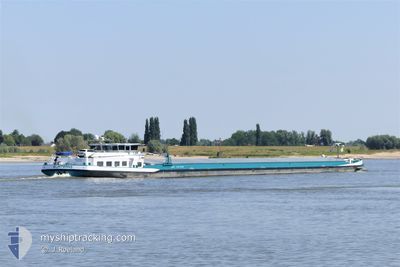
The vessel RIJNTRANS (MMSI: 244710940) is a Cargo It's sailing under the flag of [NL] Netherlands.
In this page you can find informations about the vessels current position, last detected port calls, and current voyage information. If the vessels is not in coverage by AIS you will find the latest position.
The current position of RIJNTRANS is detected by our AIS receivers and we are not responsible for the reliability of the data. The last position was recorded while the vessel was in Coverage by the Ais receivers of our vessel tracking app.
The current draught of RIJNTRANS as reported by AIS is 2.8 meters
Weather
| Temperature | 15.9°C / 60.62°F |
|---|---|
| Wind Speed | 13 knots |
| Direction | 211° SSW |
| Pressure | 1012.1 hPa |
| Humidity | 56.4 % |
| Cloud Coverage | 100 % |
Featured Company
Last Port Calls
| Port | Arrival | Departure | Time In Port |
|---|---|---|---|
| 2024-04-28 11:59 | |||
| 2024-04-25 13:06 | 2024-04-25 14:01 | 55 m | |
| 2024-04-22 18:29 | 2024-04-23 04:36 | 10 h | |
| 2024-04-20 15:34 | 2024-04-21 04:14 | 12 h | |
| 2024-04-20 07:15 | 2024-04-20 07:27 | 12 m | |
| 2024-04-18 18:14 | 2024-04-19 04:27 | 10 h | |
| 2024-04-16 15:29 | 2024-04-16 15:52 | 22 m | |
| 2024-04-14 12:31 | 2024-04-16 13:29 | 2 d | |
| 2024-04-14 10:31 | 2024-04-14 11:00 | 29 m | |
| 2024-04-13 10:33 | 2024-04-13 11:37 | 1 h |
Last Trips
| Origin | Departure | Destination | Arrival | Distance | |
|---|---|---|---|---|---|
| 2024-04-25 16:01 | 2024-04-28 13:59 | 111.60 nm | |||
| 2024-04-23 06:36 | 2024-04-25 15:06 | 49.52 nm | |||
| 2024-04-21 06:14 | 2024-04-22 20:29 | 81.54 nm | |||
| 2024-04-20 09:27 | 2024-04-20 17:34 | 25.49 nm | |||
| 2024-04-19 06:27 | 2024-04-20 09:15 | 68.37 nm | |||
| 2024-04-16 17:52 | 2024-04-18 20:14 | 174.41 nm | |||
| 2024-04-16 15:29 | 2024-04-16 17:29 | 18.37 nm | |||
| 2024-04-14 13:00 | 2024-04-14 14:31 | 17.60 nm | |||
| 2024-04-13 13:37 | 2024-04-14 12:31 | 44.36 nm | |||
| 2024-04-13 08:21 | 2024-04-13 12:33 | 46.96 nm |
Events
| Tijd | Evenement | Details | Positie / Bestemming | Info |
|---|---|---|---|---|
| 2024-04-28 12:38 | Stop beweging |
50.36833 / 7.57833
[DE] KOBLENZ
|
Snelheid: Koers: -1° |
|
| 2024-04-28 11:59 | Aankomsthaven |
|
50.36833 / 7.57833
[DE] KOBLENZ
|
Snelheid: 7 kn Koers: 343° |
| 2024-04-27 18:09 | Stop beweging | 1.57 nm, North of TRABEN TRARBACH |
49.97500 / 7.12667
FROUARD
|
Snelheid: Koers: -1° |
| 2024-04-27 16:17 | Stop beweging | 2.82 nm, North West of BERNKASTEL |
49.94833 / 7.02333
FROUARD
|
Snelheid: Koers: -1° |
| 2024-04-27 11:08 | Start beweging | 3.34 nm, North East of TRIER |
49.78667 / 6.70500
FROUARD
|
Snelheid: 7 kn Koers: 9° |
| 2024-04-27 10:15 | Stop beweging | 1.93 nm, South of TRIER |
49.72833 / 6.62167
FROUARD
|
Snelheid: Koers: -1° |
| 2024-04-27 09:05 | Start beweging | 0.19 nm, East of MERTERT |
49.69667 / 6.48167
FROUARD
|
Snelheid: 5 kn Koers: 49° |
| 2024-04-27 08:33 | Stop beweging | 2.11 nm, South West of MERTERT |
49.67333 / 6.43833
FROUARD
|
Snelheid: Koers: -1° |
| 2024-04-26 15:56 | Start beweging | 14.69 nm, North of LA MAXE |
49.40167 / 6.27500
FROUARD
|
Snelheid: 4 kn Koers: -1° |
| 2024-04-26 15:11 | Stop beweging | 14.3 nm, North of LA MAXE |
49.39667 / 6.26167
FROUARD
|
Snelheid: Koers: -1° |