

RIGHT STEP
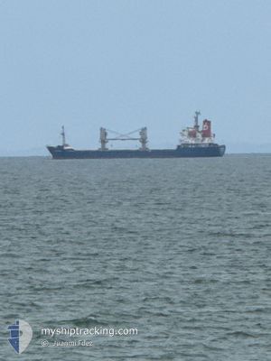
General Cargo

Current Trip
| Trip Time | 4 days |
|---|---|
| Trip Distance | 662.05 nm |
| AVG Speed | 6.3 Knopen |
| MAX Speed | 9.9 Knopen |
| Diepgang | 5.5 M |
| AVG Wind | 15.9 knots |
| MAX Wind | 33 knots |
| MIN Temp | 8.4°C / 47.12°F |
| MAX Temp | 12.9°C / 55.22°F |
| Positie ontvangen | 2 d geleden |
Current Position
| Lengtegraad | --- |
|---|---|
| Breedtegraat | --- |
| Status | Moored |
| Snelheid | |
| Koers | 221° |
| Gebied | Irish Sea and St. George's Channel |
| Station | T-AIS |
| Positie ontvangen | 2 d geleden |
Information
The current position of RIGHT STEP is in Irish Sea and St. George's Channel with coordinates 54.03384° / -6.13445° as reported on 2025-03-26 17:09 by AIS to our vessel tracker app. The vessel's current speed is 0 Knopen and is currently inside the port of GREENORE.
The vessel RIGHT STEP (IMO: 9128013, MMSI: 304816000) is a General Cargo that was built in 1996 ( 29 Jaar oud ). It's sailing under the flag of [AG] Antigua Barbuda.
In this page you can find informations about the vessels current position, last detected port calls, and current voyage information. If the vessels is not in coverage by AIS you will find the latest position.
The current position of RIGHT STEP is detected by our AIS receivers and we are not responsible for the reliability of the data. The last position was recorded while the vessel was in Coverage by the Ais receivers of our vessel tracking app.
The current draught of RIGHT STEP as reported by AIS is 5.5 meters
Weather
| Temperature | 2.7°C / 36.86°F |
|---|---|
| Wind Speed | 6 knots |
| Direction | 246° WSW |
| Pressure | 1018.6 hPa |
| Humidity | 90.6 % |
| Cloud Coverage | 100 % |


Featured Company
Last Port Calls
| Port | Arrival | Departure | Time In Port |
|---|---|---|---|
| 2025-03-25 07:06 | |||
| 2025-03-20 07:12 | 2025-03-21 00:19 | 17 h | |
| 2025-03-14 06:58 | 2025-03-18 08:23 | 4 d | |
| 2025-03-04 05:43 | 2025-03-05 15:30 | 1 d | |
| 2025-02-26 02:27 | 2025-02-27 11:07 | 1 d | |
| 2025-02-13 13:58 | 2025-02-17 20:05 | 4 d | |
| 2025-01-28 15:59 | 2025-02-01 15:31 | 3 d | |
| 2025-01-18 16:19 | 2025-01-20 18:29 | 2 d | |
| 2025-01-13 15:00 | 2025-01-17 18:19 | 4 d | |
| 2025-01-03 13:28 |
Last Trips
| Origin | Departure | Destination | Arrival | Distance | |
|---|---|---|---|---|---|
| 2025-03-21 00:19 | 2025-03-25 07:06 | 662.05 nm | |||
| 2025-03-18 08:23 | 2025-03-20 07:12 | 394.55 nm | |||
| 2025-03-05 15:30 | 2025-03-14 06:58 | 945.74 nm | |||
| 2025-02-27 11:07 | 2025-03-04 05:43 | 505.17 nm | |||
| 2025-02-17 20:05 | 2025-02-26 02:27 | 1467.30 nm | |||
| 2025-02-01 15:31 | 2025-02-13 13:58 | 501.25 nm | |||
| 2025-01-20 18:29 | 2025-01-28 15:59 | 1452.58 nm | |||
| 2025-01-17 18:19 | 2025-01-18 16:19 | 196.61 nm | |||
| 2025-01-03 13:28 | 2025-01-13 15:00 | 1596.60 nm |
Events
| Tijd | Evenement | Details | Positie / Bestemming | Info |
|---|---|---|---|---|
| 2025-03-26 17:15 | Status Changed | Default Moored |
54.03384 / -6.13443
[IE] GREENORE
|
Snelheid: Koers: 221° |
| 2025-03-26 17:09 | Status Changed | Moored Default |
54.03384 / -6.13446
[IE] GREENORE
|
Snelheid: Koers: 221° |
| 2025-03-26 17:09 | Buitenbereik |
54.03384 / -6.13446
Irish Sea and St. George's Channel
[IE] GREENORE
|
Snelheid: Koers: 2.3° |
|
| 2025-03-26 16:51 | Binnenbereik |
54.03384 / -6.13446
Irish Sea and St. George's Channel
[IE] GREENORE
|
Snelheid: Koers: 2.3° |
|
| 2025-03-25 07:27 | Status Changed | Default Moored |
54.03384 / -6.13443
[IE] GREENORE
|
Snelheid: Koers: 222° |
| 2025-03-25 07:09 | Status Changed | Moored Under way using engine |
54.03381 / -6.13447
[IE] GREENORE
|
Snelheid: Koers: 222° |
| 2025-03-25 07:09 | Buitenbereik |
54.03381 / -6.13447
Irish Sea and St. George's Channel
[IE] GREENORE
|
Snelheid: Koers: 357° |
|
| 2025-03-25 07:07 | Stop beweging |
54.03390 / -6.13444
[IE] GREENORE
|
Snelheid: 0.3 kn Koers: 221° |
|
| 2025-03-25 07:06 | Aankomsthaven |
|
54.03410 / -6.13434
[IE] GREENORE
|
Snelheid: 1.9 kn Koers: 192° |
| 2025-03-25 06:55 | Wijzig zee gebeid | Irish part of the Irish Sea and St. George's Channel United Kingdom part of the Irish Sea and St. George's Channel |
54.03690 / -6.12955
Irish Sea and St. George's Channel
IE GRN
|
Snelheid: 3.3 kn Koers: 305.2° |