

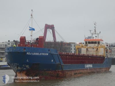
RDJ IJSSELSTROOM
General Cargo

Current Trip
| Time Travelled | 5 days |
|---|---|
| Remaining Time | 3 days |
| Distance Travelled | 436.08 nm |
| Remaining Distance | 811.37 nm |
| AVG Speed | 10.1 Knopen |
| MAX Speed | 11.4 Knopen |
| AVG Wind | 11.8 knots |
| MAX Wind | 22.1 knots |
| MIN Temp | -7.9°C / 17.78°F |
| MAX Temp | 1.9°C / 35.42°F |
| Diepgang | 5.3 M |
| Positie ontvangen | 1 m geleden |
Current Position
| Lengtegraad | --- |
|---|---|
| Breedtegraat | --- |
| Status | Under way using engine |
| Snelheid | 7.9 Knopen |
| Koers | 241.3° |
| Gebied | Baltic Sea |
| Station | T-AIS |
| Positie ontvangen | 1 m geleden |
Information
The current position of RDJ IJSSELSTROOM is in Baltic Sea with coordinates 56.07715° / 16.49468° as reported on 2025-02-21 01:12 by AIS to our vessel tracker app. The vessel's current speed is 7.9 Knopen and is heading at the port of TERNEUZEN. The estimated time of arrival as calculated by MyShipTracking vessel tracking app is 2025-02-25 00:23 LT
The vessel RDJ IJSSELSTROOM (IMO: 9505314, MMSI: 246412000) is a General Cargo that was built in 2010 ( 15 Jaar oud ). It's sailing under the flag of [NL] Netherlands.
In this page you can find informations about the vessels current position, last detected port calls, and current voyage information. If the vessels is not in coverage by AIS you will find the latest position.
The current position of RDJ IJSSELSTROOM is detected by our AIS receivers and we are not responsible for the reliability of the data. The last position was recorded while the vessel was in Coverage by the Ais receivers of our vessel tracking app.
The current draught of RDJ IJSSELSTROOM as reported by AIS is 5.3 meters
Weather
| Temperature | 1.6°C / 34.88°F |
|---|---|
| Wind Speed | 22 knots |
| Direction | 177° S |
| Pressure | 1027.1 hPa |
| Humidity | 72.1 % |
| Cloud Coverage | 31 % |


Featured Company
Last Port Calls
| Port | Arrival | Departure | Time In Port |
|---|---|---|---|
| 2025-02-13 22:22 | 2025-02-15 12:51 | 1 d | |
| 2025-02-05 11:02 | 2025-02-06 18:54 | 1 d | |
| 2025-01-30 12:47 | 2025-02-03 13:09 | 4 d | |
| 2025-01-26 20:00 | 2025-01-27 18:31 | 22 h | |
| 2025-01-19 16:07 | 2025-01-21 18:03 | 2 d | |
| 2025-01-18 02:20 | 2025-01-19 02:41 | 1 d | |
| 2025-01-15 02:55 | 2025-01-15 18:32 | 15 h | |
| 2025-01-12 12:39 | 2025-01-14 18:10 | 2 d | |
| 2025-01-08 00:59 | 2025-01-09 07:34 | 1 d | |
| 2025-01-07 01:36 | 2025-01-07 23:12 | 21 h |
Most Visited Ports (Last year)
| Port | Arrivals | |
|---|---|---|
| 4 | ||
| 4 | ||
| 3 | ||
| 3 | ||
| 3 | ||
| 3 |
Last Trips
| Origin | Departure | Destination | Arrival | Distance | |
|---|---|---|---|---|---|
| 2025-02-06 18:54 | 2025-02-14 00:22 | 1552.48 nm | |||
| 2025-02-03 14:09 | 2025-02-05 11:02 | 419.24 nm | |||
| 2025-01-27 18:31 | 2025-01-30 13:47 | 616.63 nm | |||
| 2025-01-21 19:03 | 2025-01-26 20:00 | 602.65 nm | |||
| 2025-01-19 02:41 | 2025-01-19 17:07 | 150.06 nm | |||
| 2025-01-15 18:32 | 2025-01-18 02:20 | 548.15 nm | |||
| 2025-01-14 18:10 | 2025-01-15 02:55 | 106.64 nm | |||
| 2025-01-09 08:34 | 2025-01-12 12:39 | 662.31 nm | |||
| 2025-01-08 00:12 | 2025-01-08 01:59 | 11.78 nm | |||
| 2025-01-06 23:57 | 2025-01-07 02:36 | 16.42 nm |
Events
| Tijd | Evenement | Details | Positie / Bestemming | Info |
|---|---|---|---|---|
| 2025-02-21 00:20 | Status Changed | Under way using engine Default |
56.13955 / 16.67716
NLTNZ
|
Snelheid: 8.4 kn Koers: 231° |
| 2025-02-21 00:18 | Status Changed | Default Under way using engine |
56.14286 / 16.68473
NLTNZ
|
Snelheid: 8.1 kn Koers: 231.4° |
| 2025-02-21 00:11 | Status Changed | Under way using engine Default |
56.15293 / 16.70763
NLTNZ
|
Snelheid: 8.8 kn Koers: 231° |
| 2025-02-21 00:10 | Binnenbereik |
56.15279 / 16.70733
Baltic Sea
NLTNZ
|
Snelheid: 8.1 kn Koers: 231.4° |
|
| 2025-02-20 14:22 | Status Changed | Default Under way using engine |
57.20087 / 18.85031
NLTNZ
|
Snelheid: 10.7 kn Koers: 216.9° |
| 2025-02-20 14:21 | Status Changed | Under way using engine Default |
57.20289 / 18.85306
NLTNZ
|
Snelheid: 10.6 kn Koers: 217° |
| 2025-02-20 14:21 | Buitenbereik |
57.20289 / 18.85306
Baltic Sea
NLTNZ
|
Snelheid: 10.7 kn Koers: 216.9° |
|
| 2025-02-20 13:57 | Status Changed | Default Under way using engine |
57.25785 / 18.92943
NLTNZ
|
Snelheid: 10.6 kn Koers: 216.5° |
| 2025-02-20 12:03 | Status Changed | Under way using engine Default |
57.52882 / 19.29914
NLTNZ
|
Snelheid: 10.9 kn Koers: 216° |
| 2025-02-20 11:21 | Status Changed | Default Under way using engine |
57.63039 / 19.44157
NLTNZ
|
Snelheid: 11 kn Koers: 216.5° |