
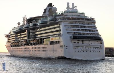
RADIANCE OF THE SEAS
Passengers Ship
Current Trip
| Time Travelled | 11 h, 11 mins |
|---|---|
| Remaining Time | --- |
| Distance Travelled | 186.42 nm |
| Remaining Distance | --- |
| AVG Speed | 16.6 Knopen |
| MAX Speed | 23.2 Knopen |
| AVG Wind | 3.4 knots |
| MAX Wind | 12.6 knots |
| MIN Temp | 3.8°C / 38.84°F |
| MAX Temp | 11.2°C / 52.16°F |
| Diepgang | 8.8 M |
| Positie ontvangen | 1 m geleden |
Current Position
| Lengtegraad | -125.79096° |
|---|---|
| Breedtegraat | 48.34175° |
| Status | Under way using engine |
| Snelheid | 9.4 Knopen |
| Koers | 309.9° |
| Gebied | North Pacific Ocean |
| Station | T-AIS |
| Positie ontvangen | 1 m geleden |
Info
Information
The current position of RADIANCE OF THE SEAS is in North Pacific Ocean with coordinates 48.34175° / -125.79096° as reported on 2024-05-02 13:38 by AIS to our vessel tracker app. The vessel's current speed is 9.4 Knopen
The vessel RADIANCE OF THE SEAS (IMO: 9195195, MMSI: 311319000) is a Passengers Ship that was built in 2001 ( 23 Jaar oud ). It's sailing under the flag of [BS] Bahamas.
In this page you can find informations about the vessels current position, last detected port calls, and current voyage information. If the vessels is not in coverage by AIS you will find the latest position.
The current position of RADIANCE OF THE SEAS is detected by our AIS receivers and we are not responsible for the reliability of the data. The last position was recorded while the vessel was in Coverage by the Ais receivers of our vessel tracking app.
The current draught of RADIANCE OF THE SEAS as reported by AIS is 8.8 meters
Weather
| Temperature | 9.7°C / 49.46°F |
|---|---|
| Wind Speed | 12 knots |
| Direction | 351° N |
| Pressure | 1018 hPa |
| Humidity | 70.7 % |
| Cloud Coverage | --- |
Featured Company
Last Port Calls
| Port | Arrival | Departure | Time In Port |
|---|---|---|---|
| 2024-04-26 04:30 | 2024-05-02 02:29 | 5 d | |
| 2024-04-22 13:06 | 2024-04-23 00:12 | 11 h | |
| 2024-04-19 13:32 | 2024-04-20 00:07 | 10 h | |
| 2024-04-16 13:18 | 2024-04-17 00:25 | 11 h | |
| 2024-04-12 14:45 | 2024-04-12 23:44 | 8 h | |
| 2024-04-11 14:13 | 2024-04-12 00:26 | 10 h | |
| 2024-04-08 09:15 | 2024-04-08 21:42 | 12 h | |
| 2024-04-06 11:15 | 2024-04-06 22:42 | 11 h | |
| 2024-04-04 08:59 | 2024-04-04 21:51 | 12 h | |
| 2024-04-02 14:31 | 2024-04-02 23:51 | 9 h |
Last Trips
| Origin | Departure | Destination | Arrival | Distance | |
|---|---|---|---|---|---|
| 2024-04-22 17:12 | 2024-04-25 21:30 | 1198.43 nm | |||
| 2024-04-19 19:07 | 2024-04-22 06:06 | 1121.06 nm | |||
| 2024-04-16 18:25 | 2024-04-19 08:32 | 1043.77 nm | |||
| 2024-04-12 18:44 | 2024-04-16 07:18 | 1080.59 nm | |||
| 2024-04-11 19:26 | 2024-04-12 09:45 | 284.28 nm | |||
| 2024-04-08 17:42 | 2024-04-11 09:13 | 1301.82 nm | |||
| 2024-04-06 17:42 | 2024-04-08 05:15 | 514.68 nm | |||
| 2024-04-04 17:51 | 2024-04-06 06:15 | 514.58 nm | |||
| 2024-04-02 18:51 | 2024-04-04 04:59 | 512.11 nm | |||
| 2024-04-01 18:37 | 2024-04-02 09:31 | 253.21 nm |
Events
| Tijd | Evenement | Details | Positie / Bestemming | Info |
|---|---|---|---|---|
| 2024-05-02 13:32 | Status Changed | Under way using engine Default |
48.33365 / -125.77012
CAVAN
|
Snelheid: 10.2 kn Koers: 283° |
| 2024-05-02 13:16 | Status Changed | Default Under way using engine |
48.32333 / -125.70500
CAVAN
|
Snelheid: 10.1 kn Koers: 282.3° |
| 2024-05-02 13:13 | Wijzig zee gebeid | Canadian part of the North Pacific Ocean Canadian part of the The Coastal Waters of Southeast Alaska and British Columbia |
48.32090 / -125.69128
North Pacific Ocean
CAVAN
|
Snelheid: 10.1 kn Koers: 282.3° |
| 2024-05-02 13:13 | Status Changed | Under way using engine Default |
48.32090 / -125.69128
CAVAN
|
Snelheid: 10.1 kn Koers: 275° |
| 2024-05-02 13:02 | Binnenbereik |
48.32090 / -125.69128
North Pacific Ocean
CAVAN
|
Snelheid: 10.1 kn Koers: 282.3° |
|
| 2024-05-02 08:35 | Status Changed | Default Under way using engine |
48.29060 / -123.93095
CAVAN
|
Snelheid: 23.2 kn Koers: 276.6° |
| 2024-05-02 08:26 | Buitenbereik |
48.28236 / -123.84955
The Coastal Waters of Southeast Alaska and British Columbia
CAVAN
|
Snelheid: 23.2 kn Koers: 276.6° |
|
| 2024-05-02 06:23 | Wijzig zee gebeid | Canadian part of the The Coastal Waters of Southeast Alaska and British Columbia United States part of the The Coastal Waters of Southeast Alaska and British Columbia |
48.52466 / -123.21073
The Coastal Waters of Southeast Alaska and British Columbia
CAVAN
|
Snelheid: 16.7 kn Koers: 176.1° |
| 2024-05-02 05:47 | Wijzig zee gebeid | United States part of the The Coastal Waters of Southeast Alaska and British Columbia Canadian part of the The Coastal Waters of Southeast Alaska and British Columbia |
48.68787 / -123.25509
The Coastal Waters of Southeast Alaska and British Columbia
CAVAN
|
Snelheid: 16.1 kn Koers: 183.7° |
| 2024-05-02 05:02 | Wijzig zee gebeid | Canadian part of the The Coastal Waters of Southeast Alaska and British Columbia United States part of the The Coastal Waters of Southeast Alaska and British Columbia |
48.79650 / -123.01272
The Coastal Waters of Southeast Alaska and British Columbia
CAVAN
|
Snelheid: 12.5 kn Koers: 206.4° |