

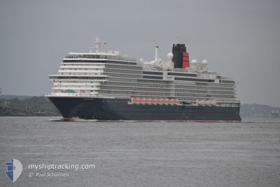
QUEEN ANNE
Passenger

Current Trip
| Time Travelled | 6 days |
|---|---|
| Remaining Time | --- |
| Distance Travelled | 40.63 nm |
| Remaining Distance | --- |
| AVG Speed | 15 Knopen |
| MAX Speed | 17.6 Knopen |
| AVG Wind | 5.7 knots |
| MAX Wind | 7.9 knots |
| MIN Temp | 24°C / 75.2°F |
| MAX Temp | 24.3°C / 75.74°F |
| Diepgang | 8.1 M |
| Positie ontvangen | 6 d geleden |
Current Position
| Lengtegraad | --- |
|---|---|
| Breedtegraat | --- |
| Status | Under way using engine |
| Snelheid | 17.4 Knopen |
| Koers | 199.9° |
| Gebied | North Pacific Ocean |
| Station | T-AIS |
| Positie ontvangen | 6 d geleden |
Information
The current position of QUEEN ANNE is in North Pacific Ocean with coordinates 20.65219° / -158.16008° as reported on 2025-02-11 07:03 by AIS to our vessel tracker app. The vessel's current speed is 17.4 Knopen
The vessel QUEEN ANNE (IMO: 9839399, MMSI: 310835000) is a Passenger It's sailing under the flag of [BM] Bermuda.
In this page you can find informations about the vessels current position, last detected port calls, and current voyage information. If the vessels is not in coverage by AIS you will find the latest position.
The current position of QUEEN ANNE is detected by our AIS receivers and we are not responsible for the reliability of the data. The last position was recorded while the vessel was in Coverage by the Ais receivers of our vessel tracking app.
The current draught of QUEEN ANNE as reported by AIS is 8.1 meters
Weather
| Temperature | 24.2°C / 75.56°F |
|---|---|
| Wind Speed | 8 knots |
| Direction | 131° SE |
| Pressure | 1019.7 hPa |
| Humidity | 67.7 % |
| Cloud Coverage | 10 % |


Featured Company
Last Port Calls
| Port | Arrival | Departure | Time In Port |
|---|---|---|---|
| 2025-02-09 17:19 | 2025-02-11 04:25 | 1 d | |
| 2025-02-03 12:56 | 2025-02-05 02:37 | 1 d | |
| 2025-01-24 10:56 | 2025-01-24 19:28 | 8 h | |
| 2025-01-21 10:29 | 2025-01-21 23:33 | 13 h | |
| 2025-01-18 09:54 | 2025-01-19 00:14 | 14 h | |
| 2025-01-09 05:16 | 2025-01-09 21:07 | 15 h | |
| 2025-01-07 04:24 | 2025-01-07 18:40 | 14 h | |
| 2025-01-05 05:21 | 2025-01-05 17:09 | 11 h | |
| 2025-01-03 06:55 | 2025-01-03 16:47 | 9 h | |
| 2024-12-29 07:10 | 2024-12-29 23:23 | 16 h |
Last Trips
| Origin | Departure | Destination | Arrival | Distance | |
|---|---|---|---|---|---|
| 2025-02-04 18:37 | 2025-02-09 07:19 | 2097.73 nm | |||
| 2025-01-24 14:28 | 2025-02-03 04:56 | 3489.22 nm | |||
| 2025-01-21 18:33 | 2025-01-24 05:56 | 1097.34 nm | |||
| 2025-01-18 19:14 | 2025-01-21 05:29 | 965.57 nm | |||
| 2025-01-09 21:07 | 2025-01-18 04:54 | 3380.96 nm | |||
| 2025-01-07 19:40 | 2025-01-09 05:16 | 518.86 nm | |||
| 2025-01-05 17:09 | 2025-01-07 05:24 | 534.73 nm | |||
| 2025-01-03 17:47 | 2025-01-05 05:21 | 598.71 nm | |||
| 2024-12-29 23:23 | 2025-01-03 07:55 | 1008.83 nm | |||
| 2024-12-27 17:58 | 2024-12-29 07:10 | 240.47 nm |
Events
| Tijd | Evenement | Details | Positie / Bestemming | Info |
|---|---|---|---|---|
| 2025-02-11 07:03 | Buitenbereik |
20.65219 / -158.16008
North Pacific Ocean
USHNL > WSAPW
|
Snelheid: 17.4 kn Koers: 199.9° |
|
| 2025-02-11 04:25 | Vertrekhaven |
|
21.29326 / -157.87243
USHNL > WSAPW
|
Snelheid: 6.5 kn Koers: 208° |
| 2025-02-11 04:19 | Start beweging |
21.30069 / -157.86835
[US] HONOLULU
|
Snelheid: 3.5 kn Koers: 205° |
|
| 2025-02-11 03:54 | Status Changed | Under way using engine Moored |
21.30267 / -157.86497
[US] HONOLULU
|
Snelheid: Koers: 39° |
| 2025-02-11 01:01 | ETA Changed | 2025/02/17 20:00 2025/02/09 17:00 |
21.30266 / -157.86496
[US] HONOLULU
|
Snelheid: Koers: 39° |
| 2025-02-11 01:01 | Destination Changed | USHNL > WSAPW USSFO > USHNL |
21.30266 / -157.86496
[US] HONOLULU
|
Snelheid: Koers: 39° |
| 2025-02-09 17:43 | Status Changed | Moored Under way using engine |
21.30256 / -157.86497
[US] HONOLULU
|
Snelheid: Koers: 39° |
| 2025-02-09 17:34 | Stop beweging |
21.30232 / -157.86526
[US] HONOLULU
|
Snelheid: 0.2 kn Koers: 43° |
|
| 2025-02-09 17:19 | Aankomsthaven |
|
21.29457 / -157.87166
[US] HONOLULU
|
Snelheid: 6 kn Koers: 28.6° |
| 2025-02-09 12:53 | Wijzig zee gebeid | United States (Hawaii) part of the North Pacific Ocean United States part of the North Pacific Ocean |
21.68454 / -156.95898
North Pacific Ocean
USSFO > USHNL
|
Snelheid: 18.4 kn Koers: 229.6° |