
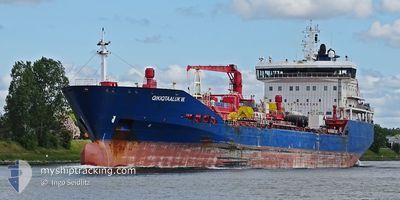
QIKIQTAALUK W.
Oil/Chemical Tanker
Current Trip
| Time Travelled | 6 days |
|---|---|
| Remaining Time | --- |
| Distance Travelled | 229.73 nm |
| Remaining Distance | --- |
| AVG Speed | 11.7 Knopen |
| MAX Speed | 13.3 Knopen |
| AVG Wind | 6 knots |
| MAX Wind | 10.8 knots |
| MIN Temp | 3.5°C / 38.3°F |
| MAX Temp | 14.6°C / 58.28°F |
| Diepgang | 8.2 M |
| Positie ontvangen | 5 d geleden |
Current Position
| Lengtegraad | -58.33297° |
|---|---|
| Breedtegraat | 49.13206° |
| Status | Under way using engine |
| Snelheid | 8 Knopen |
| Koers | 165.1° |
| Gebied | Gulf of St-Lawrence |
| Station | T-AIS |
| Positie ontvangen | 5 d geleden |
Info
Information
The current position of QIKIQTAALUK W. is in Gulf of St-Lawrence with coordinates 49.13206° / -58.33297° as reported on 2024-05-31 20:42 by AIS to our vessel tracker app. The vessel's current speed is 8 Knopen
The vessel QIKIQTAALUK W. (IMO: 9421221, MMSI: 316037697) is a Oil/Chemical Tanker that was built in 2011 ( 13 Jaar oud ). It's sailing under the flag of [CA] Canada.
In this page you can find informations about the vessels current position, last detected port calls, and current voyage information. If the vessels is not in coverage by AIS you will find the latest position.
The current position of QIKIQTAALUK W. is detected by our AIS receivers and we are not responsible for the reliability of the data. The last position was recorded while the vessel was in Coverage by the Ais receivers of our vessel tracking app.
The current draught of QIKIQTAALUK W. as reported by AIS is 8.2 meters
Weather
| Temperature | 8.1°C / 46.58°F |
|---|---|
| Wind Speed | 4 knots |
| Direction | 96° E |
| Pressure | 1009.4 hPa |
| Humidity | 96.6 % |
| Cloud Coverage | 99 % |
Featured Company
Last Port Calls
| Port | Arrival | Departure | Time In Port |
|---|---|---|---|
| 2024-05-30 13:00 | 2024-05-30 23:56 | 10 h | |
| 2024-05-26 11:35 | 2024-05-26 22:07 | 10 h | |
| 2024-05-22 23:00 | 2024-05-24 12:43 | 1 d | |
| 2024-05-21 14:02 | 2024-05-22 01:26 | 11 h | |
| 2024-05-11 07:10 | 2024-05-11 22:42 | 15 h | |
| 2024-05-06 14:00 | 2024-05-10 06:43 | 3 d | |
| 2024-05-03 03:09 | 2024-05-03 05:03 | 1 h | |
| 2024-05-01 20:06 | 2024-05-01 20:42 | 36 m | |
| 2024-04-28 12:01 | 2024-04-30 00:14 | 1 d | |
| 2024-04-26 06:30 | 2024-04-27 10:56 | 1 d |
Most Visited Ports (Last year)
| Port | Arrivals | |
|---|---|---|
| 13 | ||
| 10 | ||
| 5 | ||
| 4 | ||
| 4 | ||
| 3 |
Last Trips
| Origin | Departure | Destination | Arrival | Distance | |
|---|---|---|---|---|---|
| 2024-05-26 22:07 | 2024-05-30 13:00 | 587.18 nm | |||
| 2024-05-24 12:43 | 2024-05-26 11:35 | 608.17 nm | |||
| 2024-05-22 01:26 | 2024-05-22 23:00 | 262.50 nm | |||
| 2024-05-11 22:42 | 2024-05-21 14:02 | 547.36 nm | |||
| 2024-05-10 06:43 | 2024-05-11 07:10 | 265.38 nm | |||
| 2024-05-03 05:03 | 2024-05-06 14:00 | 968.62 nm | |||
| 2024-05-01 20:42 | 2024-05-03 03:09 | 297.56 nm | |||
| 2024-04-30 00:14 | 2024-05-01 20:06 | 298.41 nm | |||
| 2024-04-27 10:56 | 2024-04-28 12:01 | 6.64 nm | |||
| 2024-04-25 01:30 | 2024-04-26 06:30 | 285.71 nm |
Events
| Tijd | Evenement | Details | Positie / Bestemming | Info |
|---|---|---|---|---|
| 2024-05-31 21:14 | Stop beweging | 16.78 nm, North West of CORNER BROOK |
49.09333 / -58.31833
CORNER BROOK
|
Snelheid: Koers: -1° |
| 2024-05-31 20:47 | Status Changed | Default Under way using engine |
49.12167 / -58.32834
CORNER BROOK
|
Snelheid: 8 kn Koers: 165.1° |
| 2024-05-31 20:42 | Buitenbereik |
49.13206 / -58.33297
Gulf of St-Lawrence
CORNER BROOK
|
Snelheid: 8 kn Koers: 165.1° |
|
| 2024-05-31 20:27 | Destination Changed | CORNER BROOK SYDNEY,NS |
49.15861 / -58.38181
CORNER BROOK
|
Snelheid: 12.3 kn Koers: 98.9° |
| 2024-05-31 20:27 | ETA Changed | 2024/05/31 21:30 2024/05/30 14:30 |
49.15861 / -58.38181
CORNER BROOK
|
Snelheid: 12.3 kn Koers: 98.9° |
| 2024-05-31 20:27 | Status Changed | Under way using engine Default |
49.15861 / -58.38181
SYDNEY,NS
|
Snelheid: 13 kn Koers: 87° |
| 2024-05-31 20:11 | Binnenbereik |
49.15821 / -58.37835
Gulf of St-Lawrence
CORNER BROOK
|
Snelheid: 12.1 kn Koers: 100.4° |
|
| 2024-05-31 02:56 | Vertrekhaven |
|
46.14761 / -60.20957
SYDNEY,NS
|
Snelheid: 3.7 kn Koers: 308° |
| 2024-05-31 02:52 | Start beweging |
46.14304 / -60.20325
[CA] SYDNEY (NS)
|
Snelheid: 3.7 kn Koers: 308° |
|
| 2024-05-30 16:04 | Stop beweging |
46.14189 / -60.20055
[CA] SYDNEY (NS)
|
Snelheid: 0.2 kn Koers: 334° |