
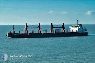
POYANG
Cargo
Current Trip
| Time Travelled | 31 days |
|---|---|
| Remaining Time | --- |
| Distance Travelled | 7471.34 nm |
| Remaining Distance | --- |
| AVG Speed | 11.3 Knopen |
| MAX Speed | 14.8 Knopen |
| AVG Wind | 14.5 knots |
| MAX Wind | 32 knots |
| MIN Temp | -0.5°C / 31.1°F |
| MAX Temp | 28.6°C / 83.48°F |
| Diepgang | 7.2 M |
| Positie ontvangen | 2 d geleden |
Current Position
| Lengtegraad | --- |
|---|---|
| Breedtegraat | --- |
| Status | Under way using engine |
| Snelheid | 8.7 Knopen |
| Koers | 355.8° |
| Gebied | Tasman Sea |
| Station | T-AIS |
| Positie ontvangen | 2 d geleden |
Info
Information
The current position of POYANG is in Tasman Sea with coordinates -45.48693° / 165.99297° as reported on 2025-02-14 19:23 by AIS to our vessel tracker app. The vessel's current speed is 8.7 Knopen and is heading at the port of NEWCASTLE. The estimated time of arrival as calculated by MyShipTracking vessel tracking app is 2025-02-18 12:00 LT
The vessel POYANG (IMO: 9721580, MMSI: 477669100) is a Cargo It's sailing under the flag of [HK] Hong Kong.
In this page you can find informations about the vessels current position, last detected port calls, and current voyage information. If the vessels is not in coverage by AIS you will find the latest position.
The current position of POYANG is detected by our AIS receivers and we are not responsible for the reliability of the data. The last position was recorded while the vessel was in Coverage by the Ais receivers of our vessel tracking app.
The current draught of POYANG as reported by AIS is 7.2 meters
Weather
| Temperature | 16.4°C / 61.52°F |
|---|---|
| Wind Speed | 21 knots |
| Direction | 122° ESE |
| Pressure | 1002.9 hPa |
| Humidity | 93.6 % |
| Cloud Coverage | 100 % |
Featured Company
Last Port Calls
| Port | Arrival | Departure | Time In Port |
|---|---|---|---|
| 2025-01-06 04:41 | 2025-01-16 18:58 | 10 d | |
| 2025-01-04 08:48 | 2025-01-04 20:47 | 11 h | |
| 2025-01-01 05:21 | 2025-01-04 06:35 | 3 d | |
| 2024-12-19 15:20 | 2024-12-21 14:33 | 1 d |
Most Visited Ports (Last year)
| Port | Arrivals | |
|---|---|---|
| 3 | ||
| 1 | ||
| 1 | ||
| 1 | ||
| 1 | ||
| 1 |
Last Trips
| Origin | Departure | Destination | Arrival | Distance | |
|---|---|---|---|---|---|
| 2025-01-04 20:47 | 2025-01-06 04:41 | 368.27 nm | |||
| 2025-01-04 06:35 | 2025-01-04 08:48 | 28.69 nm | |||
| 2024-12-21 14:33 | 2025-01-01 05:21 | 1418.68 nm | |||
| 2024-11-24 10:27 | 2024-12-19 15:20 | 6731.95 nm |
Events
| Tijd | Evenement | Details | Positie / Bestemming | Info |
|---|---|---|---|---|
| 2025-02-14 19:28 | Status Changed | Default Under way using engine |
-45.47580 / 165.99185
AU NTL
|
Snelheid: 8.7 kn Koers: 355.8° |
| 2025-02-14 19:23 | Status Changed | Under way using engine Default |
-45.48693 / 165.99297
AU NTL
|
Snelheid: 8.7 kn Koers: 356° |
| 2025-02-14 19:23 | Buitenbereik |
-45.48693 / 165.99297
Tasman Sea
AU NTL
|
Snelheid: 8.7 kn Koers: 355.8° |
|
| 2025-02-14 19:18 | Status Changed | Default Under way using engine |
-45.49975 / 165.99438
AU NTL
|
Snelheid: 8.6 kn Koers: 353.1° |
| 2025-02-14 16:16 | Draught Changed | 7.2 9.4 |
-45.91267 / 166.17145
AU NTL
|
Snelheid: 8.8 kn Koers: 338.3° |
| 2025-02-14 16:16 | Destination Changed | AU NTL NZ BLU |
-45.91267 / 166.17145
AU NTL
|
Snelheid: 8.8 kn Koers: 338.3° |
| 2025-02-14 16:16 | ETA Changed | 2025/02/18 01:00 2025/02/10 12:30 |
-45.91267 / 166.17145
AU NTL
|
Snelheid: 8.8 kn Koers: 338.3° |
| 2025-02-14 15:57 | Status Changed | Under way using engine Default |
-45.95562 / 166.19725
NZ BLU
|
Snelheid: 8.2 kn Koers: 335° |
| 2025-02-14 15:48 | Status Changed | Default Under way using engine |
-45.97370 / 166.21008
NZ BLU
|
Snelheid: 8.4 kn Koers: 332.2° |
| 2025-02-14 15:41 | Gevonden in zee | New Zealand part of the Tasman Sea |
-45.98745 / 166.22000
Tasman Sea
|
Snelheid: 8.4 kn Koers: 332.2° |