
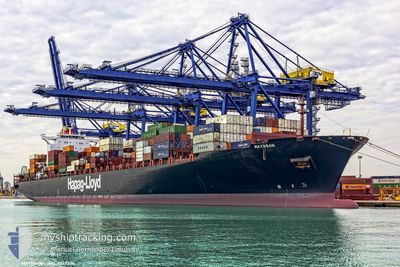
POTOMAC EXPRESS
Container Ship
Current Trip
KRBNP
| Time Travelled | 21 h, 13 mins |
|---|---|
| Remaining Time | --- |
| Distance Travelled | 21.05 nm |
| Remaining Distance | --- |
| AVG Speed | 8 Knopen |
| MAX Speed | 12 Knopen |
| AVG Wind | 9.7 knots |
| MAX Wind | 11 knots |
| MIN Temp | 1.3°C / 34.34°F |
| MAX Temp | 2.6°C / 36.68°F |
| Diepgang | 11 M |
| Positie ontvangen | 3 d geleden |
Current Position
| Lengtegraad | --- |
|---|---|
| Breedtegraat | --- |
| Status | Under way using engine |
| Snelheid | 18.7 Knopen |
| Koers | 190.7° |
| Gebied | North Pacific Ocean |
| Station | T-AIS |
| Positie ontvangen | 3 d geleden |
Info
Information
The current position of POTOMAC EXPRESS is in North Pacific Ocean with coordinates 35.04693° / 139.69364° as reported on 2026-01-05 08:39 by AIS to our vessel tracker app. The vessel's current speed is 18.7 Knopen
The vessel POTOMAC EXPRESS (IMO: 9349526, MMSI: 366418000) is a Container Ship that was built in 2008 ( 18 Jaar oud ). It's sailing under the flag of [US] USA.
In this page you can find informations about the vessels current position, last detected port calls, and current voyage information. If the vessels is not in coverage by AIS you will find the latest position.
The current position of POTOMAC EXPRESS is detected by our AIS receivers and we are not responsible for the reliability of the data. The last position was recorded while the vessel was in Coverage by the Ais receivers of our vessel tracking app.
The current draught of POTOMAC EXPRESS as reported by AIS is 11 meters
Weather
| Temperature | 5.5°C / 41.9°F |
|---|---|
| Wind Speed | 12 knots |
| Direction | 262° W |
| Pressure | 1020.7 hPa |
| Humidity | 47.9 % |
| Cloud Coverage | --- |
Featured Company
Last Port Calls
| Port | Arrival | Departure | Time In Port |
|---|---|---|---|
| 2026-01-07 17:45 | 2026-01-08 18:31 | 1 d | |
| 2026-01-05 07:30 | 2026-01-05 15:59 | 8 h | |
| 2025-12-16 13:55 | 2025-12-21 05:21 | 4 d | |
| 2025-11-27 02:37 | 2025-11-28 02:49 | 1 d | |
| 2025-11-23 17:17 | 2025-11-24 11:29 | 18 h | |
| 2025-11-05 14:15 | 2025-11-12 06:22 | 6 d |
Most Visited Ports (Last year)
| Port | Arrivals | |
|---|---|---|
| 7 | ||
| 7 | ||
| 6 | ||
| 2 | ||
| 2 | ||
| 2 |
Last Trips
| Origin | Departure | Destination | Arrival | Distance | |
|---|---|---|---|---|---|
| 2026-01-05 15:59 | 2026-01-07 17:45 | 870.78 nm | |||
| 2025-12-21 05:21 | 2026-01-05 07:30 | 5609.29 nm | |||
| 2025-11-28 02:49 | 2025-12-16 13:55 | 6447.83 nm | |||
| 2025-11-24 11:29 | 2025-11-27 02:37 | 885.47 nm | |||
| 2025-11-12 06:22 | 2025-11-23 17:17 | 5119.47 nm | |||
| 2025-10-25 01:36 | 2025-11-05 14:15 | 5713.21 nm |
Events
| Tijd | Evenement | Details | Positie / Bestemming | Info |
|---|---|---|---|---|
| 2026-01-08 12:17 | Stop beweging | 5.73 nm, South of BUSAN |
35.01083 / 129.08128
KRBNP
|
Snelheid: 0.3 kn Koers: 329° |
| 2026-01-08 09:31 | Vertrekhaven |
|
35.05127 / 128.77841
KRBNP
|
Snelheid: 7.7 kn Koers: 259° |
| 2026-01-08 09:17 | Start beweging |
35.07538 / 128.80843
[KR] BUSAN NEW PORT
|
Snelheid: 4.6 kn Koers: 259° |
|
| 2026-01-07 09:37 | Stop beweging |
35.07733 / 128.81413
[KR] BUSAN NEW PORT
|
Snelheid: Koers: 269° |
|
| 2026-01-07 08:45 | Aankomsthaven |
|
35.06024 / 128.78548
[KR] BUSAN NEW PORT
|
Snelheid: 9.2 kn Koers: 0° |
| 2026-01-05 08:40 | Status Changed | Default Under way using engine |
35.03849 / 139.69231
KRBNP
|
Snelheid: 18.7 kn Koers: 190.7° |
| 2026-01-05 08:39 | Buitenbereik |
35.04693 / 139.69364
North Pacific Ocean
KRBNP
|
Snelheid: 18.7 kn Koers: 190.7° |
|
| 2026-01-05 08:31 | Status Changed | Under way using engine Default |
35.07957 / 139.72142
KRBNP
|
Snelheid: 19 kn Koers: 201° |
| 2026-01-05 08:25 | Status Changed | Default Under way using engine |
35.10828 / 139.73303
KRBNP
|
Snelheid: 19 kn Koers: 180.9° |
| 2026-01-05 06:59 | Vertrekhaven |
|
35.38249 / 139.68527
KRBNP
|
Snelheid: 13.4 kn Koers: 150° |