

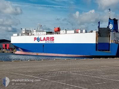
POLARIS PRINCESS
Vehicles Carrier

Current Trip
| Time Travelled | 6 h, 14 mins |
|---|---|
| Remaining Time | 12 h, 1 mins |
| Distance Travelled | 84.63 nm |
| Remaining Distance | 196.40 nm |
| AVG Speed | 15.5 Knopen |
| MAX Speed | 15.9 Knopen |
| AVG Wind | 10.9 knots |
| MAX Wind | 14.1 knots |
| MIN Temp | 13.7°C / 56.66°F |
| MAX Temp | 14°C / 57.2°F |
| Diepgang | 5.1 M |
| Positie ontvangen | 2 m geleden |
Current Position
| Lengtegraad | --- |
|---|---|
| Breedtegraat | --- |
| Status | Under way using engine |
| Snelheid | 15.4 Knopen |
| Koers | 304.4° |
| Gebied | Tyrrhenian Sea |
| Station | T-AIS |
| Positie ontvangen | 2 m geleden |
Information
The current position of POLARIS PRINCESS is in Tyrrhenian Sea with coordinates 42.77537° / 9.91343° as reported on 2025-02-22 03:20 by AIS to our vessel tracker app. The vessel's current speed is 15.4 Knopen and is heading at the port of TOULON. The estimated time of arrival as calculated by MyShipTracking vessel tracking app is 2025-02-22 15:23 LT
The vessel POLARIS PRINCESS (IMO: 9136967, MMSI: 538009732) is a Vehicles Carrier that was built in 1996 ( 29 Jaar oud ). It's sailing under the flag of [MH] Marshall Is.
In this page you can find informations about the vessels current position, last detected port calls, and current voyage information. If the vessels is not in coverage by AIS you will find the latest position.
The current position of POLARIS PRINCESS is detected by our AIS receivers and we are not responsible for the reliability of the data. The last position was recorded while the vessel was in Coverage by the Ais receivers of our vessel tracking app.
The current draught of POLARIS PRINCESS as reported by AIS is 5.1 meters
Weather
| Temperature | 13.9°C / 57.02°F |
|---|---|
| Wind Speed | 14 knots |
| Direction | 170° S |
| Pressure | 1026.2 hPa |
| Humidity | 87 % |
| Cloud Coverage | 49 % |


Featured Company
Last Port Calls
| Port | Arrival | Departure | Time In Port |
|---|---|---|---|
| 2025-02-21 07:08 | 2025-02-21 21:08 | 13 h | |
| 2025-02-16 07:05 | 2025-02-16 18:31 | 11 h | |
| 2025-02-09 05:05 | 2025-02-09 12:30 | 7 h | |
| 2025-02-06 14:46 | 2025-02-07 02:52 | 12 h | |
| 2025-02-03 09:32 | 2025-02-03 19:50 | 10 h | |
| 2025-01-31 19:41 | 2025-02-01 11:14 | 15 h | |
| 2025-01-30 12:49 | 2025-01-30 17:52 | 5 h | |
| 2025-01-29 02:43 | 2025-01-29 10:39 | 7 h | |
| 2025-01-26 05:47 | 2025-01-26 14:24 | 8 h | |
| 2025-01-25 08:32 | 2025-01-25 16:14 | 7 h |
Most Visited Ports (Last year)
| Port | Arrivals | |
|---|---|---|
| 20 | ||
| 19 | ||
| 14 | ||
| 9 | ||
| 7 | ||
| 6 |
Last Trips
| Origin | Departure | Destination | Arrival | Distance | |
|---|---|---|---|---|---|
| 2025-02-16 21:31 | 2025-02-21 08:08 | 1405.54 nm | |||
| 2025-02-09 13:30 | 2025-02-16 10:05 | 2382.03 nm | |||
| 2025-02-07 03:52 | 2025-02-09 06:05 | 555.55 nm | |||
| 2025-02-03 20:50 | 2025-02-06 15:46 | 682.21 nm | |||
| 2025-02-01 12:14 | 2025-02-03 10:32 | 264.06 nm | |||
| 2025-01-30 18:52 | 2025-01-31 20:41 | 214.05 nm | |||
| 2025-01-29 11:39 | 2025-01-30 13:49 | 263.57 nm | |||
| 2025-01-26 15:24 | 2025-01-29 03:43 | 745.22 nm | |||
| 2025-01-25 17:14 | 2025-01-26 06:47 | 101.22 nm | |||
| 2025-01-24 15:08 | 2025-01-25 09:32 | 195.29 nm |
Events
| Tijd | Evenement | Details | Positie / Bestemming | Info |
|---|---|---|---|---|
| 2025-02-22 03:09 | Status Changed | Under way using engine Default |
42.75056 / 9.96382
FRTLN
|
Snelheid: 15.9 kn Koers: 305° |
| 2025-02-22 02:46 | Status Changed | Default Under way using engine |
42.69554 / 10.07537
FRTLN
|
Snelheid: 15.8 kn Koers: 306.1° |
| 2025-02-22 02:33 | Status Changed | Under way using engine Default |
42.66201 / 10.13836
FRTLN
|
Snelheid: 15.7 kn Koers: 308° |
| 2025-02-22 02:29 | Status Changed | Default Under way using engine |
42.65214 / 10.15503
FRTLN
|
Snelheid: 15.4 kn Koers: 308° |
| 2025-02-22 02:21 | Status Changed | Under way using engine Default |
42.62958 / 10.19334
FRTLN
|
Snelheid: 15.4 kn Koers: 306° |
| 2025-02-22 02:17 | Status Changed | Default Under way using engine |
42.61875 / 10.21257
FRTLN
|
Snelheid: 15.3 kn Koers: 306.3° |
| 2025-02-22 01:59 | Status Changed | Under way using engine Default |
42.57266 / 10.29590
FRTLN
|
Snelheid: 15.2 kn Koers: 308° |
| 2025-02-22 01:57 | Status Changed | Default Under way using engine |
42.56930 / 10.30198
FRTLN
|
Snelheid: 15 kn Koers: 307.8° |
| 2025-02-22 01:51 | Status Changed | Under way using engine Default |
42.55297 / 10.33073
FRTLN
|
Snelheid: 15 kn Koers: 309° |
| 2025-02-22 01:49 | Status Changed | Default Under way using engine |
42.54891 / 10.33775
FRTLN
|
Snelheid: 15 kn Koers: 307.6° |