

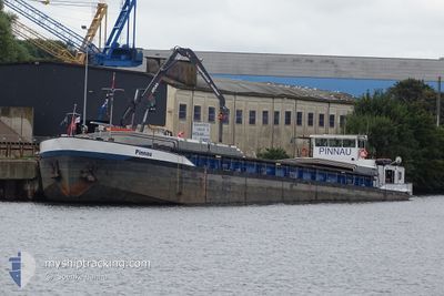
PINNAU
Other Type

Current Trip
OLDENBURG
| Time Travelled | 14 h, 7 mins |
|---|---|
| Remaining Time | --- |
| Distance Travelled | 49.61 nm |
| Remaining Distance | --- |
| AVG Speed | 6.1 Knopen |
| MAX Speed | 6.7 Knopen |
| AVG Wind | 3.9 knots |
| MAX Wind | 5.3 knots |
| MIN Temp | 12.1°C / 53.78°F |
| MAX Temp | 18.9°C / 66.02°F |
| Diepgang | 0.3 M |
| Positie ontvangen | 7 m geleden |
Current Position
| Lengtegraad | --- |
|---|---|
| Breedtegraat | --- |
| Status | Moored |
| Snelheid | |
| Koers | 80° |
| Gebied | North Sea |
| Station | T-AIS |
| Positie ontvangen | 7 m geleden |
Information
The current position of PINNAU is in North Sea with coordinates 52.38256° / 9.25936° as reported on 2025-04-28 22:00 by AIS to our vessel tracker app. The vessel's current speed is 0 Knopen
The vessel PINNAU (MMSI: 211511440) is a Other Type It's sailing under the flag of [DE] Germany.
In this page you can find informations about the vessels current position, last detected port calls, and current voyage information. If the vessels is not in coverage by AIS you will find the latest position.
The current position of PINNAU is detected by our AIS receivers and we are not responsible for the reliability of the data. The last position was recorded while the vessel was in Coverage by the Ais receivers of our vessel tracking app.
The current draught of PINNAU as reported by AIS is 0.3 meters
Weather
| Temperature | 10.1°C / 50.18°F |
|---|---|
| Wind Speed | 4 knots |
| Direction | 2° N |
| Pressure | 1027.1 hPa |
| Humidity | 73.5 % |
| Cloud Coverage | 100 % |


Featured Company
Last Port Calls
| Port | Arrival | Departure | Time In Port |
|---|---|---|---|
| 2025-04-25 13:54 | 2025-04-28 10:00 | 2 d | |
| 2025-04-19 10:48 | 2025-04-22 07:41 | 2 d | |
| 2025-04-13 15:33 | 2025-04-14 02:30 | 10 h | |
| 2025-04-07 16:36 | 2025-04-13 10:22 | 5 d | |
| 2025-04-03 15:19 | 2025-04-06 20:38 | 3 d | |
| 2025-04-03 06:12 | 2025-04-03 09:55 | 3 h | |
| 2025-04-02 18:55 | 2025-04-03 02:03 | 7 h | |
| 2025-04-01 19:22 | 2025-04-02 14:11 | 18 h | |
| 2025-03-30 15:59 | 2025-04-01 09:41 | 1 d | |
| 2025-03-24 21:36 | 2025-03-25 06:32 | 8 h |
Last Trips
| Origin | Departure | Destination | Arrival | Distance | |
|---|---|---|---|---|---|
| 2025-04-22 07:41 | 2025-04-25 13:54 | 184.80 nm | |||
| 2025-04-14 02:30 | 2025-04-19 10:48 | 201.30 nm | |||
| 2025-04-13 10:22 | 2025-04-13 15:33 | 45.58 nm | |||
| 2025-04-06 20:38 | 2025-04-07 16:36 | 5.23 nm | |||
| 2025-04-03 09:55 | 2025-04-03 15:19 | 45.34 nm | |||
| 2025-04-03 02:03 | 2025-04-03 06:12 | 41.60 nm | |||
| 2025-04-02 14:11 | 2025-04-02 18:55 | 31.01 nm | |||
| 2025-04-01 09:41 | 2025-04-01 19:22 | 67.93 nm | |||
| 2025-03-25 06:32 | 2025-03-30 15:59 | 226.93 nm | |||
| 2025-03-24 19:45 | 2025-03-24 21:36 | 12.49 nm |
Events
| Tijd | Evenement | Details | Positie / Bestemming | Info |
|---|---|---|---|---|
| 2025-04-28 19:56 | Binnenbereik |
52.38255 / 9.25935
North Sea
|
Snelheid: Koers: 166.4° |
|
| 2025-04-28 17:14 | Status Changed | Default Under way using engine |
52.38251 / 9.25901
OLDENBURG
|
Snelheid: 2 kn Koers: 80° |
| 2025-04-28 17:12 | Buitenbereik |
52.38246 / 9.25852
North Sea
|
Snelheid: 2 kn Koers: 81° |
|
| 2025-04-28 17:08 | Binnenbereik |
52.38157 / 9.25238
North Sea
|
Snelheid: 4.3 kn Koers: 80.7° |
|
| 2025-04-28 15:43 | Buitenbereik |
52.31467 / 9.06175
North Sea
|
Snelheid: 6.1 kn Koers: 59.3° |
|
| 2025-04-28 14:37 | Binnenbereik |
52.30165 / 8.90140
North Sea
|
Snelheid: 5.4 kn Koers: 91° |
|
| 2025-04-28 11:02 | Buitenbereik |
52.33203 / 8.32804
North Sea
|
Snelheid: 6.5 kn Koers: 120.6° |
|
| 2025-04-28 09:29 | Start beweging | 4.49 nm, East of BRAMSCHE |
52.41285 / 8.11634
OLDENBURG
|
Snelheid: 5.7 kn Koers: 93° |
| 2025-04-28 09:28 | Status Changed | Under way using engine Moored |
52.41297 / 8.11352
OLDENBURG
|
Snelheid: 0.1 kn Koers: 90° |
| 2025-04-28 08:44 | Stop beweging | 4.37 nm, East of BRAMSCHE |
52.41306 / 8.11305
OLDENBURG
|
Snelheid: 0.3 kn Koers: 90° |