
PILOTT.WANGEROOG
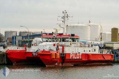
Pilot Ship
Current Trip
PILOTAGE
| Time Travelled | --- |
|---|---|
| Remaining Time | --- |
| Distance Travelled | 3947.78 nm |
| Remaining Distance | --- |
| AVG Speed | 9.6 Knopen |
| MAX Speed | 9.6 Knopen |
| AVG Wind | 13.5 knots |
| MAX Wind | 37.8 knots |
| MIN Temp | 7.6°C / 45.68°F |
| MAX Temp | 24.3°C / 75.74°F |
| Diepgang | 2.9 M |
| Positie ontvangen | 8 m geleden |
Current Position
| Lengtegraad | --- |
|---|---|
| Breedtegraat | --- |
| Status | Under way using engine |
| Snelheid | 8 Knopen |
| Koers | 340° |
| Gebied | North Sea |
| Station | T-AIS |
| Positie ontvangen | 8 m geleden |
Info
Information
The current position of PILOTT.WANGEROOG is in North Sea with coordinates 53.86017° / 7.86283° as reported on 2024-10-18 05:20 by AIS to our vessel tracker app. The vessel's current speed is 8 Knopen
The vessel PILOTT.WANGEROOG (IMO: 8993887, MMSI: 211113790) is a Pilot Ship that was built in 2004 ( 20 Jaar oud ). It's sailing under the flag of [DE] Germany.
In this page you can find informations about the vessels current position, last detected port calls, and current voyage information. If the vessels is not in coverage by AIS you will find the latest position.
The current position of PILOTT.WANGEROOG is detected by our AIS receivers and we are not responsible for the reliability of the data. The last position was recorded while the vessel was in Coverage by the Ais receivers of our vessel tracking app.
The current draught of PILOTT.WANGEROOG as reported by AIS is 2.9 meters
Weather
| Temperature | 14°C / 57.2°F |
|---|---|
| Wind Speed | 3 knots |
| Direction | 144° SE |
| Pressure | 1015.1 hPa |
| Humidity | 98.6 % |
| Cloud Coverage | 100 % |
Featured Company
Last Port Calls
Most Visited Ports (Last year)
| Port | Arrivals | |
|---|---|---|
| 9 | ||
| 2 | ||
| 1 |
Last Trips
| Origin | Departure | Destination | Arrival | Distance |
|---|
Events
| Tijd | Evenement | Details | Positie / Bestemming | Info |
|---|---|---|---|---|
| 2024-10-18 03:22 | Binnenbereik |
53.86383 / 7.80666
North Sea
|
Snelheid: 4 kn Koers: 104° |
|
| 2024-10-18 01:49 | Buitenbereik |
53.85867 / 7.84300
North Sea
|
Snelheid: 1 kn Koers: 285° |
|
| 2024-10-18 01:13 | Start beweging | 6.03 nm, North of WANGEROOGE |
53.87317 / 7.84417
PILOTAGE
|
Snelheid: 3.8 kn Koers: 99° |
| 2024-10-18 00:19 | Stop beweging | 5.71 nm, North of WANGEROOGE |
53.86867 / 7.85683
PILOTAGE
|
Snelheid: Koers: 218° |
| 2024-10-17 22:59 | Binnenbereik |
53.86767 / 7.82050
North Sea
|
Snelheid: 6 kn Koers: 119° |
|
| 2024-10-17 20:35 | Buitenbereik |
53.87150 / 7.81600
North Sea
|
Snelheid: 14 kn Koers: 302° |
|
| 2024-10-17 20:03 | Binnenbereik |
53.85883 / 7.83283
North Sea
|
Snelheid: 1 kn Koers: 105° |
|
| 2024-10-17 17:19 | Buitenbereik |
53.88000 / 7.81050
North Sea
|
Snelheid: 12 kn Koers: 288° |
|
| 2024-10-17 17:12 | Start beweging | 5.89 nm, North of WANGEROOGE |
53.87133 / 7.84950
PILOTAGE
|
Snelheid: 9 kn Koers: 289° |
| 2024-10-17 17:01 | Stop beweging | 5.77 nm, North of WANGEROOGE |
53.86966 / 7.85567
PILOTAGE
|
Snelheid: Koers: 288° |