
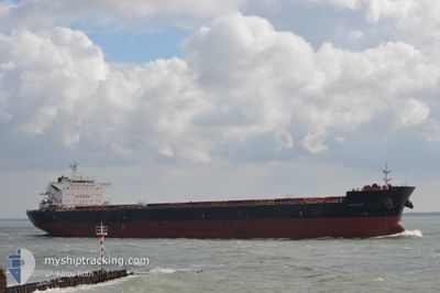
PETALON
Bulk Carrier
Current Trip
ONAHAMA
| Time Travelled | 1 day |
|---|---|
| Remaining Time | --- |
| Distance Travelled | 136.62 nm |
| Remaining Distance | --- |
| AVG Speed | 4.8 Knopen |
| MAX Speed | 9.7 Knopen |
| AVG Wind | 19.4 knots |
| MAX Wind | 40.8 knots |
| MIN Temp | 12.2°C / 53.96°F |
| MAX Temp | 19.8°C / 67.64°F |
| Diepgang | 12.2 M |
| Positie ontvangen | 8 d geleden |
Current Position
| Lengtegraad | 140.90062° |
|---|---|
| Breedtegraat | 36.88540° |
| Status | At anchor |
| Snelheid | 0.1 Knopen |
| Koers | 191° |
| Gebied | North Pacific Ocean |
| Station | T-AIS |
| Positie ontvangen | 8 d geleden |
Info
Information
The current position of PETALON is in North Pacific Ocean with coordinates 36.88540° / 140.90062° as reported on 2024-05-05 20:28 by AIS to our vessel tracker app. The vessel's current speed is 0.1 Knopen
The vessel PETALON (IMO: 9469041, MMSI: 215721000) is a Bulk Carrier that was built in 2010 ( 14 Jaar oud ). It's sailing under the flag of [MT] Malta.
In this page you can find informations about the vessels current position, last detected port calls, and current voyage information. If the vessels is not in coverage by AIS you will find the latest position.
The current position of PETALON is detected by our AIS receivers and we are not responsible for the reliability of the data. The last position was recorded while the vessel was in Coverage by the Ais receivers of our vessel tracking app.
The current draught of PETALON as reported by AIS is 12.2 meters
Weather
| Temperature | 15.2°C / 59.36°F |
|---|---|
| Wind Speed | 18 knots |
| Direction | 35° NE |
| Pressure | 1019 hPa |
| Humidity | 67 % |
| Cloud Coverage | 100 % |
Featured Company
Most Visited Ports (Last year)
| Port | Arrivals | |
|---|---|---|
| 3 | ||
| 1 | ||
| 1 | ||
| 1 | ||
| 1 | ||
| 1 |
Last Trips
| Origin | Departure | Destination | Arrival | Distance | |
|---|---|---|---|---|---|
| 2024-03-15 04:58 | 2024-05-07 05:52 | 2912.10 nm | |||
| 2024-01-16 06:24 | 2024-03-08 14:55 | 1377.33 nm |
Events
| Tijd | Evenement | Details | Positie / Bestemming | Info |
|---|---|---|---|---|
| 2024-05-13 22:00 | Start beweging | 14.13 nm, South East of NAKANOSAKU |
36.79115 / 141.15915
ONAHAMA
|
Snelheid: 3.2 kn Koers: 28° |
| 2024-05-13 21:29 | Stop beweging | 14.39 nm, South East of NAKANOSAKU |
36.78333 / 141.15666
ONAHAMA
|
Snelheid: Koers: -1° |
| 2024-05-13 17:57 | Start beweging | 3.76 nm, South East of ONAHAMA |
36.87658 / 140.93457
ONAHAMA
|
Snelheid: 3.2 kn Koers: 111° |
| 2024-05-13 17:40 | Stop beweging | 3.97 nm, South East of ONAHAMA |
36.87113 / 140.93248
ONAHAMA
|
Snelheid: 0.3 kn Koers: 53° |
| 2024-05-12 05:44 | Vertrekhaven |
|
36.90913 / 140.88028
ONAHAMA
|
Snelheid: 4.5 kn Koers: 156° |
| 2024-05-12 05:30 | Start beweging |
36.92803 / 140.88600
[JP] ONAHAMA
|
Snelheid: 4.5 kn Koers: 156° |
|
| 2024-05-06 21:44 | Stop beweging |
36.93372 / 140.88243
[JP] ONAHAMA
|
Snelheid: Koers: 143° |
|
| 2024-05-06 20:52 | Aankomsthaven |
|
36.92207 / 140.88698
[JP] ONAHAMA
|
Snelheid: 4.4 kn Koers: 10° |
| 2024-05-06 20:21 | Start beweging | 2.46 nm, South of ONAHAMA |
36.88543 / 140.89461
ONAHAMA
|
Snelheid: 5.5 kn Koers: 327° |
| 2024-05-05 20:28 | Buitenbereik |
36.88540 / 140.90062
North Pacific Ocean
|
Snelheid: 0.1 kn Koers: 311° |