
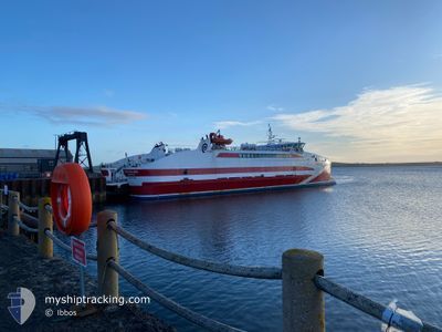
PENTALINA
Ro-Ro/Passenger Ship
Current Trip
| Time Travelled | 46 mins |
|---|---|
| Remaining Time | 14 mins |
| Distance Travelled | 10.92 nm |
| Remaining Distance | --- |
| AVG Speed | 15.6 Knopen |
| MAX Speed | 17.1 Knopen |
| AVG Wind | 19.7 knots |
| MAX Wind | 28.5 knots |
| MIN Temp | 3°C / 37.4°F |
| MAX Temp | 4°C / 39.2°F |
| Diepgang | 2.5 M |
| Positie ontvangen | 1 m geleden |
Current Position
| Lengtegraad | --- |
|---|---|
| Breedtegraat | --- |
| Status | Under way using engine |
| Snelheid | 15.8 Knopen |
| Koers | 24.7° |
| Gebied | North Sea |
| Station | T-AIS |
| Positie ontvangen | 1 m geleden |
Info
Information
The current position of PENTALINA is in North Sea with coordinates 58.82269° / -3.05334° as reported on 2026-01-06 19:21 by AIS to our vessel tracker app. The vessel's current speed is 15.8 Knopen and is heading at the port of ST MARGARET'S HOPE. The estimated time of arrival as calculated by MyShipTracking vessel tracking app is 2026-01-06 19:36 LT
The vessel PENTALINA (IMO: 9437969, MMSI: 235061705) is a Ro-Ro/Passenger Ship that was built in 2008 ( 18 Jaar oud ). It's sailing under the flag of [GB] United Kingdom.
In this page you can find informations about the vessels current position, last detected port calls, and current voyage information. If the vessels is not in coverage by AIS you will find the latest position.
The current position of PENTALINA is detected by our AIS receivers and we are not responsible for the reliability of the data. The last position was recorded while the vessel was in Coverage by the Ais receivers of our vessel tracking app.
The current draught of PENTALINA as reported by AIS is 2.5 meters
Weather
| Temperature | 4°C / 39.2°F |
|---|---|
| Wind Speed | 28 knots |
| Direction | 115° ESE |
| Pressure | 998.8 hPa |
| Humidity | 96.9 % |
| Cloud Coverage | 100 % |
Featured Company
Last Port Calls
| Port | Arrival | Departure | Time In Port |
|---|---|---|---|
| 2026-01-06 17:52 | 2026-01-06 18:36 | 43 m | |
| 2026-01-06 14:38 | 2026-01-06 16:43 | 2 h | |
| 2026-01-06 12:56 | 2026-01-06 13:38 | 41 m | |
| 2026-01-06 10:55 | 2026-01-06 11:50 | 54 m | |
| 2026-01-06 08:52 | 2026-01-06 09:57 | 1 h | |
| 2026-01-05 20:05 | 2026-01-06 07:44 | 11 h | |
| 2026-01-05 18:03 | 2026-01-05 19:04 | 1 h | |
| 2026-01-05 14:39 | 2026-01-05 16:57 | 2 h | |
| 2026-01-05 12:32 | 2026-01-05 13:37 | 1 h | |
| 2026-01-05 10:44 | 2026-01-05 11:27 | 42 m |
Most Visited Ports (Last year)
| Port | Arrivals | |
|---|---|---|
| 958 | ||
| 958 | ||
| 1 |
Last Trips
| Origin | Departure | Destination | Arrival | Distance | |
|---|---|---|---|---|---|
| 2026-01-06 16:43 | 2026-01-06 17:52 | 15.57 nm | |||
| 2026-01-06 13:38 | 2026-01-06 14:38 | 15.21 nm | |||
| 2026-01-06 11:50 | 2026-01-06 12:56 | 14.96 nm | |||
| 2026-01-06 09:57 | 2026-01-06 10:55 | 15.54 nm | |||
| 2026-01-06 07:44 | 2026-01-06 08:52 | 15.07 nm | |||
| 2026-01-05 19:04 | 2026-01-05 20:05 | 15.05 nm | |||
| 2026-01-05 16:57 | 2026-01-05 18:03 | 15.45 nm | |||
| 2026-01-05 13:37 | 2026-01-05 14:39 | 15.24 nm | |||
| 2026-01-05 11:27 | 2026-01-05 12:32 | 15.22 nm | |||
| 2026-01-05 09:45 | 2026-01-05 10:44 | 15.31 nm |
Events
| Tijd | Evenement | Details | Positie / Bestemming | Info |
|---|---|---|---|---|
| 2026-01-06 18:36 | Vertrekhaven |
|
58.64402 / -3.15655
SMH GILLS
|
Snelheid: 13.3 kn Koers: 9° |
| 2026-01-06 18:35 | Start beweging |
58.64093 / -3.15759
[GB] GILLS
|
Snelheid: 7.6 kn Koers: 30° |
|
| 2026-01-06 18:34 | Status Changed | Under way using engine Default |
58.63986 / -3.15943
[GB] GILLS
|
Snelheid: Koers: 53° |
| 2026-01-06 18:05 | Status Changed | Default Moored |
58.63949 / -3.16059
[GB] GILLS
|
Snelheid: Koers: 52° |
| 2026-01-06 18:02 | ETA Changed | 2026/01/06 19:45 2026/01/06 18:15 |
58.63949 / -3.16059
[GB] GILLS
|
Snelheid: Koers: 52° |
| 2026-01-06 18:02 | Status Changed | Moored Under way using engine |
58.63949 / -3.16059
[GB] GILLS
|
Snelheid: Koers: 52° |
| 2026-01-06 17:59 | Stop beweging |
58.63950 / -3.16058
[GB] GILLS
|
Snelheid: 0.3 kn Koers: 52° |
|
| 2026-01-06 17:52 | Aankomsthaven |
|
58.64140 / -3.15673
[GB] GILLS
|
Snelheid: 5 kn Koers: 200.2° |
| 2026-01-06 16:43 | Vertrekhaven |
|
58.83582 / -2.95629
SMH GILLS
|
Snelheid: 7.3 kn Koers: 345° |
| 2026-01-06 16:41 | Start beweging |
58.83250 / -2.95799
[GB] ST MARGARET'S HOPE
|
Snelheid: 6.9 kn Koers: 61° |