
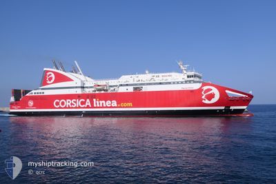
PASCAL PAOLI
Ro-Ro/Passenger Ship
Current Trip
| Time Travelled | 10 h, 23 mins |
|---|---|
| Remaining Time | 2 h, 8 mins |
| Distance Travelled | 176.87 nm |
| Remaining Distance | --- |
| AVG Speed | 17.4 Knopen |
| MAX Speed | 17.9 Knopen |
| AVG Wind | 13.4 knots |
| MAX Wind | 18.3 knots |
| MIN Temp | 14.5°C / 58.1°F |
| MAX Temp | 15.5°C / 59.9°F |
| Diepgang | 6.2 M |
| Positie ontvangen | 1 h, 16 m geleden |
Current Position
| Lengtegraad | --- |
|---|---|
| Breedtegraat | --- |
| Status | Under way using engine |
| Snelheid | 17.9 Knopen |
| Koers | 87° |
| Gebied | Mediterranean Sea - Western Basin |
| Station | T-AIS |
| Positie ontvangen | 1 h, 16 m geleden |
Information
The current position of PASCAL PAOLI is in Mediterranean Sea - Western Basin with coordinates 43.04277° / 8.69995° as reported on 2025-03-28 02:15 by AIS to our vessel tracker app. The vessel's current speed is 17.9 Knopen and is heading at the port of BASTIA. The estimated time of arrival as calculated by MyShipTracking vessel tracking app is 2025-03-28 05:40 LT
The vessel PASCAL PAOLI (IMO: 9247510, MMSI: 228081000) is a Ro-Ro/Passenger Ship that was built in 2003 ( 22 Jaar oud ). It's sailing under the flag of [FR] France.
In this page you can find informations about the vessels current position, last detected port calls, and current voyage information. If the vessels is not in coverage by AIS you will find the latest position.
The current position of PASCAL PAOLI is detected by our AIS receivers and we are not responsible for the reliability of the data. The last position was recorded while the vessel was in Coverage by the Ais receivers of our vessel tracking app.
The current draught of PASCAL PAOLI as reported by AIS is 6.2 meters
Weather
| Temperature | 14.6°C / 58.28°F |
|---|---|
| Wind Speed | 9 knots |
| Direction | 77° ENE |
| Pressure | 1009 hPa |
| Humidity | 71.9 % |
| Cloud Coverage | 100 % |
Featured Company
Last Port Calls
| Port | Arrival | Departure | Time In Port |
|---|---|---|---|
| 2025-03-27 05:37 | 2025-03-27 17:09 | 11 h | |
| 2025-03-26 05:45 | 2025-03-26 16:48 | 11 h | |
| 2025-03-25 05:36 | 2025-03-25 17:01 | 11 h | |
| 2025-03-24 06:53 | 2025-03-24 16:52 | 9 h | |
| 2025-03-23 06:35 | 2025-03-23 16:59 | 10 h | |
| 2025-03-22 05:48 | 2025-03-22 16:51 | 11 h | |
| 2025-03-21 05:13 | 2025-03-21 17:05 | 11 h | |
| 2025-03-20 05:50 | 2025-03-20 16:53 | 11 h | |
| 2025-03-19 05:34 | 2025-03-19 16:58 | 11 h | |
| 2025-03-18 06:10 | 2025-03-18 16:48 | 10 h |
Last Trips
| Origin | Departure | Destination | Arrival | Distance | |
|---|---|---|---|---|---|
| 2025-03-26 17:48 | 2025-03-27 06:37 | 218.45 nm | |||
| 2025-03-25 18:01 | 2025-03-26 06:45 | 218.19 nm | |||
| 2025-03-24 17:52 | 2025-03-25 06:36 | 218.03 nm | |||
| 2025-03-23 17:59 | 2025-03-24 07:53 | 217.23 nm | |||
| 2025-03-22 17:51 | 2025-03-23 07:35 | 214.53 nm | |||
| 2025-03-21 18:05 | 2025-03-22 06:48 | 217.16 nm | |||
| 2025-03-20 17:53 | 2025-03-21 06:13 | 217.00 nm | |||
| 2025-03-19 17:58 | 2025-03-20 06:50 | 218.05 nm | |||
| 2025-03-18 17:48 | 2025-03-19 06:34 | 213.40 nm | |||
| 2025-03-17 18:11 | 2025-03-18 07:10 | 218.44 nm |
Events
| Tijd | Evenement | Details | Positie / Bestemming | Info |
|---|---|---|---|---|
| 2025-03-28 02:46 | Status Changed | Default Under way using engine |
43.05167 / 8.90493
FR BIA P7
|
Snelheid: 17.9 kn Koers: 87° |
| 2025-03-28 02:15 | Status Changed | Under way using engine Default |
43.04277 / 8.69995
FR BIA P7
|
Snelheid: 17.8 kn Koers: 87° |
| 2025-03-28 02:15 | Buitenbereik |
43.04277 / 8.69995
Mediterranean Sea - Western Basin
FR BIA P7
|
Snelheid: 17.9 kn Koers: 87° |
|
| 2025-03-28 02:11 | Status Changed | Default Under way using engine |
43.04165 / 8.66947
FR BIA P7
|
Snelheid: 17.9 kn Koers: 87° |
| 2025-03-27 23:56 | Wijzig zee gebeid | French part of the Mediterranean Sea - Western Basin Monégasque part of the Mediterranean Sea - Western Basin |
42.99625 / 7.75938
Mediterranean Sea - Western Basin
FR BIA P7
|
Snelheid: 17.3 kn Koers: 85° |
| 2025-03-27 23:49 | Wijzig zee gebeid | Monégasque part of the Mediterranean Sea - Western Basin French part of the Mediterranean Sea - Western Basin |
42.99362 / 7.71793
Mediterranean Sea - Western Basin
FR BIA P7
|
Snelheid: 17.5 kn Koers: 85° |
| 2025-03-27 20:45 | Status Changed | Under way using engine Default |
42.94878 / 6.49375
FR BIA P7
|
Snelheid: 17.6 kn Koers: 86° |
| 2025-03-27 20:20 | Status Changed | Default Under way using engine |
42.94298 / 6.33122
FR BIA P7
|
Snelheid: 17.8 kn Koers: 88° |
| 2025-03-27 17:43 | Status Changed | Under way using engine Default |
43.15947 / 5.34543
FR BIA P7
|
Snelheid: 16.9 kn Koers: 150° |
| 2025-03-27 17:41 | Status Changed | Default Under way using engine |
43.16527 / 5.34102
FR BIA P7
|
Snelheid: 17 kn Koers: 150° |