
PARTNERSHIP
Bulk Carrier
Current Trip
KR YYG
| Time Travelled | 22 days |
|---|---|
| Remaining Time | --- |
| Distance Travelled | 5945.11 nm |
| Remaining Distance | --- |
| AVG Speed | 11.1 Knopen |
| MAX Speed | 13.8 Knopen |
| AVG Wind | 14.1 knots |
| MAX Wind | 23 knots |
| MIN Temp | 12.9°C / 55.22°F |
| MAX Temp | 28.5°C / 83.3°F |
| Diepgang | 17.8 M |
| Positie ontvangen | 1 m geleden |
Current Position
| Lengtegraad | 17.71841° |
|---|---|
| Breedtegraat | -33.76785° |
| Status | Under way using engine |
| Snelheid | 12.2 Knopen |
| Koers | 94.8° |
| Gebied | South Atlantic Ocean |
| Station | T-AIS |
| Positie ontvangen | 1 m geleden |
Info
Information
The current position of PARTNERSHIP is in South Atlantic Ocean with coordinates -33.76785° / 17.71841° as reported on 2024-08-03 10:36 by AIS to our vessel tracker app. The vessel's current speed is 12.2 Knopen
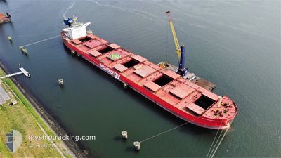
The vessel PARTNERSHIP (IMO: 9597848, MMSI: 538007497) is a Bulk Carrier that was built in 2012 ( 12 Jaar oud ). It's sailing under the flag of [MH] Marshall Is.
In this page you can find informations about the vessels current position, last detected port calls, and current voyage information. If the vessels is not in coverage by AIS you will find the latest position.
The current position of PARTNERSHIP is detected by our AIS receivers and we are not responsible for the reliability of the data. The last position was recorded while the vessel was in Coverage by the Ais receivers of our vessel tracking app.
The current draught of PARTNERSHIP as reported by AIS is 17.8 meters
Weather
| Temperature | 12.9°C / 55.22°F |
|---|---|
| Wind Speed | 7 knots |
| Direction | 343° NNW |
| Pressure | 1014.4 hPa |
| Humidity | 71 % |
| Cloud Coverage | 34 % |
Featured Company
Last Port Calls
| Port | Arrival | Departure | Time In Port |
|---|---|---|---|
| 2024-07-10 02:04 | 2024-07-11 23:15 | 1 d | |
| 2024-07-07 19:14 | 2024-07-09 04:43 | 1 d | |
| 2024-06-03 14:03 |
Most Visited Ports (Last year)
| Port | Arrivals | |
|---|---|---|
| 4 | ||
| 4 | ||
| 2 | ||
| 1 | ||
| 1 | ||
| 1 |
Last Trips
| Origin | Departure | Destination | Arrival | Distance | |
|---|---|---|---|---|---|
| 2024-07-08 23:43 | 2024-07-09 21:04 | 10.78 nm | |||
| 2024-06-03 16:03 | 2024-07-07 14:14 | 4526.77 nm |
Events
| Tijd | Evenement | Details | Positie / Bestemming | Info |
|---|---|---|---|---|
| 2024-08-03 10:13 | Draught Changed | 17.8 8.5 |
-33.75924 / 17.62497
KR YYG
|
Snelheid: 12 kn Koers: 98.4° |
| 2024-08-03 10:13 | Destination Changed | KR YYG CO PBO |
-33.75924 / 17.62497
KR YYG
|
Snelheid: 12 kn Koers: 98.4° |
| 2024-08-03 10:13 | ETA Changed | 2024/08/31 03:00 2024/06/17 23:00 |
-33.75924 / 17.62497
KR YYG
|
Snelheid: 12 kn Koers: 98.4° |
| 2024-08-03 10:05 | Status Changed | Under way using engine Default |
-33.75532 / 17.59543
CO PBO
|
Snelheid: 11.9 kn Koers: 97° |
| 2024-08-03 10:04 | Status Changed | Default Under way using engine |
-33.75464 / 17.59027
CO PBO
|
Snelheid: 12 kn Koers: 102.1° |
| 2024-08-03 09:53 | Status Changed | Under way using engine Default |
-33.74795 / 17.54658
CO PBO
|
Snelheid: 12.1 kn Koers: 103° |
| 2024-08-03 09:39 | Status Changed | Default Under way using engine |
-33.73347 / 17.49676
CO PBO
|
Snelheid: 12.2 kn Koers: 114.8° |
| 2024-08-03 09:35 | Status Changed | Under way using engine Default |
-33.72765 / 17.48210
CO PBO
|
Snelheid: 12.3 kn Koers: 123° |
| 2024-08-03 09:26 | Status Changed | Default Under way using engine |
-33.71148 / 17.44835
CO PBO
|
Snelheid: 12.4 kn Koers: 121.8° |
| 2024-08-03 09:22 | Status Changed | Under way using engine Default |
-33.70478 / 17.43545
CO PBO
|
Snelheid: 12.6 kn Koers: 113° |