
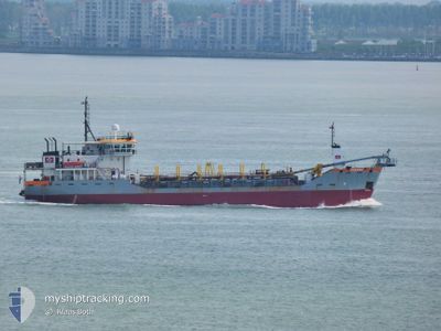
PARANA
Dredging or underwater ops
Current Trip
SAINT JOHN ANTIGUA
| Time Travelled | 4 days |
|---|---|
| Remaining Time | --- |
| Distance Travelled | 405.53 nm |
| Remaining Distance | --- |
| AVG Speed | 7.4 Knopen |
| MAX Speed | 10.1 Knopen |
| AVG Wind | 6.3 knots |
| MAX Wind | 13.8 knots |
| MIN Temp | 23.4°C / 74.12°F |
| MAX Temp | 31.8°C / 89.24°F |
| Diepgang | 3.7 M |
| Positie ontvangen | 2023-07-08 23:52 |
Current Position
| Lengtegraad | -62.70670° |
|---|---|
| Breedtegraat | 17.17544° |
| Status | Restricted manoeuverability |
| Snelheid | 9.2 Knopen |
| Koers | 150.2° |
| Gebied | Caribbean Sea |
| Station | T-AIS |
| Positie ontvangen | 2023-07-08 23:52 |
Info
Information
The current position of PARANA is in Caribbean Sea with coordinates 17.17544° / -62.70670° as reported on 2023-07-08 23:52 by AIS to our vessel tracker app. The vessel's current speed is 9.2 Knopen
The vessel PARANA (IMO: 9198965, MMSI: 244342000) is a Dredging or underwater ops It's sailing under the flag of [NL] Netherlands.
In this page you can find informations about the vessels current position, last detected port calls, and current voyage information. If the vessels is not in coverage by AIS you will find the latest position.
The current position of PARANA is detected by our AIS receivers and we are not responsible for the reliability of the data. The last position was recorded while the vessel was in Coverage by the Ais receivers of our vessel tracking app.
The current draught of PARANA as reported by AIS is 3.7 meters
Weather
| Temperature | 26°C / 78.8°F |
|---|---|
| Wind Speed | 3 knots |
| Direction | 57° ENE |
| Pressure | 1012 hPa |
| Humidity | 86.2 % |
| Cloud Coverage | 64 % |
Featured Company
Last Port Calls
| Port | Arrival | Departure | Time In Port |
|---|---|---|---|
| 2024-05-14 09:46 | 2024-05-14 18:34 | 8 h | |
| 2024-05-14 07:22 | 2024-05-14 08:58 | 1 h | |
| 2024-05-13 20:06 | 2024-05-14 01:02 | 4 h | |
| 2024-05-13 06:02 | 2024-05-13 11:50 | 5 h | |
| 2024-05-12 23:02 | 2024-05-13 00:06 | 1 h | |
| 2024-05-12 21:22 | 2024-05-12 21:30 | 8 m | |
| 2024-05-12 09:22 | 2024-05-12 09:30 | 8 m | |
| 2024-05-11 18:34 | 2024-05-11 23:02 | 4 h | |
| 2024-05-09 20:38 | 2024-05-09 20:46 | 7 m | |
| 2024-05-09 13:38 | 2024-05-09 16:26 | 2 h |
Most Visited Ports (Last year)
| Port | Arrivals | |
|---|---|---|
| 77 | ||
| 40 | ||
| 22 | ||
| 8 | ||
| 7 | ||
| 1 |
Last Trips
| Origin | Departure | Destination | Arrival | Distance | |
|---|---|---|---|---|---|
| 2024-05-14 08:58 | 2024-05-14 09:46 | 2.16 nm | |||
| 2024-05-14 01:02 | 2024-05-14 07:22 | 43.35 nm | |||
| 2024-05-13 11:50 | 2024-05-13 20:06 | 52.27 nm | |||
| 2024-05-13 00:06 | 2024-05-13 06:02 | 42.73 nm | |||
| 2024-05-12 21:30 | 2024-05-12 23:02 | 2.94 nm | |||
| 2024-05-12 09:30 | 2024-05-12 21:22 | 65.91 nm | |||
| 2024-05-11 23:02 | 2024-05-12 09:22 | 56.91 nm | |||
| 2024-05-09 20:46 | 2024-05-11 18:34 | 175.95 nm | |||
| 2024-05-09 16:26 | 2024-05-09 20:38 | 7.95 nm | |||
| 2024-04-26 10:57 | 2024-05-09 13:38 | 904.64 nm |
Events
| Tijd | Evenement | Details | Positie / Bestemming | Info |
|---|---|---|---|---|
| 2024-05-18 10:46 | Start beweging | 2.12 nm, North of GEORGETOWN |
6.82470 / -58.17214
SAINT JOHN ANTIGUA
|
Snelheid: 6.9 kn Koers: 198° |
| 2024-05-18 10:12 | Stop beweging | 1.65 nm, North of GEORGETOWN |
6.81667 / -58.17667
SAINT JOHN ANTIGUA
|
Snelheid: Koers: -1° |
| 2024-05-18 09:50 | Start beweging | 2.11 nm, North of GEORGETOWN |
6.82451 / -58.17274
SAINT JOHN ANTIGUA
|
Snelheid: 8.7 kn Koers: 17° |
| 2024-05-18 09:30 | Stop beweging | 1.65 nm, North of GEORGETOWN |
6.81667 / -58.17667
SAINT JOHN ANTIGUA
|
Snelheid: Koers: -1° |
| 2024-05-18 09:07 | Start beweging | 2.38 nm, North of GEORGETOWN |
6.82890 / -58.17095
SAINT JOHN ANTIGUA
|
Snelheid: 3.3 kn Koers: 187° |
| 2024-05-18 08:38 | Stop beweging | 1.69 nm, North of GEORGETOWN |
6.81730 / -58.17691
SAINT JOHN ANTIGUA
|
Snelheid: 0.1 kn Koers: 8° |
| 2024-05-18 08:13 | Start beweging | 2.09 nm, North of GEORGETOWN |
6.82417 / -58.17263
SAINT JOHN ANTIGUA
|
Snelheid: 8.2 kn Koers: 6° |
| 2024-05-18 07:56 | Stop beweging | 1.64 nm, North of GEORGETOWN |
6.81641 / -58.17696
SAINT JOHN ANTIGUA
|
Snelheid: 0.1 kn Koers: 3° |
| 2024-05-17 10:42 | Start beweging | 2.12 nm, North of GEORGETOWN |
6.82464 / -58.17279
SAINT JOHN ANTIGUA
|
Snelheid: 8.5 kn Koers: 18° |
| 2024-05-17 10:13 | Stop beweging | 1.65 nm, North of GEORGETOWN |
6.81667 / -58.17667
SAINT JOHN ANTIGUA
|
Snelheid: Koers: -1° |