
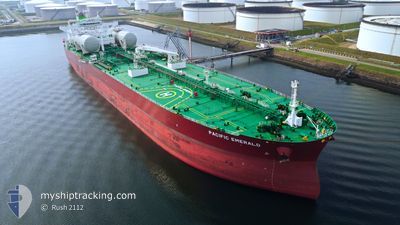
PACIFIC EMERALD
Tanker
Current Trip
| Time Travelled | 20 days |
|---|---|
| Remaining Time | --- |
| Distance Travelled | 5754.50 nm |
| Remaining Distance | --- |
| AVG Speed | 11.7 Knopen |
| MAX Speed | 13.8 Knopen |
| AVG Wind | 10.6 knots |
| MAX Wind | 22.8 knots |
| MIN Temp | 4.5°C / 40.1°F |
| MAX Temp | 30.7°C / 87.26°F |
| Diepgang | 12.4 M |
| Positie ontvangen | 5 d geleden |
Current Position
| Lengtegraad | -79.90805° |
|---|---|
| Breedtegraat | 9.25467° |
| Status | Under way using engine |
| Snelheid | 0.6 Knopen |
| Koers | 356° |
| Gebied | North Pacific Ocean |
| Station | T-AIS |
| Positie ontvangen | 5 d geleden |
Info
Information
The current position of PACIFIC EMERALD is in North Pacific Ocean with coordinates 9.25467° / -79.90805° as reported on 2024-04-23 15:39 by AIS to our vessel tracker app. The vessel's current speed is 0.6 Knopen and is heading at the port of BALBOA. The estimated time of arrival as calculated by MyShipTracking vessel tracking app is 2024-04-22 23:59 LT
The vessel PACIFIC EMERALD (IMO: 9893022, MMSI: 538009197) is a Tanker It's sailing under the flag of [MH] Marshall Is.
In this page you can find informations about the vessels current position, last detected port calls, and current voyage information. If the vessels is not in coverage by AIS you will find the latest position.
The current position of PACIFIC EMERALD is detected by our AIS receivers and we are not responsible for the reliability of the data. The last position was recorded while the vessel was in Coverage by the Ais receivers of our vessel tracking app.
The current draught of PACIFIC EMERALD as reported by AIS is 12.4 meters
Weather
| Temperature | 22.5°C / 72.5°F |
|---|---|
| Wind Speed | 17 knots |
| Direction | 39° NE |
| Pressure | 1017 hPa |
| Humidity | 70.7 % |
| Cloud Coverage | --- |
Featured Company
Most Visited Ports (Last year)
| Port | Arrivals | |
|---|---|---|
| 4 | ||
| 3 | ||
| 3 | ||
| 2 | ||
| 1 | ||
| 1 |
Last Trips
| Origin | Departure | Destination | Arrival | Distance | |
|---|---|---|---|---|---|
| 2024-03-31 08:22 | 2024-04-05 02:10 | 21.06 nm | |||
| 2024-03-22 14:33 | 2024-03-28 13:53 | 25.00 nm | |||
| 2024-02-25 01:33 | 2024-03-19 15:09 | 6640.53 nm | |||
| 2024-01-21 09:55 | 2024-02-22 08:25 | 4695.85 nm |
Events
| Tijd | Evenement | Details | Positie / Bestemming | Info |
|---|---|---|---|---|
| 2024-04-23 19:22 | Start beweging | 3.55 nm, South of CRISTOBAL |
9.28714 / -79.91464
PA BLB
|
Snelheid: 3.4 kn Koers: 351° |
| 2024-04-23 15:46 | Status Changed | Default Under way using engine |
9.25514 / -79.90793
PA BLB
|
Snelheid: 0.6 kn Koers: 356° |
| 2024-04-23 15:46 | Stop beweging | 5.45 nm, South of CRISTOBAL |
9.25514 / -79.90793
PA BLB
|
Snelheid: Koers: 357° |
| 2024-04-23 15:39 | Buitenbereik |
9.25467 / -79.90805
North Pacific Ocean
|
Snelheid: 0.6 kn Koers: 7.6° |
|
| 2024-04-23 15:35 | Status Changed | Under way using engine Default |
9.25365 / -79.90801
PA BLB
|
Snelheid: 1.6 kn Koers: 354° |
| 2024-04-23 15:22 | Status Changed | Default Under way using engine |
9.24656 / -79.91076
PA BLB
|
Snelheid: 3.4 kn Koers: 40° |
| 2024-04-23 15:08 | Status Changed | Under way using engine Default |
9.23758 / -79.91888
PA BLB
|
Snelheid: 4.5 kn Koers: 359° |
| 2024-04-23 14:54 | Status Changed | Default Under way using engine |
9.22295 / -79.92299
PA BLB
|
Snelheid: 4.9 kn Koers: 331° |
| 2024-04-23 14:42 | Status Changed | Under way using engine Default |
9.20674 / -79.91364
PA BLB
|
Snelheid: 7.3 kn Koers: 301° |
| 2024-04-23 14:26 | Binnenbereik |
9.20674 / -79.91364
North Pacific Ocean
|
Snelheid: 6.1 kn Koers: 304.9° |