
PACIFIC ASSURANCE
Cargo
Current Trip
| Time Travelled | 14 days |
|---|---|
| Remaining Time | 1 mins |
| Distance Travelled | 3919.66 nm |
| Remaining Distance | 7.63 nm |
| AVG Speed | 12.6 Knopen |
| MAX Speed | 12.6 Knopen |
| AVG Wind | 12.5 knots |
| MAX Wind | 30.6 knots |
| MIN Temp | 11.4°C / 52.52°F |
| MAX Temp | 30.9°C / 87.62°F |
| Diepgang | 17.8 M |
| Positie ontvangen | 2 d geleden |
Current Position
| Lengtegraad | 124.10767° |
|---|---|
| Breedtegraat | 36.66344° |
| Status | Under way using engine |
| Snelheid | 12.8 Knopen |
| Koers | 356.5° |
| Gebied | Yellow Sea |
| Station | T-AIS |
| Positie ontvangen | 2 d geleden |
Info
Information
The current position of PACIFIC ASSURANCE is in Yellow Sea with coordinates 36.66344° / 124.10767° as reported on 2024-05-14 15:41 by AIS to our vessel tracker app. The vessel's current speed is 12.8 Knopen and is heading at the port of CAOFEIDIAN. The estimated time of arrival as calculated by MyShipTracking vessel tracking app is 2024-05-17 11:07 LT
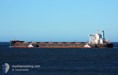
The vessel PACIFIC ASSURANCE (IMO: 9683104, MMSI: 565199000) is a Cargo It's sailing under the flag of [SG] Singapore.
In this page you can find informations about the vessels current position, last detected port calls, and current voyage information. If the vessels is not in coverage by AIS you will find the latest position.
The current position of PACIFIC ASSURANCE is detected by our AIS receivers and we are not responsible for the reliability of the data. The last position was recorded while the vessel was in Coverage by the Ais receivers of our vessel tracking app.
The current draught of PACIFIC ASSURANCE as reported by AIS is 17.8 meters
Weather
| Temperature | 15°C / 59°F |
|---|---|
| Wind Speed | 7 knots |
| Direction | 68° ENE |
| Pressure | 1007 hPa |
| Humidity | 81.9 % |
| Cloud Coverage | 26 % |
Featured Company
Last Port Calls
| Port | Arrival | Departure | Time In Port |
|---|---|---|---|
| 2024-05-01 18:34 | 2024-05-03 05:18 | 1 d | |
| 2024-04-14 23:38 | 2024-04-17 20:20 | 2 d | |
| 2024-03-26 15:34 | 2024-03-28 00:14 | 1 d | |
| 2024-03-08 12:11 |
Most Visited Ports (Last year)
| Port | Arrivals | |
|---|---|---|
| 9 | ||
| 3 | ||
| 3 | ||
| 1 | ||
| 1 | ||
| 1 |
Last Trips
| Origin | Departure | Destination | Arrival | Distance | |
|---|---|---|---|---|---|
| 2024-04-17 20:20 | 2024-05-01 18:34 | 3947.31 nm | |||
| 2024-03-28 00:14 | 2024-04-14 23:38 | 3982.16 nm | |||
| 2024-03-08 12:11 | 2024-03-26 15:34 | 3618.65 nm |
Events
| Tijd | Evenement | Details | Positie / Bestemming | Info |
|---|---|---|---|---|
| 2024-05-17 02:48 | Stop beweging | 9.57 nm, South East of CAOFEIDIAN |
38.87658 / 118.68626
CN CFD
|
Snelheid: 0.3 kn Koers: 2° |
| 2024-05-17 02:44 | Start beweging | 9.56 nm, South East of CAOFEIDIAN |
38.87645 / 118.68563
CN CFD
|
Snelheid: 11.8 kn Koers: 269° |
| 2024-05-17 00:57 | Stop beweging | 9.46 nm, South East of CAOFEIDIAN |
38.87735 / 118.68340
CN CFD
|
Snelheid: 0.1 kn Koers: 48° |
| 2024-05-17 00:48 | Start beweging | 8.83 nm, South East of CAOFEIDIAN |
38.88742 / 118.67856
CN CFD
|
Snelheid: 29.1 kn Koers: 344° |
| 2024-05-16 23:17 | Stop beweging | 9.43 nm, South East of CAOFEIDIAN |
38.87791 / 118.68333
CN CFD
|
Snelheid: Koers: 49° |
| 2024-05-16 23:08 | Start beweging | 9.44 nm, South East of CAOFEIDIAN |
38.87765 / 118.68333
CN CFD
|
Snelheid: 4.9 kn Koers: 47° |
| 2024-05-16 00:59 | Stop beweging | 9.51 nm, South East of CAOFEIDIAN |
38.87829 / 118.68748
CN CFD
|
Snelheid: 0.3 kn Koers: 341° |
| 2024-05-16 00:53 | Start beweging | 9.57 nm, South East of CAOFEIDIAN |
38.87705 / 118.68729
CN CFD
|
Snelheid: 31.1 kn Koers: 161° |
| 2024-05-16 00:20 | Stop beweging | 9.41 nm, South East of CAOFEIDIAN |
38.87883 / 118.68438
CN CFD
|
Snelheid: 0.1 kn Koers: 42° |
| 2024-05-16 00:16 | Start beweging | 9.8 nm, South East of CAOFEIDIAN |
38.87414 / 118.69070
CN CFD
|
Snelheid: 23.5 kn Koers: 125° |