
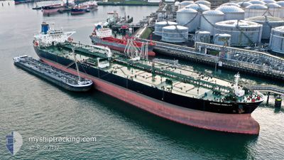
OTTOMAN NOBILITY
Crude Oil Tanker
Current Trip
ESALG>NGERT
| Time Travelled | --- |
|---|---|
| Remaining Time | --- |
| Distance Travelled | 3067.97 nm |
| Remaining Distance | --- |
| AVG Speed | 13.1 Knopen |
| MAX Speed | 17.6 Knopen |
| AVG Wind | 12.6 knots |
| MAX Wind | 22 knots |
| MIN Temp | 13.8°C / 56.84°F |
| MAX Temp | 26.9°C / 80.42°F |
| Diepgang | 8.8 M |
| Positie ontvangen | 2 d geleden |
Current Position
| Lengtegraad | 18.17442° |
|---|---|
| Breedtegraat | -34.93036° |
| Status | Under way using engine |
| Snelheid | 12.3 Knopen |
| Koers | 117° |
| Gebied | South Atlantic Ocean |
| Station | T-AIS |
| Positie ontvangen | 2 d geleden |
Info
Information
The current position of OTTOMAN NOBILITY is in South Atlantic Ocean with coordinates -34.93036° / 18.17442° as reported on 2024-04-24 19:49 by AIS to our vessel tracker app. The vessel's current speed is 12.3 Knopen
The vessel OTTOMAN NOBILITY (IMO: 9290359, MMSI: 271000773) is a Crude Oil Tanker that was built in 2005 ( 19 Jaar oud ). It's sailing under the flag of [TR] Turkey.
In this page you can find informations about the vessels current position, last detected port calls, and current voyage information. If the vessels is not in coverage by AIS you will find the latest position.
The current position of OTTOMAN NOBILITY is detected by our AIS receivers and we are not responsible for the reliability of the data. The last position was recorded while the vessel was in Coverage by the Ais receivers of our vessel tracking app.
The current draught of OTTOMAN NOBILITY as reported by AIS is 8.8 meters
Weather
| Temperature | 21.4°C / 70.52°F |
|---|---|
| Wind Speed | 5 knots |
| Direction | 110° ESE |
| Pressure | 1026.8 hPa |
| Humidity | 59.9 % |
| Cloud Coverage | 90 % |
Featured Company
Last Port Calls
| Port | Arrival | Departure | Time In Port |
|---|---|---|---|
| 2024-02-12 05:43 | 2024-02-12 15:00 | 9 h |
Most Visited Ports (Last year)
| Port | Arrivals | |
|---|---|---|
| 5 | ||
| 2 | ||
| 2 | ||
| 1 | ||
| 1 |
Last Trips
| Origin | Departure | Destination | Arrival | Distance | |
|---|---|---|---|---|---|
| 2023-12-04 22:43 | 2024-02-12 07:43 | 10810.48 nm |
Events
| Tijd | Evenement | Details | Positie / Bestemming | Info |
|---|---|---|---|---|
| 2024-04-27 15:18 | Stop beweging | 11.64 nm, South East of DURBAN |
-30.05786 / 31.11214
ESALG>NGERT
|
Snelheid: 0.3 kn Koers: 169° |
| 2024-04-24 19:51 | Status Changed | Default Under way using engine |
-34.93333 / 18.18134
ESALG>NGERT
|
Snelheid: 12.3 kn Koers: 117° |
| 2024-04-24 19:49 | Status Changed | Under way using engine Default |
-34.93036 / 18.17442
ESALG>NGERT
|
Snelheid: 12.3 kn Koers: 119° |
| 2024-04-24 19:49 | Buitenbereik |
-34.93036 / 18.17442
South Atlantic Ocean
|
Snelheid: 12.3 kn Koers: 117° |
|
| 2024-04-24 18:59 | Status Changed | Default Under way using engine |
-34.84781 / 17.98653
ESALG>NGERT
|
Snelheid: 12.7 kn Koers: 126.5° |
| 2024-04-24 18:53 | Status Changed | Under way using engine Default |
-34.83710 / 17.96391
ESALG>NGERT
|
Snelheid: 12.4 kn Koers: 151° |
| 2024-04-24 18:53 | Binnenbereik |
-34.83710 / 17.96391
South Atlantic Ocean
|
Snelheid: 12.7 kn Koers: 126.5° |
|
| 2024-04-24 16:15 | Status Changed | Default Under way using engine |
-34.33968 / 17.79741
ESALG>NGERT
|
Snelheid: 12 kn Koers: 207.5° |
| 2024-04-24 16:08 | Status Changed | Under way using engine Default |
-34.32027 / 17.81420
ESALG>NGERT
|
Snelheid: 12 kn Koers: 191° |
| 2024-04-24 16:08 | Buitenbereik |
-34.32027 / 17.81420
South Atlantic Ocean
|
Snelheid: 12 kn Koers: 207.5° |