
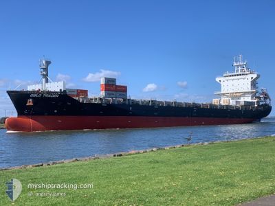
OSLO TRADER
Cargo
Current Trip
| Time Travelled | 22 h, 29 mins |
|---|---|
| Remaining Time | 4 days |
| Distance Travelled | 389.63 nm |
| Remaining Distance | 1957.81 nm |
| AVG Speed | 17.7 Knopen |
| MAX Speed | 18.7 Knopen |
| AVG Wind | 8.6 knots |
| MAX Wind | 13.8 knots |
| MIN Temp | 25.6°C / 78.08°F |
| MAX Temp | 29°C / 84.2°F |
| Diepgang | 8.3 M |
| Positie ontvangen | 22 h, 15 m geleden |
Current Position
| Lengtegraad | --- |
|---|---|
| Breedtegraat | --- |
| Status | Under way using engine |
| Snelheid | 13.3 Knopen |
| Koers | 300.4° |
| Gebied | Indian Ocean |
| Station | T-AIS |
| Positie ontvangen | 22 h, 15 m geleden |
Info
Information
The current position of OSLO TRADER is in Indian Ocean with coordinates -20.11684° / 57.45634° as reported on 2025-12-09 09:53 by AIS to our vessel tracker app. The vessel's current speed is 13.3 Knopen and is heading at the port of CAPE TOWN. The estimated time of arrival as calculated by MyShipTracking vessel tracking app is 2025-12-15 01:12 LT
The vessel OSLO TRADER (IMO: 9817925, MMSI: 354727000) is a Cargo It's sailing under the flag of [PA] Panama.
In this page you can find informations about the vessels current position, last detected port calls, and current voyage information. If the vessels is not in coverage by AIS you will find the latest position.
The current position of OSLO TRADER is detected by our AIS receivers and we are not responsible for the reliability of the data. The last position was recorded while the vessel was in Coverage by the Ais receivers of our vessel tracking app.
The current draught of OSLO TRADER as reported by AIS is 8.3 meters
Weather
| Temperature | 25.7°C / 78.26°F |
|---|---|
| Wind Speed | 13 knots |
| Direction | 2° N |
| Pressure | 1014.2 hPa |
| Humidity | 80.4 % |
| Cloud Coverage | 100 % |
Featured Company
Last Port Calls
| Port | Arrival | Departure | Time In Port |
|---|---|---|---|
| 2025-12-09 12:55 | 2025-12-09 13:40 | 44 m | |
| 2025-12-06 05:34 | 2025-12-07 11:36 | 1 d | |
| 2025-12-03 05:43 | 2025-12-03 21:34 | 15 h | |
| 2025-11-27 12:16 | 2025-11-28 21:17 | 1 d | |
| 2025-11-25 08:09 | 2025-11-26 05:51 | 21 h | |
| 2025-11-22 00:09 | 2025-11-22 22:17 | 22 h | |
| 2025-11-07 15:15 | 2025-11-09 17:06 | 2 d | |
| 2025-10-31 23:04 | 2025-11-05 04:33 | 4 d | |
| 2025-10-26 10:47 | 2025-10-27 01:11 | 14 h | |
| 2025-10-08 05:36 | 2025-10-08 18:59 | 13 h |
Last Trips
| Origin | Departure | Destination | Arrival | Distance | |
|---|---|---|---|---|---|
| 2025-12-07 11:36 | 2025-12-09 12:55 | 7.87 nm | |||
| 2025-12-03 21:34 | 2025-12-06 05:34 | 217.18 nm | |||
| 2025-11-28 21:17 | 2025-12-03 05:43 | 324.52 nm | |||
| 2025-11-26 05:51 | 2025-11-27 12:16 | 162.41 nm | |||
| 2025-11-22 22:17 | 2025-11-25 08:09 | 576.70 nm | |||
| 2025-11-09 17:06 | 2025-11-22 00:09 | 2147.32 nm | |||
| 2025-11-05 04:33 | 2025-11-07 15:15 | 840.89 nm | |||
| 2025-10-27 01:11 | 2025-10-31 23:04 | 422.61 nm | |||
| 2025-10-08 18:59 | 2025-10-26 10:47 | 7025.00 nm | |||
| 2025-10-05 15:10 | 2025-10-08 05:36 | 463.99 nm |
Events
| Tijd | Evenement | Details | Positie / Bestemming | Info |
|---|---|---|---|---|
| 2025-12-09 10:00 | Status Changed | Default Under way using engine |
-20.09986 / 57.43333
ZACPT
|
Snelheid: 13.3 kn Koers: 300.4° |
| 2025-12-09 09:53 | Buitenbereik |
-20.11684 / 57.45634
Indian Ocean
ZACPT
|
Snelheid: 13.3 kn Koers: 300.4° |
|
| 2025-12-09 09:45 | Start beweging | 0.91 nm, North West of PORT LOUIS |
-20.12717 / 57.47509
ZACPT
|
Snelheid: 4.8 kn Koers: 300° |
| 2025-12-09 09:40 | Vertrekhaven |
|
-20.12908 / 57.47743
ZACPT
|
Snelheid: 0.4 kn Koers: 355° |
| 2025-12-09 09:39 | Status Changed | Under way using engine At anchor |
-20.12917 / 57.47752
[MU] PORT LOUIS
|
Snelheid: 0.4 kn Koers: 12° |
| 2025-12-09 09:35 | Status Changed | At anchor Default |
-20.12929 / 57.47803
[MU] PORT LOUIS
|
Snelheid: 0.3 kn Koers: 354° |
| 2025-12-09 09:13 | Status Changed | Default At anchor |
-20.12943 / 57.47837
[MU] PORT LOUIS
|
Snelheid: 0.2 kn Koers: 320° |
| 2025-12-09 08:58 | Status Changed | At anchor Default |
-20.12958 / 57.47919
[MU] PORT LOUIS
|
Snelheid: 0.2 kn Koers: 303° |
| 2025-12-09 08:55 | Aankomsthaven |
|
-20.12959 / 57.47935
[MU] PORT LOUIS
|
Snelheid: 0.5 kn Koers: 283° |
| 2025-12-09 08:49 | Status Changed | Default At anchor |
-20.12906 / 57.47917
ZACPT
|
Snelheid: 0.5 kn Koers: 266° |