
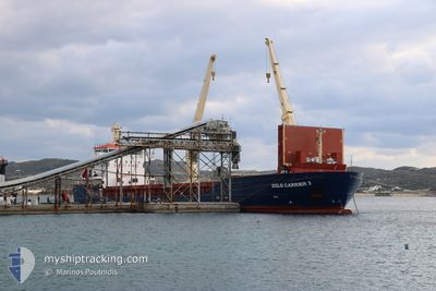
OSLO CARRIER 3
General Cargo
Current Trip
| Time Travelled | 2 days |
|---|---|
| Remaining Time | --- |
| Distance Travelled | 577.84 nm |
| Remaining Distance | --- |
| AVG Speed | 10.4 Knopen |
| MAX Speed | 11 Knopen |
| AVG Wind | 5.8 knots |
| MAX Wind | 16 knots |
| MIN Temp | 13.2°C / 55.76°F |
| MAX Temp | 17.2°C / 62.96°F |
| Diepgang | 8.5 M |
| Positie ontvangen | 1 h, 32 m geleden |
Current Position
| Lengtegraad | 16.19840° |
|---|---|
| Breedtegraat | 55.95907° |
| Status | Under way using engine |
| Snelheid | 10.2 Knopen |
| Koers | 238.9° |
| Gebied | Baltic Sea |
| Station | T-AIS |
| Positie ontvangen | 1 h, 32 m geleden |
Info
Information
The current position of OSLO CARRIER 3 is in Baltic Sea with coordinates 55.95907° / 16.19840° as reported on 2024-09-20 02:43 by AIS to our vessel tracker app. The vessel's current speed is 10.2 Knopen and is heading at the port of ALEXANDRIA. The estimated time of arrival as calculated by MyShipTracking vessel tracking app is 2024-10-05 15:00 LT
The vessel OSLO CARRIER 3 (IMO: 9366146, MMSI: 258035000) is a General Cargo that was built in 2011 ( 13 Jaar oud ). It's sailing under the flag of [NO] Norway.
In this page you can find informations about the vessels current position, last detected port calls, and current voyage information. If the vessels is not in coverage by AIS you will find the latest position.
The current position of OSLO CARRIER 3 is detected by our AIS receivers and we are not responsible for the reliability of the data. The last position was recorded while the vessel was in Coverage by the Ais receivers of our vessel tracking app.
The current draught of OSLO CARRIER 3 as reported by AIS is 8.5 meters
Weather
| Temperature | 17°C / 62.6°F |
|---|---|
| Wind Speed | 12 knots |
| Direction | 68° ENE |
| Pressure | 1030.4 hPa |
| Humidity | 90 % |
| Cloud Coverage | --- |
Featured Company
Last Port Calls
| Port | Arrival | Departure | Time In Port |
|---|---|---|---|
| 2024-09-15 16:45 | 2024-09-17 23:40 | 2 d | |
| 2024-08-18 10:45 | 2024-08-27 18:53 | 9 d | |
| 2024-08-16 06:17 | 2024-08-17 05:37 | 23 h | |
| 2024-08-09 05:22 | 2024-08-13 19:24 | 4 d | |
| 2024-07-26 05:39 | 2024-07-26 23:07 | 17 h | |
| 2024-07-23 05:34 | 2024-07-25 15:13 | 2 d | |
| 2024-07-18 19:52 | 2024-07-20 11:38 | 1 d | |
| 2024-07-18 05:50 | 2024-07-18 05:51 | 1 m | |
| 2024-07-05 14:04 | 2024-07-06 18:40 | 1 d | |
| 2024-07-01 22:34 | 2024-07-04 17:58 | 2 d |
Last Trips
| Origin | Departure | Destination | Arrival | Distance | |
|---|---|---|---|---|---|
| 2024-08-27 18:53 | 2024-09-15 16:45 | 4170.06 nm | |||
| 2024-08-17 05:37 | 2024-08-18 10:45 | 322.15 nm | |||
| 2024-08-13 19:24 | 2024-08-16 06:17 | 554.19 nm | |||
| 2024-07-26 23:07 | 2024-08-09 05:22 | 3216.33 nm | |||
| 2024-07-25 15:13 | 2024-07-26 05:39 | 127.15 nm | |||
| 2024-07-20 11:38 | 2024-07-23 05:34 | 717.45 nm | |||
| 2024-07-18 05:51 | 2024-07-18 19:52 | 133.96 nm | |||
| 2024-07-06 18:40 | 2024-07-18 05:50 | 2759.01 nm | |||
| 2024-07-04 17:58 | 2024-07-05 14:04 | 193.93 nm | |||
| 2024-06-29 02:50 | 2024-07-01 22:34 | 725.60 nm |
Events
| Tijd | Evenement | Details | Positie / Bestemming | Info |
|---|---|---|---|---|
| 2024-09-20 02:49 | Status Changed | Default Under way using engine |
55.95029 / 16.17238
ALEXANDRIA
|
Snelheid: 10.2 kn Koers: 238.9° |
| 2024-09-20 02:43 | Status Changed | Under way using engine Default |
55.95907 / 16.19840
ALEXANDRIA
|
Snelheid: 10.3 kn Koers: 239° |
| 2024-09-20 02:43 | Buitenbereik |
55.95907 / 16.19840
Baltic Sea
ALEXANDRIA
|
Snelheid: 10.2 kn Koers: 238.9° |
|
| 2024-09-20 02:41 | Status Changed | Default Under way using engine |
55.96175 / 16.20630
ALEXANDRIA
|
Snelheid: 10.3 kn Koers: 238.8° |
| 2024-09-20 02:36 | Status Changed | Under way using engine Default |
55.96992 / 16.23040
ALEXANDRIA
|
Snelheid: 10.4 kn Koers: 239° |
| 2024-09-20 02:21 | Binnenbereik |
55.96992 / 16.23040
Baltic Sea
ALEXANDRIA
|
Snelheid: 10.3 kn Koers: 238.8° |
|
| 2024-09-20 01:05 | Status Changed | Default Under way using engine |
56.10447 / 16.64085
ALEXANDRIA
|
Snelheid: 10.6 kn Koers: 237.3° |
| 2024-09-20 00:59 | Buitenbereik |
56.11415 / 16.66816
Baltic Sea
ALEXANDRIA
|
Snelheid: 10.6 kn Koers: 237.3° |
|
| 2024-09-20 00:23 | Status Changed | Under way using engine Default |
56.19176 / 16.77718
ALEXANDRIA
|
Snelheid: 10.4 kn Koers: 202° |
| 2024-09-20 00:21 | Status Changed | Default Under way using engine |
56.19805 / 16.78185
ALEXANDRIA
|
Snelheid: 10.4 kn Koers: 202.3° |