

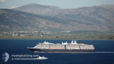
OOSTERDAM
Passengers Ship

Current Trip
CL PUQ
| Time Travelled | 1 h, 48 mins |
|---|---|
| Remaining Time | --- |
| Distance Travelled | 23.57 nm |
| Remaining Distance | --- |
| AVG Speed | 16.9 Knopen |
| MAX Speed | 18.3 Knopen |
| AVG Wind | 17.9 knots |
| MAX Wind | 22.4 knots |
| MIN Temp | 8.7°C / 47.66°F |
| MAX Temp | 10.6°C / 51.08°F |
| Diepgang | 8 M |
| Positie ontvangen | 1 d geleden |
Current Position
| Lengtegraad | --- |
|---|---|
| Breedtegraat | --- |
| Status | Under way using engine |
| Snelheid | 17.3 Knopen |
| Koers | 257° |
| Gebied | South Pacific Ocean |
| Station | T-AIS |
| Positie ontvangen | 1 d geleden |
Information
The current position of OOSTERDAM is in South Pacific Ocean with coordinates -54.90822° / -68.58553° as reported on 2025-02-12 20:16 by AIS to our vessel tracker app. The vessel's current speed is 17.3 Knopen
The vessel OOSTERDAM (IMO: 9221281, MMSI: 245417000) is a Passengers Ship that was built in 2003 ( 22 Jaar oud ). It's sailing under the flag of [NL] Netherlands.
In this page you can find informations about the vessels current position, last detected port calls, and current voyage information. If the vessels is not in coverage by AIS you will find the latest position.
The current position of OOSTERDAM is detected by our AIS receivers and we are not responsible for the reliability of the data. The last position was recorded while the vessel was in Coverage by the Ais receivers of our vessel tracking app.
The current draught of OOSTERDAM as reported by AIS is 8 meters
Weather
| Temperature | 9.5°C / 49.1°F |
|---|---|
| Wind Speed | 22 knots |
| Direction | 236° SW |
| Pressure | 1012.9 hPa |
| Humidity | 76.2 % |
| Cloud Coverage | 67 % |


Featured Company
Last Port Calls
| Port | Arrival | Departure | Time In Port |
|---|---|---|---|
| 2025-02-13 11:57 | 2025-02-13 22:28 | 10 h | |
| 2025-02-12 10:22 | 2025-02-12 18:12 | 7 h | |
| 2025-02-02 12:28 | 2025-02-02 22:17 | 9 h | |
| 2025-01-31 08:58 | 2025-01-31 21:10 | 12 h | |
| 2025-01-27 10:04 | 2025-01-29 23:26 | 2 d | |
| 2025-01-26 09:14 | 2025-01-26 21:18 | 12 h | |
| 2025-01-23 11:02 | 2025-01-23 20:37 | 9 h | |
| 2025-01-13 11:36 | 2025-01-13 23:01 | 11 h | |
| 2025-01-11 18:26 | 2025-01-11 23:25 | 4 h | |
| 2025-01-08 20:06 | 2025-01-08 20:33 | 27 m |
Last Trips
| Origin | Departure | Destination | Arrival | Distance | |
|---|---|---|---|---|---|
| 2025-02-12 15:12 | 2025-02-13 08:57 | 284.29 nm | |||
| 2025-02-02 19:17 | 2025-02-12 07:22 | 2551.89 nm | |||
| 2025-01-31 18:10 | 2025-02-02 09:28 | 707.33 nm | |||
| 2025-01-29 20:26 | 2025-01-31 05:58 | 248.66 nm | |||
| 2025-01-26 18:18 | 2025-01-27 07:04 | 138.70 nm | |||
| 2025-01-23 17:37 | 2025-01-26 06:14 | 772.75 nm | |||
| 2025-01-13 20:01 | 2025-01-23 08:02 | 2680.73 nm | |||
| 2025-01-11 20:25 | 2025-01-13 08:36 | 388.04 nm | |||
| 2025-01-08 17:33 | 2025-01-11 15:26 | 1069.75 nm | |||
| 2025-01-06 19:17 | 2025-01-08 17:06 | 606.10 nm |
Events
| Tijd | Evenement | Details | Positie / Bestemming | Info |
|---|---|---|---|---|
| 2025-02-13 22:38 | Start beweging | 1.96 nm, South of PUNTA ARENAS |
-53.17530 / -70.88157
CL PUQ
|
Snelheid: 6.8 kn Koers: 157° |
| 2025-02-13 22:28 | Vertrekhaven |
|
-53.17267 / -70.88802
CL PUQ
|
Snelheid: 1.3 kn Koers: 96° |
| 2025-02-13 12:36 | Stop beweging |
-53.17637 / -70.89516
[CL] PUNTA ARENAS
|
Snelheid: 0.2 kn Koers: 298° |
|
| 2025-02-13 11:57 | Aankomsthaven |
|
-53.17746 / -70.89825
[CL] PUNTA ARENAS
|
Snelheid: 4.7 kn Koers: 282° |
| 2025-02-12 20:20 | Status Changed | Default Under way using engine |
-54.91322 / -68.62002
CL PUQ
|
Snelheid: 17.3 kn Koers: 257° |
| 2025-02-12 20:16 | Buitenbereik |
-54.90822 / -68.58553
South Pacific Ocean
CL PUQ
|
Snelheid: 17.3 kn Koers: 257° |
|
| 2025-02-12 19:38 | Wijzig zee gebeid | Argentinean part of the South Pacific Ocean Chilean (disputed - Chilean point of view) part of the South Pacific Ocean |
-54.88037 / -68.35617
South Pacific Ocean
CL PUQ
|
Snelheid: 14.5 kn Koers: 279.4° |
| 2025-02-12 18:58 | Wijzig zee gebeid | Chilean (disputed - Chilean point of view) part of the South Pacific Ocean Argentinean part of the South Pacific Ocean |
-54.88303 / -68.07278
South Pacific Ocean
CL PUQ
|
Snelheid: 12.8 kn Koers: 263° |
| 2025-02-12 18:17 | Status Changed | Under way using engine Moored |
-54.81361 / -68.28350
CL PUQ
|
Snelheid: 1.9 kn Koers: 145° |
| 2025-02-12 18:12 | Vertrekhaven |
|
-54.81288 / -68.28931
CL PUQ
|
Snelheid: 2.9 kn Koers: 237° |