
ONIKS
General Cargo
Current Trip
| Trip Time | --- |
|---|---|
| Trip Distance | --- |
| AVG Speed | --- |
| MAX Speed | --- |
| Diepgang | --- |
| AVG Wind | --- |
| MAX Wind | --- |
| MIN Temp | --- |
| MAX Temp | --- |
| Positie ontvangen | 8 d geleden |
Current Position
| Lengtegraad | 29.56463° |
|---|---|
| Breedtegraat | 41.27220° |
| Status | Under way using engine |
| Snelheid | 9.8 Knopen |
| Koers | 80.9° |
| Gebied | Black Sea |
| Station | T-AIS |
| Positie ontvangen | 8 d geleden |
Info
Information
The current position of ONIKS is in Black Sea with coordinates 41.27220° / 29.56463° as reported on 2024-05-04 19:41 by AIS to our vessel tracker app. The vessel's current speed is 9.8 Knopen and is currently inside the port of TEMRYUK.
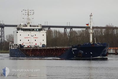
The vessel ONIKS (IMO: 9555321, MMSI: 273339540) is a General Cargo that was built in 2012 ( 12 Jaar oud ). It's sailing under the flag of [RU] Russia.
In this page you can find informations about the vessels current position, last detected port calls, and current voyage information. If the vessels is not in coverage by AIS you will find the latest position.
The current position of ONIKS is detected by our AIS receivers and we are not responsible for the reliability of the data. The last position was recorded while the vessel was in Coverage by the Ais receivers of our vessel tracking app.
The current draught of ONIKS as reported by AIS is 4.7 meters
Weather
| Temperature | 15.5°C / 59.9°F |
|---|---|
| Wind Speed | 12 knots |
| Direction | 351° N |
| Pressure | 1013.7 hPa |
| Humidity | 44.4 % |
| Cloud Coverage | 58 % |
Featured Company
Last Port Calls
| Port | Arrival | Departure | Time In Port |
|---|---|---|---|
| 2024-04-27 14:06 | 2024-05-03 07:24 | 5 d | |
| 2024-04-12 23:09 | |||
| 2024-04-03 17:53 | 2024-04-05 19:24 | 2 d | |
| 2024-04-02 07:24 | 2024-04-03 14:48 | 1 d | |
| 2024-03-28 14:41 | |||
| 2024-03-18 08:17 | 2024-03-19 06:35 | 22 h | |
| 2024-03-02 15:21 |
Most Visited Ports (Last year)
| Port | Arrivals | |
|---|---|---|
| 11 | ||
| 5 | ||
| 4 | ||
| 4 | ||
| 2 | ||
| 2 |
Last Trips
Events
| Tijd | Evenement | Details | Positie / Bestemming | Info |
|---|---|---|---|---|
| 2024-05-08 01:35 | Stop beweging | 10.57 nm, South of TAMAN |
44.94826 / 36.63471
RU TMR
|
Snelheid: 0.1 kn Koers: 239° |
| 2024-05-08 01:01 | Start beweging | 10.49 nm, South of TAMAN |
44.94935 / 36.63815
RU TMR
|
Snelheid: 42.4 kn Koers: 68° |
| 2024-05-08 00:46 | Stop beweging | 10.58 nm, South of TAMAN |
44.94806 / 36.63471
RU TMR
|
Snelheid: 0.2 kn Koers: 251° |
| 2024-05-04 19:43 | Status Changed | Default Under way using engine |
41.27332 / 29.57359
RU TMR
|
Snelheid: 9.8 kn Koers: 80.9° |
| 2024-05-04 19:41 | Status Changed | Under way using engine Default |
41.27220 / 29.56463
RU TMR
|
Snelheid: 9.7 kn Koers: 91° |
| 2024-05-04 19:41 | Buitenbereik |
41.27220 / 29.56463
Black Sea
RU TMR
|
Snelheid: 9.8 kn Koers: 80.9° |
|
| 2024-05-04 19:13 | Status Changed | Default Under way using engine |
41.27104 / 29.46559
RU TMR
|
Snelheid: 9.8 kn Koers: 90.9° |
| 2024-05-04 17:40 | Wijzig zee gebeid | Turkish part of the Black Sea Turkish part of the Sea of Marmara |
41.23160 / 29.14710
Black Sea
RU TMR
|
Snelheid: 8.2 kn Koers: 41.7° |
| 2024-05-04 08:13 | Start beweging | 10.51 nm, South of YESILKOY |
40.78983 / 28.90137
RU TMR
|
Snelheid: 3.7 kn Koers: 227° |
| 2024-05-04 08:09 | Stop beweging | 10.48 nm, South of YESILKOY |
40.79111 / 28.90406
RU TMR
|
Snelheid: 0.1 kn Koers: 247° |