
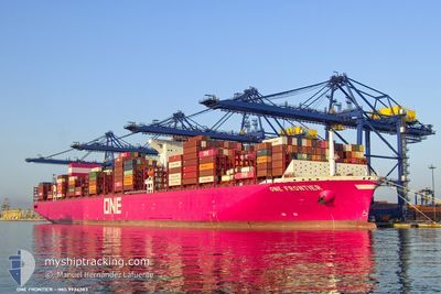
ONE FRONTIER
Cargo A
Current Trip
| Time Travelled | 18 days |
|---|---|
| Remaining Time | --- |
| Distance Travelled | 6787.96 nm |
| Remaining Distance | 4818.66 nm |
| AVG Speed | 14.8 Knopen |
| MAX Speed | 17.7 Knopen |
| AVG Wind | 14.9 knots |
| MAX Wind | 37 knots |
| MIN Temp | 4°C / 39.2°F |
| MAX Temp | 28.9°C / 84.02°F |
| Diepgang | 13.2 M |
| Positie ontvangen | 2 d geleden |
Current Position
| Lengtegraad | 18.62881° |
|---|---|
| Breedtegraat | -34.63448° |
| Status | Under way using engine |
| Snelheid | 15.4 Knopen |
| Koers | 118.2° |
| Gebied | South Atlantic Ocean |
| Station | T-AIS |
| Positie ontvangen | 2 d geleden |
Info
Information
The current position of ONE FRONTIER is in South Atlantic Ocean with coordinates -34.63448° / 18.62881° as reported on 2024-05-09 16:58 by AIS to our vessel tracker app. The vessel's current speed is 15.4 Knopen and is heading at the port of SINGAPORE. The estimated time of arrival as calculated by MyShipTracking vessel tracking app is 2024-05-24 05:00 LT
The vessel ONE FRONTIER (IMO: 9934383, MMSI: 477867900) is a Cargo A It's sailing under the flag of [HK] Hong Kong.
In this page you can find informations about the vessels current position, last detected port calls, and current voyage information. If the vessels is not in coverage by AIS you will find the latest position.
The current position of ONE FRONTIER is detected by our AIS receivers and we are not responsible for the reliability of the data. The last position was recorded while the vessel was in Coverage by the Ais receivers of our vessel tracking app.
The current draught of ONE FRONTIER as reported by AIS is 13.2 meters
Weather
| Temperature | 21.7°C / 71.06°F |
|---|---|
| Wind Speed | 13 knots |
| Direction | 193° SSW |
| Pressure | 1022 hPa |
| Humidity | 64.1 % |
| Cloud Coverage | --- |
Featured Company
Last Trips
Events
| Tijd | Evenement | Details | Positie / Bestemming | Info |
|---|---|---|---|---|
| 2024-05-09 17:03 | Status Changed | Default Under way using engine |
-34.64457 / 18.65151
SGSIN PWBGA
|
Snelheid: 15.4 kn Koers: 118.2° |
| 2024-05-09 16:58 | Buitenbereik |
-34.63448 / 18.62881
South Atlantic Ocean
SGSIN PWBGA
|
Snelheid: 15.4 kn Koers: 118.2° |
|
| 2024-05-09 16:04 | Destination Changed | SGSIN PWBGA SGSIN PEBGA |
-34.52288 / 18.37820
SGSIN PWBGA
|
Snelheid: 15.5 kn Koers: 113.8° |
| 2024-05-09 13:58 | Status Changed | Under way using engine Default |
-34.24927 / 17.82518
SGSIN PEBGA
|
Snelheid: 15.1 kn Koers: 137° |
| 2024-05-09 13:54 | Status Changed | Default Under way using engine |
-34.23512 / 17.80931
SGSIN PEBGA
|
Snelheid: 15.2 kn Koers: 139.1° |
| 2024-05-09 13:46 | Status Changed | Under way using engine Default |
-34.21187 / 17.78370
SGSIN PEBGA
|
Snelheid: 15.1 kn Koers: 135° |
| 2024-05-09 13:35 | Binnenbereik |
-34.21187 / 17.78370
South Atlantic Ocean
SGSIN PEBGA
|
Snelheid: 15.1 kn Koers: 136.2° |
|
| 2024-05-09 12:14 | Status Changed | Default Under way using engine |
-33.91647 / 17.46288
SGSIN PEBGA
|
Snelheid: 15.2 kn Koers: 142° |
| 2024-05-09 12:07 | Buitenbereik |
-33.89186 / 17.43921
South Atlantic Ocean
SGSIN PEBGA
|
Snelheid: 15.2 kn Koers: 142° |
|
| 2024-05-09 11:40 | Status Changed | Under way using engine Default |
-33.80066 / 17.35908
SGSIN PEBGA
|
Snelheid: 15.3 kn Koers: 149° |