
OLYMPIC FLAG
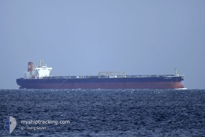
Crude Oil Tanker
Current Trip
| Time Travelled | --- |
|---|---|
| Remaining Time | 1 day |
| Distance Travelled | --- |
| Remaining Distance | 749.86 nm |
| AVG Speed | --- |
| MAX Speed | --- |
| AVG Wind | --- |
| MAX Wind | --- |
| MIN Temp | --- |
| MAX Temp | --- |
| Diepgang | 15 M |
| Positie ontvangen | 2 d geleden |
Current Position
| Lengtegraad | --- |
|---|---|
| Breedtegraat | --- |
| Status | Under way using engine |
| Snelheid | 13.9 Knopen |
| Koers | 83.6° |
| Gebied | Mediterranean Sea - Western Basin |
| Station | T-AIS |
| Positie ontvangen | 2 d geleden |
Info
Information
The current position of OLYMPIC FLAG is in Mediterranean Sea - Western Basin with coordinates 37.29244° / 3.89779° as reported on 2025-12-09 22:37 by AIS to our vessel tracker app. The vessel's current speed is 13.9 Knopen and is heading at the port of PORT SAID. The estimated time of arrival as calculated by MyShipTracking vessel tracking app is 2025-12-14 14:53 LT
The vessel OLYMPIC FLAG (IMO: 9271341, MMSI: 240168000) is a Crude Oil Tanker that was built in 2004 ( 21 Jaar oud ). It's sailing under the flag of [GR] Greece.
In this page you can find informations about the vessels current position, last detected port calls, and current voyage information. If the vessels is not in coverage by AIS you will find the latest position.
The current position of OLYMPIC FLAG is detected by our AIS receivers and we are not responsible for the reliability of the data. The last position was recorded while the vessel was in Coverage by the Ais receivers of our vessel tracking app.
The current draught of OLYMPIC FLAG as reported by AIS is 15 meters
Weather
| Temperature | 17.7°C / 63.86°F |
|---|---|
| Wind Speed | 4 knots |
| Direction | 359° N |
| Pressure | 1020.9 hPa |
| Humidity | 59.6 % |
| Cloud Coverage | 13 % |
Featured Company
Last Port Calls
| Port | Arrival | Departure | Time In Port |
|---|---|---|---|
| 2025-11-25 16:01 | |||
| 2025-11-06 08:18 | 2025-11-06 17:31 | 9 h | |
| 2025-10-15 07:16 | 2025-10-15 16:15 | 8 h |
Most Visited Ports (Last year)
| Port | Arrivals | |
|---|---|---|
| 9 | ||
| 6 | ||
| 2 | ||
| 1 | ||
| 1 | ||
| 1 |
Last Trips
| Origin | Departure | Destination | Arrival | Distance | |
|---|---|---|---|---|---|
| 2025-09-27 03:40 | 2025-11-25 16:01 | 15360.55 nm | |||
| 2025-09-27 03:40 | 2025-11-06 08:18 | 9697.32 nm | |||
| 2025-09-27 03:40 | 2025-10-15 07:16 | 4852.58 nm |
Events
| Tijd | Evenement | Details | Positie / Bestemming | Info |
|---|---|---|---|---|
| 2025-12-12 07:39 | Stop beweging |
35.45667 / 19.58833
EG PSD
|
Snelheid: Koers: -1° |
|
| 2025-12-09 22:45 | Status Changed | Default Under way using engine |
37.29368 / 3.93470
EG PSD
|
Snelheid: 13.9 kn Koers: 83.6° |
| 2025-12-09 22:37 | Buitenbereik |
37.29244 / 3.89779
Mediterranean Sea - Western Basin
EG PSD
|
Snelheid: 13.9 kn Koers: 83.6° |
|
| 2025-12-09 21:43 | Status Changed | Under way using engine Default |
37.27047 / 3.63491
EG PSD
|
Snelheid: 14.1 kn Koers: 84° |
| 2025-12-09 21:33 | Status Changed | Default Under way using engine |
37.26582 / 3.58396
EG PSD
|
Snelheid: 14.2 kn Koers: 84° |
| 2025-12-09 21:23 | Status Changed | Under way using engine Default |
37.26190 / 3.53938
EG PSD
|
Snelheid: 14.2 kn Koers: 84° |
| 2025-12-09 21:21 | Status Changed | Default Under way using engine |
37.26086 / 3.52710
EG PSD
|
Snelheid: 14.2 kn Koers: 85.2° |
| 2025-12-09 18:12 | Status Changed | Under way using engine Default |
37.18111 / 2.59034
EG PSD
|
Snelheid: 14.4 kn Koers: 83° |
| 2025-12-09 17:45 | Status Changed | Default Under way using engine |
37.16749 / 2.45935
EG PSD
|
Snelheid: 14.2 kn Koers: 81.8° |
| 2025-12-09 16:56 | Status Changed | Under way using engine Default |
37.14242 / 2.21778
EG PSD
|
Snelheid: 14.1 kn Koers: 82° |