

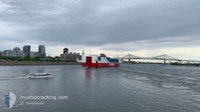
OCEANEX CONNAIGRA
Ro-Ro Cargo

Current Trip
| Time Travelled | 2 days |
|---|---|
| Remaining Time | --- |
| Distance Travelled | 842.78 nm |
| Remaining Distance | --- |
| AVG Speed | 15.5 Knopen |
| MAX Speed | 23.8 Knopen |
| AVG Wind | 15.9 knots |
| MAX Wind | 27.8 knots |
| MIN Temp | -17.6°C / 0.32°F |
| MAX Temp | -3.3°C / 26.06°F |
| Diepgang | 8.3 M |
| Positie ontvangen | 1 d geleden |
Current Position
| Lengtegraad | --- |
|---|---|
| Breedtegraat | --- |
| Status | Under way using engine |
| Snelheid | 11.2 Knopen |
| Koers | 55.5° |
| Gebied | North Atlantic Ocean |
| Station | T-AIS |
| Positie ontvangen | 1 d geleden |
Information
The current position of OCEANEX CONNAIGRA is in North Atlantic Ocean with coordinates 46.24913° / -72.73578° as reported on 2025-03-02 00:38 by AIS to our vessel tracker app. The vessel's current speed is 11.2 Knopen and is heading at the port of ST JOHNS. The estimated time of arrival as calculated by MyShipTracking vessel tracking app is 2025-03-04 11:00 LT
The vessel OCEANEX CONNAIGRA (IMO: 9649718, MMSI: 316025676) is a Ro-Ro Cargo that was built in 2013 ( 12 Jaar oud ). It's sailing under the flag of [CA] Canada.
In this page you can find informations about the vessels current position, last detected port calls, and current voyage information. If the vessels is not in coverage by AIS you will find the latest position.
The current position of OCEANEX CONNAIGRA is detected by our AIS receivers and we are not responsible for the reliability of the data. The last position was recorded while the vessel was in Coverage by the Ais receivers of our vessel tracking app.
The current draught of OCEANEX CONNAIGRA as reported by AIS is 8.3 meters
Weather
| Temperature | -3.4°C / 25.88°F |
|---|---|
| Wind Speed | 15 knots |
| Direction | 320° NW |
| Pressure | 1011.5 hPa |
| Humidity | 59.5 % |
| Cloud Coverage | 100 % |


Featured Company
Last Port Calls
| Port | Arrival | Departure | Time In Port |
|---|---|---|---|
| 2025-02-28 09:36 | 2025-03-01 20:43 | 1 d | |
| 2025-02-25 10:07 | 2025-02-26 03:38 | 17 h | |
| 2025-02-21 19:51 | 2025-02-22 19:23 | 23 h | |
| 2025-02-18 06:22 | 2025-02-19 09:27 | 1 d | |
| 2025-02-14 12:56 | 2025-02-15 19:28 | 1 d | |
| 2025-02-11 10:11 | 2025-02-12 03:50 | 17 h | |
| 2025-02-07 13:49 | 2025-02-08 18:55 | 1 d | |
| 2025-02-04 10:09 | 2025-02-05 02:25 | 16 h | |
| 2025-01-31 20:13 | 2025-02-01 20:16 | 1 d | |
| 2025-01-28 10:09 | 2025-01-29 02:55 | 16 h |
Last Trips
| Origin | Departure | Destination | Arrival | Distance | |
|---|---|---|---|---|---|
| 2025-02-26 00:08 | 2025-02-28 04:36 | 1030.82 nm | |||
| 2025-02-22 14:23 | 2025-02-25 06:37 | 1020.15 nm | |||
| 2025-02-19 05:57 | 2025-02-21 14:51 | 1027.58 nm | |||
| 2025-02-15 14:28 | 2025-02-18 02:52 | 1032.09 nm | |||
| 2025-02-12 00:20 | 2025-02-14 07:56 | 1034.06 nm | |||
| 2025-02-08 13:55 | 2025-02-11 06:41 | 1034.46 nm | |||
| 2025-02-04 22:55 | 2025-02-07 08:49 | 1036.71 nm | |||
| 2025-02-01 15:16 | 2025-02-04 06:39 | 1023.42 nm | |||
| 2025-01-28 23:25 | 2025-01-31 15:13 | 1138.41 nm | |||
| 2025-01-25 14:02 | 2025-01-28 06:39 | 1018.85 nm |
Events
| Tijd | Evenement | Details | Positie / Bestemming | Info |
|---|---|---|---|---|
| 2025-03-02 00:44 | Status Changed | Default Under way using engine |
46.25830 / -72.71592
ST-JOHN'S NL
|
Snelheid: 11.2 kn Koers: 55.5° |
| 2025-03-02 00:38 | Status Changed | Under way using engine Default |
46.24913 / -72.73578
ST-JOHN'S NL
|
Snelheid: 11.1 kn Koers: 56° |
| 2025-03-02 00:38 | Buitenbereik |
46.24913 / -72.73578
North Atlantic Ocean
ST-JOHN'S NL
|
Snelheid: 11.2 kn Koers: 55.5° |
|
| 2025-03-01 23:59 | Status Changed | Default Under way using engine |
46.19380 / -72.88650
ST-JOHN'S NL
|
Snelheid: 11.4 kn Koers: 52.5° |
| 2025-03-01 20:43 | Vertrekhaven |
|
45.63223 / -73.48687
ST-JOHN'S NL
|
Snelheid: 11.4 kn Koers: 24° |
| 2025-03-01 19:47 | Start beweging |
45.49565 / -73.54890
[CA] MONTREAL
|
Snelheid: 3.6 kn Koers: 4° |
|
| 2025-03-01 19:40 | Status Changed | Under way using engine Moored |
45.49343 / -73.54897
[CA] MONTREAL
|
Snelheid: Koers: 4° |
| 2025-03-01 19:39 | Draught Changed | 8.3 8.4 |
45.49343 / -73.54897
[CA] MONTREAL
|
Snelheid: Koers: 4° |
| 2025-03-01 18:03 | Status Changed | Moored Default |
45.49343 / -73.54897
[CA] MONTREAL
|
Snelheid: Koers: 4° |
| 2025-03-01 17:57 | Status Changed | Default Moored |
45.49342 / -73.54896
[CA] MONTREAL
|
Snelheid: Koers: 4° |