

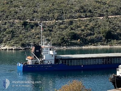
NS THOR
General Cargo

Current Trip
| Time Travelled | 1 day |
|---|---|
| Remaining Time | --- |
| Distance Travelled | 105.33 nm |
| Remaining Distance | --- |
| AVG Speed | 8.2 Knopen |
| MAX Speed | 8.8 Knopen |
| AVG Wind | 3.2 knots |
| MAX Wind | 6.8 knots |
| MIN Temp | 7°C / 44.6°F |
| MAX Temp | 11.3°C / 52.34°F |
| Diepgang | 5.5 M |
| Positie ontvangen | 11 h, 32 m geleden |
Current Position
| Lengtegraad | --- |
|---|---|
| Breedtegraat | --- |
| Status | Under way using engine |
| Snelheid | 7.7 Knopen |
| Koers | 187.6° |
| Gebied | Adriatic Sea |
| Station | T-AIS |
| Positie ontvangen | 11 h, 32 m geleden |
Information
The current position of NS THOR is in Adriatic Sea with coordinates 39.77757° / 19.96719° as reported on 2025-02-22 00:04 by AIS to our vessel tracker app. The vessel's current speed is 7.7 Knopen and is heading at the port of TSINGELI. The estimated time of arrival as calculated by MyShipTracking vessel tracking app is 2025-02-24 18:00 LT
The vessel NS THOR (IMO: 8915744, MMSI: 312558000) is a General Cargo that was built in 1991 ( 34 Jaar oud ). It's sailing under the flag of [BZ] Belize.
In this page you can find informations about the vessels current position, last detected port calls, and current voyage information. If the vessels is not in coverage by AIS you will find the latest position.
The current position of NS THOR is detected by our AIS receivers and we are not responsible for the reliability of the data. The last position was recorded while the vessel was in Coverage by the Ais receivers of our vessel tracking app.
The current draught of NS THOR as reported by AIS is 5.5 meters
Weather
| Temperature | 9.2°C / 48.56°F |
|---|---|
| Wind Speed | 8 knots |
| Direction | 129° SE |
| Pressure | 1031 hPa |
| Humidity | 45.9 % |
| Cloud Coverage | 15 % |


Featured Company
Last Port Calls
| Port | Arrival | Departure | Time In Port |
|---|---|---|---|
| 2025-02-14 09:28 | 2025-02-21 11:21 | 7 d | |
| 2025-02-10 03:55 | 2025-02-11 01:12 | 21 h | |
| 2025-02-07 15:43 | 2025-02-09 02:15 | 1 d | |
| 2025-01-31 05:39 | 2025-02-05 07:24 | 5 d | |
| 2025-01-24 12:39 | 2025-01-27 18:53 | 3 d | |
| 2025-01-07 17:29 | 2025-01-09 00:09 | 1 d | |
| 2024-12-29 10:13 | 2025-01-04 16:16 | 6 d | |
| 2024-12-24 13:51 | 2024-12-28 21:10 | 4 d | |
| 2024-12-13 10:41 | 2024-12-15 20:03 | 2 d | |
| 2024-12-03 13:32 | 2024-12-10 08:40 | 6 d |
Last Trips
| Origin | Departure | Destination | Arrival | Distance | |
|---|---|---|---|---|---|
| 2025-02-11 04:12 | 2025-02-14 10:28 | 645.12 nm | |||
| 2025-02-09 05:15 | 2025-02-10 06:55 | 186.45 nm | |||
| 2025-02-05 09:24 | 2025-02-07 18:43 | 381.30 nm | |||
| 2025-01-27 19:53 | 2025-01-31 07:39 | 691.06 nm | |||
| 2025-01-09 03:09 | 2025-01-24 13:39 | 648.37 nm | |||
| 2025-01-04 17:16 | 2025-01-07 20:29 | 655.96 nm | |||
| 2024-12-28 22:10 | 2024-12-29 11:13 | 104.84 nm | |||
| 2024-12-15 23:03 | 2024-12-24 14:51 | 584.57 nm | |||
| 2024-12-10 09:40 | 2024-12-13 13:41 | 644.93 nm | |||
| 2024-12-02 07:39 | 2024-12-03 14:32 | 102.00 nm |
Events
| Tijd | Evenement | Details | Positie / Bestemming | Info |
|---|---|---|---|---|
| 2025-02-22 00:05 | Status Changed | Default Under way using engine |
39.77608 / 19.96691
GRTSI
|
Snelheid: 7.7 kn Koers: 187.6° |
| 2025-02-22 00:04 | Buitenbereik |
39.77757 / 19.96719
Adriatic Sea
GRTSI
|
Snelheid: 7.7 kn Koers: 187.6° |
|
| 2025-02-21 23:19 | Wijzig zee gebeid | Greek part of the Adriatic Sea Albanian part of the Adriatic Sea |
39.85065 / 19.87158
Adriatic Sea
GRTSI
|
Snelheid: 8.3 kn Koers: 134.6° |
| 2025-02-21 23:17 | Status Changed | Under way using engine Default |
39.85383 / 19.86730
GRTSI
|
Snelheid: 8.2 kn Koers: 136° |
| 2025-02-21 23:17 | Binnenbereik |
39.85065 / 19.87158
Adriatic Sea
GRTSI
|
Snelheid: 8.3 kn Koers: 134.6° |
|
| 2025-02-21 12:05 | Status Changed | Default Under way using engine |
41.21178 / 19.40574
GRTSI
|
Snelheid: 8.3 kn Koers: 206.6° |
| 2025-02-21 11:58 | Buitenbereik |
41.22765 / 19.41615
Adriatic Sea
GRTSI
|
Snelheid: 8.3 kn Koers: 206.6° |
|
| 2025-02-21 11:39 | Status Changed | Under way using engine Moored |
41.26649 / 19.44368
GRTSI
|
Snelheid: 8.7 kn Koers: 210.6° |
| 2025-02-21 11:21 | Vertrekhaven |
|
41.30111 / 19.45717
GRTSI
|
Snelheid: 6.3 kn Koers: 167° |
| 2025-02-21 11:15 | Start beweging |
41.31051 / 19.45601
[AL] DURRES
|
Snelheid: 3.1 kn Koers: 190° |