

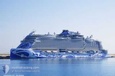
NORWEGIAN VIVA
Passenger

Current Trip
| Trip Time | 13 h, 6 mins |
|---|---|
| Trip Distance | 176.66 nm |
| AVG Speed | 13.8 Knopen |
| MAX Speed | 16 Knopen |
| Diepgang | 8.4 M |
| AVG Wind | 8.4 knots |
| MAX Wind | 15.5 knots |
| MIN Temp | 25.1°C / 77.18°F |
| MAX Temp | 26.2°C / 79.16°F |
| Positie ontvangen | 9 h, 3 m geleden |
Current Position
| Lengtegraad | --- |
|---|---|
| Breedtegraat | --- |
| Status | Under way using engine |
| Snelheid | 15.9 Knopen |
| Koers | 119.1° |
| Gebied | Caribbean Sea |
| Station | T-AIS |
| Positie ontvangen | 9 h, 3 m geleden |
Information
The current position of NORWEGIAN VIVA is in Caribbean Sea with coordinates 17.41587° / -62.47305° as reported on 2025-03-04 06:42 by AIS to our vessel tracker app. The vessel's current speed is 15.9 Knopen and is currently inside the port of ST JOHNS.
The vessel NORWEGIAN VIVA (IMO: 9823998, MMSI: 311001127) is a Passenger It's sailing under the flag of [BS] Bahamas.
In this page you can find informations about the vessels current position, last detected port calls, and current voyage information. If the vessels is not in coverage by AIS you will find the latest position.
The current position of NORWEGIAN VIVA is detected by our AIS receivers and we are not responsible for the reliability of the data. The last position was recorded while the vessel was in Coverage by the Ais receivers of our vessel tracking app.
The current draught of NORWEGIAN VIVA as reported by AIS is 8.4 meters
Weather
| Temperature | 26.8°C / 80.24°F |
|---|---|
| Wind Speed | 15 knots |
| Direction | 122° ESE |
| Pressure | 1015.7 hPa |
| Humidity | 69.5 % |
| Cloud Coverage | 28 % |


Featured Company
Last Port Calls
| Port | Arrival | Departure | Time In Port |
|---|---|---|---|
| 2025-03-04 10:03 | |||
| 2025-03-03 10:56 | 2025-03-03 20:57 | 10 h | |
| 2025-03-02 08:53 | 2025-03-02 23:28 | 14 h | |
| 2025-03-01 10:11 | 2025-03-01 20:56 | 10 h | |
| 2025-02-28 10:07 | 2025-02-28 21:18 | 11 h | |
| 2025-02-26 10:07 | 2025-02-26 21:11 | 11 h | |
| 2025-02-24 10:22 | 2025-02-24 19:03 | 8 h | |
| 2025-02-23 09:24 | 2025-02-23 23:27 | 14 h | |
| 2025-02-22 10:30 | 2025-02-22 21:07 | 10 h | |
| 2025-02-21 09:48 | 2025-02-21 21:07 | 11 h |
Last Trips
| Origin | Departure | Destination | Arrival | Distance | |
|---|---|---|---|---|---|
| 2025-03-03 16:57 | 2025-03-04 06:03 | 176.66 nm | |||
| 2025-03-02 19:28 | 2025-03-03 06:56 | 112.70 nm | |||
| 2025-03-01 16:56 | 2025-03-02 04:53 | 223.98 nm | |||
| 2025-02-28 17:18 | 2025-03-01 06:11 | 222.90 nm | |||
| 2025-02-26 17:11 | 2025-02-28 06:07 | 492.65 nm | |||
| 2025-02-24 15:03 | 2025-02-26 06:07 | 449.66 nm | |||
| 2025-02-23 19:27 | 2025-02-24 06:22 | 189.57 nm | |||
| 2025-02-22 17:07 | 2025-02-23 05:24 | 226.55 nm | |||
| 2025-02-21 17:07 | 2025-02-22 06:30 | 222.04 nm | |||
| 2025-02-19 17:03 | 2025-02-21 05:48 | 492.72 nm |
Events
| Tijd | Evenement | Details | Positie / Bestemming | Info |
|---|---|---|---|---|
| 2025-03-04 10:35 | Stop beweging |
17.12316 / -61.85059
[AG] ST JOHNS
|
Snelheid: Koers: 284° |
|
| 2025-03-04 10:03 | Aankomsthaven |
|
17.12565 / -61.86299
[AG] ST JOHNS
|
Snelheid: 7.9 kn Koers: 113° |
| 2025-03-04 06:50 | Status Changed | Default Under way using engine |
17.39923 / -62.44169
ST JOHNS, ANTIGUA
|
Snelheid: 15.9 kn Koers: 119.1° |
| 2025-03-04 06:42 | Buitenbereik |
17.41587 / -62.47305
Caribbean Sea
ST JOHNS, ANTIGUA
|
Snelheid: 15.9 kn Koers: 119.1° |
|
| 2025-03-04 06:37 | Status Changed | Under way using engine Default |
17.42817 / -62.49437
ST JOHNS, ANTIGUA
|
Snelheid: 15.8 kn Koers: 122° |
| 2025-03-04 06:23 | Status Changed | Default Under way using engine |
17.46163 / -62.54855
ST JOHNS, ANTIGUA
|
Snelheid: 15 kn Koers: 127° |
| 2025-03-04 05:20 | Wijzig zee gebeid | Saint Kitts and Nevis part of the Caribbean Sea Sint-Eustasius part of the Caribbean Sea |
17.60658 / -62.78678
Caribbean Sea
ST JOHNS, ANTIGUA
|
Snelheid: 15.6 kn Koers: 121.1° |
| 2025-03-04 04:22 | Wijzig zee gebeid | Sint-Eustasius part of the Caribbean Sea Saba part of the Caribbean Sea |
17.72110 / -63.02479
Caribbean Sea
ST JOHNS, ANTIGUA
|
Snelheid: 15.8 kn Koers: 117° |
| 2025-03-04 02:58 | Wijzig zee gebeid | Saba part of the Caribbean Sea Saint-Martin part of the Caribbean Sea |
17.88781 / -63.36567
Caribbean Sea
ST JOHNS, ANTIGUA
|
Snelheid: 15.7 kn Koers: 116.6° |
| 2025-03-04 02:04 | Gevonden in zee | Saint-Martin part of the Caribbean Sea |
17.97740 / -63.58006
Caribbean Sea
ST JOHNS, ANTIGUA
|
Snelheid: 14.8 kn Koers: 111.4° |