
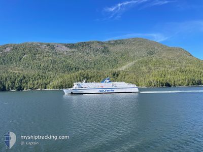
NORTHERN EXPEDITION
Ro-Ro/Passenger Ship
Current Trip
| Time Travelled | 23 days |
|---|---|
| Remaining Time | --- |
| Distance Travelled | 212.92 nm |
| Remaining Distance | --- |
| AVG Speed | 11.4 Knopen |
| MAX Speed | 17.7 Knopen |
| AVG Wind | 6.3 knots |
| MAX Wind | 29.3 knots |
| MIN Temp | 3.7°C / 38.66°F |
| MAX Temp | 8.3°C / 46.94°F |
| Diepgang | 4.9 M |
| Positie ontvangen | 1 m geleden |
Current Position
| Lengtegraad | --- |
|---|---|
| Breedtegraat | --- |
| Status | Under way using engine |
| Snelheid | |
| Koers | 240° |
| Gebied | The Coastal Waters of Southeast Alaska and British Columbia |
| Station | T-AIS |
| Positie ontvangen | 1 m geleden |
Info
Information
The current position of NORTHERN EXPEDITION is in The Coastal Waters of Southeast Alaska and British Columbia with coordinates 49.12438° / -123.08589° as reported on 2025-03-18 06:26 by AIS to our vessel tracker app. The vessel's current speed is 0 Knopen
The vessel NORTHERN EXPEDITION (IMO: 9408413, MMSI: 316014054) is a Ro-Ro/Passenger Ship that was built in 2009 ( 16 Jaar oud ). It's sailing under the flag of [CA] Canada.
In this page you can find informations about the vessels current position, last detected port calls, and current voyage information. If the vessels is not in coverage by AIS you will find the latest position.
The current position of NORTHERN EXPEDITION is detected by our AIS receivers and we are not responsible for the reliability of the data. The last position was recorded while the vessel was in Coverage by the Ais receivers of our vessel tracking app.
The current draught of NORTHERN EXPEDITION as reported by AIS is 4.9 meters
Weather
| Temperature | 5.6°C / 42.08°F |
|---|---|
| Wind Speed | 5 knots |
| Direction | 356° N |
| Pressure | 1017.6 hPa |
| Humidity | 69.6 % |
| Cloud Coverage | 100 % |
Featured Company
Last Port Calls
| Port | Arrival | Departure | Time In Port |
|---|---|---|---|
| 2025-02-22 05:26 | 2025-02-22 12:31 | 7 h | |
| 2025-02-21 21:58 | 2025-02-21 23:33 | 1 h | |
| 2025-02-21 04:24 | 2025-02-21 09:18 | 4 h | |
| 2025-02-20 06:16 | 2025-02-20 10:16 | 3 h | |
| 2025-02-18 23:25 | 2025-02-19 14:12 | 14 h | |
| 2025-02-18 12:48 | 2025-02-18 13:36 | 48 m | |
| 2025-02-17 23:59 | 2025-02-18 07:10 | 7 h | |
| 2025-02-17 17:26 | 2025-02-17 18:44 | 1 h | |
| 2025-02-17 02:32 | 2025-02-17 06:37 | 4 h | |
| 2025-02-16 06:07 | 2025-02-16 11:13 | 5 h |
Most Visited Ports (Last year)
| Port | Arrivals | |
|---|---|---|
| 192 | ||
| 146 | ||
| 93 |
Last Trips
| Origin | Departure | Destination | Arrival | Distance | |
|---|---|---|---|---|---|
| 2025-02-21 23:33 | 2025-02-22 05:26 | 97.27 nm | |||
| 2025-02-21 09:18 | 2025-02-21 21:58 | 174.28 nm | |||
| 2025-02-20 10:16 | 2025-02-21 04:24 | 185.93 nm | |||
| 2025-02-19 14:12 | 2025-02-20 06:16 | 185.95 nm | |||
| 2025-02-18 13:36 | 2025-02-18 23:25 | 172.65 nm | |||
| 2025-02-18 07:10 | 2025-02-18 12:48 | 96.86 nm | |||
| 2025-02-17 18:44 | 2025-02-17 23:59 | 97.38 nm | |||
| 2025-02-17 06:37 | 2025-02-17 17:26 | 173.29 nm | |||
| 2025-02-16 11:13 | 2025-02-17 02:32 | 186.27 nm | |||
| 2025-02-15 19:26 | 2025-02-16 06:07 | 173.11 nm |
Events
| Tijd | Evenement | Details | Positie / Bestemming | Info |
|---|---|---|---|---|
| 2025-03-11 12:00 | Draught Changed | 4.9 4.5 |
49.12438 / -123.08590
VANCOUVER DEAS BASIN
|
Snelheid: Koers: 241° |
| 2025-03-11 12:00 | Destination Changed | VANCOUVER DEAS BASIN LOCAL TOWING |
49.12438 / -123.08590
VANCOUVER DEAS BASIN
|
Snelheid: Koers: 241° |
| 2025-03-11 12:00 | ETA Changed | 2026/02/22 14:00 2026/02/22 14:30 |
49.12438 / -123.08590
VANCOUVER DEAS BASIN
|
Snelheid: Koers: 241° |
| 2025-03-11 11:55 | Draught Changed | 4.5 4.9 |
49.12438 / -123.08589
LOCAL TOWING
|
Snelheid: Koers: 241° |
| 2025-03-11 11:55 | Destination Changed | LOCAL TOWING VANCOUVER DEAS BASIN |
49.12438 / -123.08589
LOCAL TOWING
|
Snelheid: Koers: 241° |
| 2025-03-11 11:55 | ETA Changed | 2026/02/22 14:30 2026/02/22 14:00 |
49.12438 / -123.08589
LOCAL TOWING
|
Snelheid: Koers: 241° |