

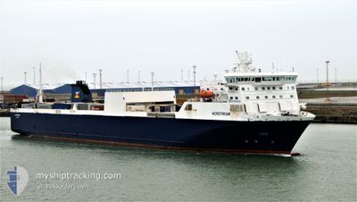
NORSTREAM
Ro-Ro Cargo

Current Trip
| Time Travelled | 14 h, 9 mins |
|---|---|
| Remaining Time | 2 h, 22 mins |
| Distance Travelled | 219.75 nm |
| Remaining Distance | 49.13 nm |
| AVG Speed | 15.2 Knopen |
| MAX Speed | 18.4 Knopen |
| AVG Wind | 23.8 knots |
| MAX Wind | 33 knots |
| MIN Temp | 8°C / 46.4°F |
| MAX Temp | 12.5°C / 54.5°F |
| Diepgang | 6.1 M |
| Positie ontvangen | 34 m geleden |
Current Position
| Lengtegraad | --- |
|---|---|
| Breedtegraat | --- |
| Status | Under way using engine |
| Snelheid | 16.5 Knopen |
| Koers | 315.6° |
| Gebied | North Sea |
| Station | T-AIS |
| Positie ontvangen | 34 m geleden |
Information
The current position of NORSTREAM is in North Sea with coordinates 54.21091° / -0.04855° as reported on 2025-02-24 02:12 by AIS to our vessel tracker app. The vessel's current speed is 16.5 Knopen and is heading at the port of TEES. The estimated time of arrival as calculated by MyShipTracking vessel tracking app is 2025-02-24 05:08 LT
The vessel NORSTREAM (IMO: 9186194, MMSI: 230653000) is a Ro-Ro Cargo that was built in 1999 ( 26 Jaar oud ). It's sailing under the flag of [FI] Finland.
In this page you can find informations about the vessels current position, last detected port calls, and current voyage information. If the vessels is not in coverage by AIS you will find the latest position.
The current position of NORSTREAM is detected by our AIS receivers and we are not responsible for the reliability of the data. The last position was recorded while the vessel was in Coverage by the Ais receivers of our vessel tracking app.
The current draught of NORSTREAM as reported by AIS is 6.1 meters
Weather
| Temperature | 9.4°C / 48.92°F |
|---|---|
| Wind Speed | 22 knots |
| Direction | 209° SSW |
| Pressure | 1005.5 hPa |
| Humidity | 84.9 % |
| Cloud Coverage | 100 % |


Featured Company
Last Port Calls
| Port | Arrival | Departure | Time In Port |
|---|---|---|---|
| 2025-02-22 12:48 | 2025-02-23 12:37 | 23 h | |
| 2025-02-21 09:12 | 2025-02-21 17:39 | 8 h | |
| 2025-02-18 05:53 | 2025-02-20 17:27 | 2 d | |
| 2025-02-17 05:14 | 2025-02-17 12:26 | 7 h | |
| 2025-02-15 13:05 | 2025-02-16 12:01 | 22 h | |
| 2025-02-14 09:18 | 2025-02-14 17:38 | 8 h | |
| 2025-02-13 10:03 | 2025-02-13 17:26 | 7 h | |
| 2025-02-12 05:10 | 2025-02-12 13:18 | 8 h | |
| 2025-02-11 05:52 | 2025-02-11 12:18 | 6 h | |
| 2025-02-10 05:03 | 2025-02-10 12:29 | 7 h |
Last Trips
| Origin | Departure | Destination | Arrival | Distance | |
|---|---|---|---|---|---|
| 2025-02-21 17:39 | 2025-02-22 13:48 | 263.94 nm | |||
| 2025-02-20 18:27 | 2025-02-21 09:12 | 262.36 nm | |||
| 2025-02-17 12:26 | 2025-02-18 06:53 | 263.58 nm | |||
| 2025-02-16 13:01 | 2025-02-17 05:14 | 261.26 nm | |||
| 2025-02-14 17:38 | 2025-02-15 14:05 | 263.88 nm | |||
| 2025-02-13 18:26 | 2025-02-14 09:18 | 263.02 nm | |||
| 2025-02-12 13:18 | 2025-02-13 11:03 | 267.42 nm | |||
| 2025-02-11 13:18 | 2025-02-12 05:10 | 262.33 nm | |||
| 2025-02-10 12:29 | 2025-02-11 06:52 | 265.43 nm | |||
| 2025-02-09 13:20 | 2025-02-10 05:03 | 262.63 nm |
Events
| Tijd | Evenement | Details | Positie / Bestemming | Info |
|---|---|---|---|---|
| 2025-02-24 02:26 | Status Changed | Default Under way using engine |
54.25814 / -.12208
BEZEE<>GBTEE
|
Snelheid: 16.5 kn Koers: 315.6° |
| 2025-02-24 00:37 | Status Changed | Under way using engine Default |
53.89415 / .45911
BEZEE<>GBTEE
|
Snelheid: 16.6 kn Koers: 318° |
| 2025-02-24 00:06 | Status Changed | Default Under way using engine |
53.77984 / .62095
BEZEE<>GBTEE
|
Snelheid: 16.5 kn Koers: 320.6° |
| 2025-02-23 23:45 | Status Changed | Under way using engine Default |
53.70726 / .72093
BEZEE<>GBTEE
|
Snelheid: 16.4 kn Koers: 322° |
| 2025-02-23 23:37 | Binnenbereik |
53.71212 / .71434
North Sea
BEZEE<>GBTEE
|
Snelheid: 16.1 kn Koers: 321.3° |
|
| 2025-02-23 22:48 | Status Changed | Default Under way using engine |
53.49996 / 1.00338
BEZEE<>GBTEE
|
Snelheid: 17.6 kn Koers: 321.6° |
| 2025-02-23 22:43 | Buitenbereik |
53.48064 / 1.03005
North Sea
BEZEE<>GBTEE
|
Snelheid: 17.6 kn Koers: 321.6° |
|
| 2025-02-23 22:39 | Status Changed | Under way using engine Default |
53.46775 / 1.04761
BEZEE<>GBTEE
|
Snelheid: 17.8 kn Koers: 329° |
| 2025-02-23 22:09 | Status Changed | Default Under way using engine |
53.34169 / 1.17751
BEZEE<>GBTEE
|
Snelheid: 18.3 kn Koers: 329.1° |
| 2025-02-23 19:24 | Status Changed | Under way using engine Default |
52.76570 / 1.98125
BEZEE<>GBTEE
|
Snelheid: 15.3 kn Koers: 334° |