
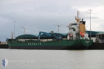
NORRLAND
General Cargo
Current Trip
| Time Travelled | 15 h, 53 mins |
|---|---|
| Remaining Time | 19 h, 36 mins |
| Distance Travelled | 195.02 nm |
| Remaining Distance | 246.08 nm |
| AVG Speed | 12.2 Knopen |
| MAX Speed | 13 Knopen |
| AVG Wind | 13 knots |
| MAX Wind | 28.8 knots |
| MIN Temp | 10.1°C / 50.18°F |
| MAX Temp | 13.9°C / 57.02°F |
| Diepgang | 6.9 M |
| Positie ontvangen | 1 h, 13 m geleden |
Current Position
| Lengtegraad | 20.80402° |
|---|---|
| Breedtegraat | 59.65006° |
| Status | Under way using engine |
| Snelheid | 12.1 Knopen |
| Koers | 287.6° |
| Gebied | Baltic Sea |
| Station | T-AIS |
| Positie ontvangen | 1 h, 13 m geleden |
Info
Information
The current position of NORRLAND is in Baltic Sea with coordinates 59.65006° / 20.80402° as reported on 2024-06-09 05:48 by AIS to our vessel tracker app. The vessel's current speed is 12.1 Knopen and is heading at the port of HUSUM. The estimated time of arrival as calculated by MyShipTracking vessel tracking app is 2024-06-10 04:37 LT
The vessel NORRLAND (IMO: 9358278, MMSI: 212521000) is a General Cargo that was built in 2006 ( 18 Jaar oud ). It's sailing under the flag of [CY] Cyprus.
In this page you can find informations about the vessels current position, last detected port calls, and current voyage information. If the vessels is not in coverage by AIS you will find the latest position.
The current position of NORRLAND is detected by our AIS receivers and we are not responsible for the reliability of the data. The last position was recorded while the vessel was in Coverage by the Ais receivers of our vessel tracking app.
The current draught of NORRLAND as reported by AIS is 6.9 meters
Weather
| Temperature | 10°C / 50°F |
|---|---|
| Wind Speed | 17 knots |
| Direction | 263° W |
| Pressure | 994.6 hPa |
| Humidity | 86.8 % |
| Cloud Coverage | 100 % |
Featured Company
Last Port Calls
| Port | Arrival | Departure | Time In Port |
|---|---|---|---|
| 2024-06-07 14:16 | 2024-06-08 18:08 | 1 d | |
| 2024-06-03 12:11 | 2024-06-04 19:19 | 1 d | |
| 2024-05-27 10:18 | 2024-05-29 11:06 | 2 d | |
| 2024-05-21 19:53 | 2024-05-24 11:39 | 2 d | |
| 2024-05-20 00:29 | 2024-05-20 01:44 | 1 h | |
| 2024-05-15 01:20 | 2024-05-17 04:44 | 2 d | |
| 2024-05-09 08:16 | 2024-05-10 07:15 | 22 h | |
| 2024-04-22 20:33 | 2024-04-24 20:38 | 2 d | |
| 2024-04-20 20:06 | 2024-04-20 21:20 | 1 h | |
| 2024-04-16 06:03 | 2024-04-18 00:25 | 1 d |
Most Visited Ports (Last year)
| Port | Arrivals | |
|---|---|---|
| 9 | ||
| 8 | ||
| 7 | ||
| 6 | ||
| 5 | ||
| 4 |
Last Trips
| Origin | Departure | Destination | Arrival | Distance | |
|---|---|---|---|---|---|
| 2024-06-04 19:19 | 2024-06-07 14:16 | 603.84 nm | |||
| 2024-05-29 11:06 | 2024-06-03 12:11 | 1060.45 nm | |||
| 2024-05-24 11:39 | 2024-05-27 10:18 | 767.64 nm | |||
| 2024-05-20 01:44 | 2024-05-21 19:53 | 501.44 nm | |||
| 2024-05-17 04:44 | 2024-05-20 00:29 | 746.02 nm | |||
| 2024-05-10 07:15 | 2024-05-15 01:20 | 211.96 nm | |||
| 2024-04-24 20:38 | 2024-05-09 08:16 | 1519.80 nm | |||
| 2024-04-20 21:20 | 2024-04-22 20:33 | 502.14 nm | |||
| 2024-04-18 00:25 | 2024-04-20 20:06 | 745.60 nm | |||
| 2024-04-13 14:30 | 2024-04-16 06:03 | 283.77 nm |
Events
| Tijd | Evenement | Details | Positie / Bestemming | Info |
|---|---|---|---|---|
| 2024-06-09 06:25 | Status Changed | Default Under way using engine |
59.68793 / 20.58519
HUSUM
|
Snelheid: 12.1 kn Koers: 287.6° |
| 2024-06-09 05:48 | Buitenbereik |
59.65006 / 20.80402
Baltic Sea
HUSUM
|
Snelheid: 12.1 kn Koers: 287.6° |
|
| 2024-06-09 00:07 | Gevonden in zee | Finnish part of the Baltic Sea |
59.63622 / 23.05811
Baltic Sea
HUSUM
|
Snelheid: 12.4 kn Koers: 259.5° |
| 2024-06-08 20:10 | Wijzig zee gebeid | Finnish part of the Gulf of Finland Estonian part of the Gulf of Finland |
59.80866 / 24.69024
Gulf of Finland
HUSUM
|
Snelheid: 12.8 kn Koers: 258.6° |
| 2024-06-08 17:48 | Status Changed | Under way using engine Default |
59.76607 / 25.60975
HUSUM
|
Snelheid: 12.5 kn Koers: 293° |
| 2024-06-08 17:41 | Status Changed | Default Under way using engine |
59.75680 / 25.65402
HUSUM
|
Snelheid: 12.5 kn Koers: 292.5° |
| 2024-06-08 17:16 | Status Changed | Under way using engine Default |
59.72395 / 25.81140
HUSUM
|
Snelheid: 12.5 kn Koers: 293° |
| 2024-06-08 16:57 | Status Changed | Default Under way using engine |
59.69809 / 25.93134
HUSUM
|
Snelheid: 12.5 kn Koers: 292.3° |
| 2024-06-08 16:49 | Status Changed | Under way using engine Default |
59.68656 / 25.98665
HUSUM
|
Snelheid: 12.6 kn Koers: 292° |
| 2024-06-08 16:25 | Status Changed | Default Under way using engine |
59.65395 / 26.13963
HUSUM
|
Snelheid: 12.6 kn Koers: 292.4° |