
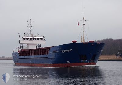
NORFRAKT
General Cargo
Current Trip
| Time Travelled | 20 h, 33 mins |
|---|---|
| Remaining Time | 2 days |
| Distance Travelled | 206.21 nm |
| Remaining Distance | 479.61 nm |
| AVG Speed | 10.1 Knopen |
| MAX Speed | 11.3 Knopen |
| AVG Wind | 9.2 knots |
| MAX Wind | 15.6 knots |
| MIN Temp | 4.3°C / 39.74°F |
| MAX Temp | 6.6°C / 43.88°F |
| Diepgang | 4.4 M |
| Positie ontvangen | 2 m geleden |
Current Position
| Lengtegraad | 4.46378° |
|---|---|
| Breedtegraat | 60.21420° |
| Status | Under way using engine |
| Snelheid | 9.9 Knopen |
| Koers | 351.1° |
| Gebied | North Sea |
| Station | T-AIS |
| Positie ontvangen | 2 m geleden |
Info
Information
The current position of NORFRAKT is in North Sea with coordinates 60.21420° / 4.46378° as reported on 2024-04-26 06:05 by AIS to our vessel tracker app. The vessel's current speed is 9.9 Knopen and is heading at the port of MOIRANA. The estimated time of arrival as calculated by MyShipTracking vessel tracking app is 2024-04-28 06:58 LT
The vessel NORFRAKT (IMO: 8713811, MMSI: 258657000) is a General Cargo that was built in 1988 ( 36 Jaar oud ). It's sailing under the flag of [NO] Norway.
In this page you can find informations about the vessels current position, last detected port calls, and current voyage information. If the vessels is not in coverage by AIS you will find the latest position.
The current position of NORFRAKT is detected by our AIS receivers and we are not responsible for the reliability of the data. The last position was recorded while the vessel was in Coverage by the Ais receivers of our vessel tracking app.
The current draught of NORFRAKT as reported by AIS is 4.4 meters
Weather
| Temperature | 5°C / 41°F |
|---|---|
| Wind Speed | 3 knots |
| Direction | 109° ESE |
| Pressure | 1007.3 hPa |
| Humidity | 80.7 % |
| Cloud Coverage | 100 % |
Featured Company
Last Port Calls
| Port | Arrival | Departure | Time In Port |
|---|---|---|---|
| 2024-04-24 08:51 | 2024-04-25 09:35 | 1 d | |
| 2024-04-23 10:56 | 2024-04-23 19:31 | 8 h | |
| 2024-04-23 05:38 | 2024-04-23 08:30 | 2 h | |
| 2024-04-20 15:58 | 2024-04-20 19:24 | 3 h | |
| 2024-04-19 11:47 | 2024-04-19 12:39 | 52 m | |
| 2024-04-14 23:38 | 2024-04-18 01:16 | 3 d | |
| 2024-04-09 16:04 | 2024-04-10 16:56 | 1 d | |
| 2024-04-09 11:51 | 2024-04-09 13:52 | 2 h | |
| 2024-04-08 22:49 | 2024-04-09 07:26 | 8 h | |
| 2024-03-31 13:07 | 2024-04-02 19:13 | 2 d |
Last Trips
| Origin | Departure | Destination | Arrival | Distance | |
|---|---|---|---|---|---|
| 2024-04-23 21:31 | 2024-04-24 10:51 | 148.23 nm | |||
| 2024-04-23 10:30 | 2024-04-23 12:56 | 22.92 nm | |||
| 2024-04-20 21:24 | 2024-04-23 07:38 | 275.80 nm | |||
| 2024-04-19 14:39 | 2024-04-20 17:58 | 274.77 nm | |||
| 2024-04-18 03:16 | 2024-04-19 13:47 | 331.66 nm | |||
| 2024-04-10 18:56 | 2024-04-15 01:38 | 917.17 nm | |||
| 2024-04-09 15:52 | 2024-04-09 18:04 | 21.90 nm | |||
| 2024-04-09 09:26 | 2024-04-09 13:51 | 42.93 nm | |||
| 2024-04-02 21:13 | 2024-04-09 00:49 | 855.65 nm | |||
| 2024-03-27 11:03 | 2024-03-31 15:07 | 844.36 nm |
Events
| Tijd | Evenement | Details | Positie / Bestemming | Info |
|---|---|---|---|---|
| 2024-04-26 05:55 | ETA Changed | 2024/04/28 13:00 2024/04/28 16:00 |
60.18496 / 4.46929
MO I RANA
|
Snelheid: 9.9 kn Koers: 355.8° |
| 2024-04-25 13:14 | Wijzig zee gebeid | Norwegian part of the North Sea Norwegian part of the Skaggerak |
57.94288 / 7.08983
North Sea
MO I RANA
|
Snelheid: 10.5 kn Koers: 288.9° |
| 2024-04-25 13:05 | Status Changed | Under way using engine Default |
57.93570 / 7.13509
MO I RANA
|
Snelheid: 10.4 kn Koers: 271° |
| 2024-04-25 13:03 | Status Changed | Default Under way using engine |
57.93546 / 7.14689
MO I RANA
|
Snelheid: 10.3 kn Koers: 271.9° |
| 2024-04-25 09:41 | ETA Changed | 2024/04/28 16:00 2024/04/28 18:00 |
58.10885 / 8.03188
MO I RANA
|
Snelheid: 9.9 kn Koers: 143.8° |
| 2024-04-25 09:35 | Vertrekhaven |
|
58.12138 / 8.01530
MO I RANA
|
Snelheid: 9.7 kn Koers: 146° |
| 2024-04-25 09:20 | Start beweging |
58.11733 / 7.97201
[NO] KRISTIANSAND
|
Snelheid: 4.8 kn Koers: 22° |
|
| 2024-04-25 09:11 | Status Changed | Under way using engine Moored |
58.11475 / 7.97074
[NO] KRISTIANSAND
|
Snelheid: Koers: 340° |
| 2024-04-25 06:13 | ETA Changed | 2024/04/28 18:00 2024/04/28 20:00 |
58.11472 / 7.97080
[NO] KRISTIANSAND
|
Snelheid: Koers: 339° |
| 2024-04-24 11:13 | Destination Changed | MO I RANA KRISTIANSAND S |
58.11472 / 7.97069
[NO] KRISTIANSAND
|
Snelheid: Koers: 340° |