
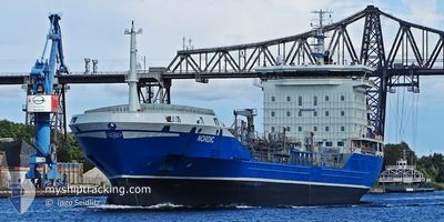
NORDIC
Oil/Chemical Tanker
Current Trip
| Time Travelled | 1 day |
|---|---|
| Remaining Time | 2 days |
| Distance Travelled | 356.99 nm |
| Remaining Distance | 668.54 nm |
| AVG Speed | 10.5 Knopen |
| MAX Speed | 12 Knopen |
| AVG Wind | 19.6 knots |
| MAX Wind | 31 knots |
| MIN Temp | 12.5°C / 54.5°F |
| MAX Temp | 15.5°C / 59.9°F |
| Diepgang | 6.1 M |
| Positie ontvangen | 1 d geleden |
Current Position
| Lengtegraad | -9.68981° |
|---|---|
| Breedtegraat | 41.74539° |
| Status | Under way using engine |
| Snelheid | 10.8 Knopen |
| Koers | 327.6° |
| Gebied | North Atlantic Ocean |
| Station | T-AIS |
| Positie ontvangen | 1 d geleden |
Info
Information
The current position of NORDIC is in North Atlantic Ocean with coordinates 41.74539° / -9.68981° as reported on 2024-05-04 01:37 by AIS to our vessel tracker app. The vessel's current speed is 10.8 Knopen and is heading at the port of AMSTERDAM. The estimated time of arrival as calculated by MyShipTracking vessel tracking app is 2024-05-07 20:20 LT
The vessel NORDIC (IMO: 9438444, MMSI: 219027463) is a Oil/Chemical Tanker that was built in 2008 ( 16 Jaar oud ). It's sailing under the flag of [DK] Denmark.
In this page you can find informations about the vessels current position, last detected port calls, and current voyage information. If the vessels is not in coverage by AIS you will find the latest position.
The current position of NORDIC is detected by our AIS receivers and we are not responsible for the reliability of the data. The last position was recorded while the vessel was in Coverage by the Ais receivers of our vessel tracking app.
The current draught of NORDIC as reported by AIS is 6.1 meters
Weather
| Temperature | 12.7°C / 54.86°F |
|---|---|
| Wind Speed | 19 knots |
| Direction | 248° WSW |
| Pressure | 1007.7 hPa |
| Humidity | 75.2 % |
| Cloud Coverage | --- |
Featured Company
Last Port Calls
| Port | Arrival | Departure | Time In Port |
|---|---|---|---|
| 2024-05-02 05:44 | 2024-05-03 18:06 | 1 d | |
| 2024-04-26 19:06 | 2024-04-27 20:46 | 1 d | |
| 2024-04-25 12:33 | 2024-04-26 18:33 | 1 d | |
| 2024-04-21 11:06 | 2024-04-22 16:29 | 1 d | |
| 2024-04-18 07:28 | 2024-04-19 11:48 | 1 d | |
| 2024-04-15 18:09 | 2024-04-17 02:18 | 1 d | |
| 2024-04-12 08:11 | 2024-04-13 08:45 | 1 d | |
| 2024-04-10 10:50 | 2024-04-10 12:02 | 1 h | |
| 2024-04-09 06:48 | 2024-04-10 09:15 | 1 d | |
| 2024-04-03 10:54 | 2024-04-03 12:21 | 1 h |
Last Trips
| Origin | Departure | Destination | Arrival | Distance | |
|---|---|---|---|---|---|
| 2024-04-27 22:46 | 2024-05-02 06:44 | 1020.70 nm | |||
| 2024-04-26 20:33 | 2024-04-26 21:06 | 2.44 nm | |||
| 2024-04-22 18:29 | 2024-04-25 14:33 | 96.77 nm | |||
| 2024-04-19 13:48 | 2024-04-21 13:06 | 480.23 nm | |||
| 2024-04-17 04:18 | 2024-04-18 09:28 | 173.36 nm | |||
| 2024-04-13 10:45 | 2024-04-15 20:09 | 599.31 nm | |||
| 2024-04-10 14:02 | 2024-04-12 10:11 | 88.34 nm | |||
| 2024-04-10 11:15 | 2024-04-10 12:50 | 9.47 nm | |||
| 2024-04-03 14:21 | 2024-04-09 08:48 | 223.74 nm | |||
| 2024-04-03 11:53 | 2024-04-03 12:54 | 8.15 nm |
Events
| Tijd | Evenement | Details | Positie / Bestemming | Info |
|---|---|---|---|---|
| 2024-05-04 01:53 | Status Changed | Default Under way using engine |
41.82333 / -9.75500
NLAMS
|
Snelheid: 10.8 kn Koers: 327.6° |
| 2024-05-04 01:37 | Status Changed | Under way using engine Default |
41.74539 / -9.68981
NLAMS
|
Snelheid: 10 kn Koers: 328° |
| 2024-05-04 01:37 | Buitenbereik |
41.74539 / -9.68981
North Atlantic Ocean
NLAMS
|
Snelheid: 10.8 kn Koers: 327.6° |
|
| 2024-05-04 01:20 | Binnenbereik |
41.74539 / -9.68981
North Atlantic Ocean
NLAMS
|
Snelheid: 10.8 kn Koers: 327.6° |
|
| 2024-05-03 21:02 | Status Changed | Default Under way using engine |
41.05333 / -9.14667
NLAMS
|
Snelheid: 11.5 kn Koers: 331° |
| 2024-05-03 20:52 | Buitenbereik |
41.02936 / -9.12845
North Atlantic Ocean
NLAMS
|
Snelheid: 11.5 kn Koers: 331° |
|
| 2024-05-03 20:50 | Status Changed | Under way using engine Default |
41.02291 / -9.12349
NLAMS
|
Snelheid: 11 kn Koers: 330° |
| 2024-05-03 20:11 | Status Changed | Default Under way using engine |
40.91667 / -9.03833
NLAMS
|
Snelheid: 10 kn Koers: 328.5° |
| 2024-05-03 18:06 | Vertrekhaven |
|
40.64242 / -8.76065
NLAMS
|
Snelheid: 10.7 kn Koers: 236° |
| 2024-05-03 17:50 | Start beweging |
40.65275 / -8.72316
[PT] AVEIRO
|
Snelheid: 4.1 kn Koers: 256° |