
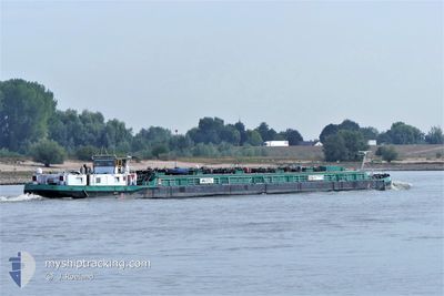
NOORTSTROOM
Tanker
Current Trip
| Time Travelled | 8 h, 5 mins |
|---|---|
| Remaining Time | --- |
| Distance Travelled | 39.77 nm |
| Remaining Distance | --- |
| AVG Speed | 6.5 Knopen |
| MAX Speed | 8.5 Knopen |
| AVG Wind | 6.4 knots |
| MAX Wind | 8.6 knots |
| MIN Temp | -0.7°C / 30.74°F |
| MAX Temp | 3.3°C / 37.94°F |
| Diepgang | 0 M |
| Positie ontvangen | 18 m geleden |
Current Position
| Lengtegraad | --- |
|---|---|
| Breedtegraat | --- |
| Status | Moored |
| Snelheid | |
| Koers | --- |
| Gebied | North Sea |
| Station | T-AIS |
| Positie ontvangen | 18 m geleden |
Info
info
Information
The current position of NOORTSTROOM is in North Sea with coordinates 49.50461° / 8.45419° as reported on 2025-02-16 20:56 by AIS to our vessel tracker app. The vessel's current speed is 0 Knopen
The vessel NOORTSTROOM (MMSI: 244020589) is a Tanker It's sailing under the flag of [NL] Netherlands.
In this page you can find informations about the vessels current position, last detected port calls, and current voyage information. If the vessels is not in coverage by AIS you will find the latest position.
The current position of NOORTSTROOM is detected by our AIS receivers and we are not responsible for the reliability of the data. The last position was recorded while the vessel was in Coverage by the Ais receivers of our vessel tracking app.
Weather
| Temperature | 0.2°C / 32.36°F |
|---|---|
| Wind Speed | 4 knots |
| Direction | 57° ENE |
| Pressure | 1021.9 hPa |
| Humidity | 51.5 % |
| Cloud Coverage | 6 % |
Featured Company
Limited time offer - Install a base station receiver to your area and list your company on MyShipTracking Free forever!
Last Port Calls
| Port | Arrival | Departure | Time In Port |
|---|---|---|---|
| 2025-02-16 13:53 | 2025-02-16 14:10 | 16 m | |
| 2025-02-15 19:48 | 2025-02-16 12:27 | 16 h | |
| 2025-02-15 17:06 | 2025-02-15 17:39 | 33 m | |
| 2025-02-14 08:34 | 2025-02-14 09:33 | 59 m | |
| 2025-02-12 20:00 | 2025-02-13 12:55 | 16 h | |
| 2025-02-12 17:11 | 2025-02-12 17:57 | 46 m | |
| 2025-02-11 06:26 | 2025-02-11 06:50 | 23 m | |
| 2025-02-10 17:03 | 2025-02-10 17:39 | 36 m | |
| 2025-02-09 17:13 | 2025-02-09 17:55 | 42 m | |
| 2025-02-09 11:05 | 2025-02-09 11:32 | 27 m |
Most Visited Ports (Last year)
| Port | Arrivals | |
|---|---|---|
| 211 | ||
| 73 | ||
| 7 | ||
| 1 | ||
| 1 | ||
| 1 |
Last Trips
| Origin | Departure | Destination | Arrival | Distance | |
|---|---|---|---|---|---|
| 2025-02-16 12:27 | 2025-02-16 13:53 | 9.73 nm | |||
| 2025-02-15 17:39 | 2025-02-15 19:48 | 9.78 nm | |||
| 2025-02-14 09:33 | 2025-02-15 17:06 | 80.22 nm | |||
| 2025-02-13 12:55 | 2025-02-14 08:34 | 9.68 nm | |||
| 2025-02-12 17:57 | 2025-02-12 20:00 | 9.73 nm | |||
| 2025-02-11 06:50 | 2025-02-12 17:11 | 79.63 nm | |||
| 2025-02-10 17:39 | 2025-02-11 06:26 | 19.51 nm | |||
| 2025-02-09 17:55 | 2025-02-10 17:03 | 44.95 nm | |||
| 2025-02-09 11:32 | 2025-02-09 17:13 | 37.99 nm | |||
| 2025-02-06 07:30 | 2025-02-09 11:05 | 9.88 nm |
Events
| Tijd | Evenement | Details | Positie / Bestemming | Info |
|---|---|---|---|---|
| 2025-02-16 19:51 | Status Changed | Moored Under way using engine |
49.50460 / 8.45417
MANNHEIM BUNGE
|
Snelheid: Koers: 511° |
| 2025-02-16 19:25 | Stop beweging | 0.83 nm, North of MANNHEIM |
49.50461 / 8.45425
MANNHEIM BUNGE
|
Snelheid: 0.2 kn Koers: 511° |
| 2025-02-16 13:10 | Vertrekhaven |
|
50.00141 / 8.31337
MANNHEIM BUNGE
|
Snelheid: 9.4 kn Koers: 256.6° |
| 2025-02-16 13:04 | Start beweging |
49.99949 / 8.33103
[DE] BISCHOFSHEIM
|
Snelheid: 5.5 kn Koers: 285.7° |
|
| 2025-02-16 12:53 | Stop beweging |
49.99906 / 8.33392
[DE] BISCHOFSHEIM
|
Snelheid: 0.1 kn Koers: 511° |
|
| 2025-02-16 12:53 | Aankomsthaven |
|
49.99906 / 8.33392
[DE] BISCHOFSHEIM
|
Snelheid: 0.7 kn Koers: 511° |
| 2025-02-16 12:08 | Start beweging | 4 nm, South West of HOCHST |
50.03626 / 8.47441
MANNHEIM BUNGE
|
Snelheid: 7.2 kn Koers: 222.1° |
| 2025-02-16 11:54 | Stop beweging | 3.87 nm, South West of HOCHST |
50.03802 / 8.47665
MANNHEIM BUNGE
|
Snelheid: 0.1 kn Koers: 511° |
| 2025-02-16 11:31 | Binnenbereik |
50.07106 / 8.52512
North Sea
|
Snelheid: 9.1 kn Koers: 157° |
|
| 2025-02-16 11:27 | Vertrekhaven |
|
50.07310 / 8.52394
MANNHEIM BUNGE
|
Snelheid: 0.5 kn Koers: 511° |