
NEW CENTURY 1
Vehicles Carrier
Current Trip
| Time Travelled | 19 h, 19 mins |
|---|---|
| Remaining Time | 2 days |
| Distance Travelled | 346.06 nm |
| Remaining Distance | 1347.48 nm |
| AVG Speed | 17.4 Knopen |
| MAX Speed | 19.9 Knopen |
| AVG Wind | 5 knots |
| MAX Wind | 19 knots |
| MIN Temp | 17.2°C / 62.96°F |
| MAX Temp | 22.2°C / 71.96°F |
| Diepgang | 7.4 M |
| Positie ontvangen | 1 m geleden |
Current Position
| Lengtegraad | --- |
|---|---|
| Breedtegraat | --- |
| Status | Under way using engine |
| Snelheid | 17.8 Knopen |
| Koers | 68.5° |
| Gebied | Tasman Sea |
| Station | T-AIS |
| Positie ontvangen | 1 m geleden |
Info
Information
The current position of NEW CENTURY 1 is in Tasman Sea with coordinates -38.15651° / 150.30734° as reported on 2025-03-15 10:25 by AIS to our vessel tracker app. The vessel's current speed is 17.8 Knopen and is heading at the port of AUCKLAND. The estimated time of arrival as calculated by MyShipTracking vessel tracking app is 2025-03-18 22:41 LT
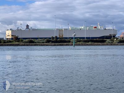
The vessel NEW CENTURY 1 (IMO: 9229398, MMSI: 355234000) is a Vehicles Carrier that was built in 2001 ( 24 Jaar oud ). It's sailing under the flag of [PA] Panama.
In this page you can find informations about the vessels current position, last detected port calls, and current voyage information. If the vessels is not in coverage by AIS you will find the latest position.
The current position of NEW CENTURY 1 is detected by our AIS receivers and we are not responsible for the reliability of the data. The last position was recorded while the vessel was in Coverage by the Ais receivers of our vessel tracking app.
The current draught of NEW CENTURY 1 as reported by AIS is 7.4 meters
Weather
| Temperature | 22.2°C / 71.96°F |
|---|---|
| Wind Speed | 19 knots |
| Direction | 5° N |
| Pressure | 1013.6 hPa |
| Humidity | 85 % |
| Cloud Coverage | 100 % |
Featured Company
Last Port Calls
| Port | Arrival | Departure | Time In Port |
|---|---|---|---|
| 2025-03-14 09:29 | 2025-03-15 02:07 | 16 h | |
| 2025-03-10 11:15 | 2025-03-11 15:54 | 1 d | |
| 2025-03-04 23:51 | 2025-03-06 23:20 | 1 d | |
| 2025-02-15 07:03 | 2025-02-15 15:26 | 8 h | |
| 2025-02-11 09:53 | 2025-02-14 17:06 | 3 d | |
| 2025-02-08 11:01 | 2025-02-10 17:02 | 2 d | |
| 2025-01-21 01:04 | 2025-01-21 17:13 | 16 h | |
| 2025-01-14 16:57 | 2025-01-17 09:53 | 2 d | |
| 2025-01-09 23:41 | 2025-01-10 23:20 | 23 h |
Last Trips
| Origin | Departure | Destination | Arrival | Distance | |
|---|---|---|---|---|---|
| 2025-03-11 15:54 | 2025-03-14 09:29 | 1140.05 nm | |||
| 2025-03-06 23:20 | 2025-03-10 11:15 | 813.26 nm | |||
| 2025-02-15 15:26 | 2025-03-04 23:51 | 4972.04 nm | |||
| 2025-02-14 17:06 | 2025-02-15 07:03 | 222.88 nm | |||
| 2025-02-10 17:02 | 2025-02-11 09:53 | 250.58 nm | |||
| 2025-01-21 17:13 | 2025-02-08 11:01 | 5000.22 nm | |||
| 2025-01-17 09:53 | 2025-01-21 01:04 | 1303.35 nm | |||
| 2025-01-10 23:20 | 2025-01-14 16:57 | 566.01 nm | |||
| 2024-12-28 14:32 | 2025-01-09 23:41 | 4067.40 nm |
Events
| Tijd | Evenement | Details | Positie / Bestemming | Info |
|---|---|---|---|---|
| 2025-03-15 07:02 | Wijzig zee gebeid | Australian part of the Tasman Sea Australian part of the Bass Strait |
-38.54670 / 149.04678
Tasman Sea
NZ AKL
|
Snelheid: 19.5 kn Koers: 67.8° |
| 2025-03-14 19:33 | ETA Changed | 2025/03/18 20:00 2025/03/18 20:30 |
-38.64846 / 144.81306
NZ AKL
|
Snelheid: 19 kn Koers: 119.9° |
| 2025-03-14 18:34 | ETA Changed | 2025/03/18 20:30 2025/03/18 18:00 |
-38.39794 / 144.62219
NZ AKL
|
Snelheid: 16.4 kn Koers: 160.3° |
| 2025-03-14 18:33 | ETA Changed | 2025/03/18 18:00 2025/03/18 20:30 |
-38.39068 / 144.61882
NZ AKL
|
Snelheid: 16.2 kn Koers: 159.9° |
| 2025-03-14 18:31 | ETA Changed | 2025/03/18 20:30 2025/03/18 22:30 |
-38.38492 / 144.61615
NZ AKL
|
Snelheid: 16.1 kn Koers: 159.2° |
| 2025-03-14 18:30 | ETA Changed | 2025/03/18 22:30 2025/03/18 18:00 |
-38.37785 / 144.61273
NZ AKL
|
Snelheid: 15.5 kn Koers: 158.6° |
| 2025-03-14 15:07 | Vertrekhaven |
|
-37.86537 / 144.92130
NZ AKL
|
Snelheid: 8.7 kn Koers: 144° |
| 2025-03-14 14:55 | Start beweging |
-37.84793 / 144.90845
[AU] MELBOURNE
|
Snelheid: 3.1 kn Koers: 150° |
|
| 2025-03-14 14:48 | Status Changed | Under way using engine Moored |
-37.84657 / 144.90585
[AU] MELBOURNE
|
Snelheid: Koers: 163° |
| 2025-03-14 13:13 | Status Changed | Moored Default |
-37.84658 / 144.90584
[AU] MELBOURNE
|
Snelheid: Koers: 163° |