
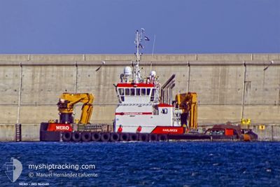
NERO
Tug
Current Trip
TUNNEL PROJECT
| Time Travelled | --- |
|---|---|
| Remaining Time | --- |
| Distance Travelled | 274.91 nm |
| Remaining Distance | --- |
| AVG Speed | 6.2 Knopen |
| MAX Speed | 11 Knopen |
| AVG Wind | 11.7 knots |
| MAX Wind | 24.4 knots |
| MIN Temp | 7.4°C / 45.32°F |
| MAX Temp | 21.5°C / 70.7°F |
| Diepgang | 2.4 M |
| Positie ontvangen | 1 m geleden |
Current Position
| Lengtegraad | 11.37399° |
|---|---|
| Breedtegraat | 54.63741° |
| Status | Restricted manoeuverability |
| Snelheid | |
| Koers | 329° |
| Gebied | Baltic Sea |
| Station | T-AIS |
| Positie ontvangen | 1 m geleden |
Info
Information
The current position of NERO is in Baltic Sea with coordinates 54.63741° / 11.37399° as reported on 2024-09-09 18:00 by AIS to our vessel tracker app. The vessel's current speed is 0 Knopen
The vessel NERO (IMO: 9641481, MMSI: 246925000) is a Tug that was built in 2013 ( 11 Jaar oud ). It's sailing under the flag of [NL] Netherlands.
In this page you can find informations about the vessels current position, last detected port calls, and current voyage information. If the vessels is not in coverage by AIS you will find the latest position.
The current position of NERO is detected by our AIS receivers and we are not responsible for the reliability of the data. The last position was recorded while the vessel was in Coverage by the Ais receivers of our vessel tracking app.
The current draught of NERO as reported by AIS is 2.4 meters
Weather
| Temperature | 18°C / 64.4°F |
|---|---|
| Wind Speed | 11 knots |
| Direction | 277° W |
| Pressure | 999.1 hPa |
| Humidity | 78.7 % |
| Cloud Coverage | 100 % |
Featured Company
Last Port Calls
Most Visited Ports (Last year)
| Port | Arrivals | |
|---|---|---|
| 115 | ||
| 6 | ||
| 6 | ||
| 4 | ||
| 3 | ||
| 2 |
Last Trips
| Origin | Departure | Destination | Arrival | Distance |
|---|
Events
| Tijd | Evenement | Details | Positie / Bestemming | Info |
|---|---|---|---|---|
| 2024-09-08 17:22 | Stop beweging | 1.27 nm, South East of RODBYHAVN |
54.63742 / 11.37391
TUNNEL PROJECT
|
Snelheid: 0.3 kn Koers: 322° |
| 2024-09-08 17:10 | Start beweging | 0.8 nm, South East of RODBYHAVN |
54.64148 / 11.36107
TUNNEL PROJECT
|
Snelheid: 4 kn Koers: 172° |
| 2024-09-08 14:37 | Stop beweging | 0.98 nm, South East of RODBYHAVN |
54.63859 / 11.36258
TUNNEL PROJECT
|
Snelheid: 0.3 kn Koers: 78° |
| 2024-09-08 14:36 | Start beweging | 1.02 nm, South East of RODBYHAVN |
54.63783 / 11.36291
TUNNEL PROJECT
|
Snelheid: 3.1 kn Koers: 318° |
| 2024-09-08 13:59 | Stop beweging | 1.1 nm, South of RODBYHAVN |
54.63589 / 11.36084
TUNNEL PROJECT
|
Snelheid: 0.3 kn Koers: 306° |
| 2024-09-08 13:45 | Start beweging | 1.48 nm, South East of RODBYHAVN |
54.63451 / 11.37714
TUNNEL PROJECT
|
Snelheid: 4.8 kn Koers: 188° |
| 2024-09-08 09:18 | Stop beweging | 1.46 nm, South East of RODBYHAVN |
54.63605 / 11.37915
TUNNEL PROJECT
|
Snelheid: 0.3 kn Koers: 257° |
| 2024-09-08 09:07 | Start beweging | 1.55 nm, South East of RODBYHAVN |
54.63088 / 11.37223
TUNNEL PROJECT
|
Snelheid: 3.9 kn Koers: 88° |
| 2024-09-08 08:55 | Stop beweging | 1.49 nm, South East of RODBYHAVN |
54.63090 / 11.36892
TUNNEL PROJECT
|
Snelheid: 0.3 kn Koers: 124° |
| 2024-09-08 08:32 | Start beweging | 1 nm, South of RODBYHAVN |
54.63694 / 11.35797
TUNNEL PROJECT
|
Snelheid: 3.9 kn Koers: 189° |