
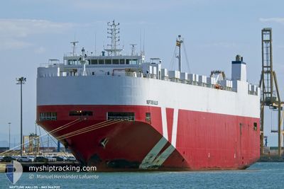
NEPTUNE KALLOS
Vehicles Carrier
Current Trip
| Time Travelled | 2 days |
|---|---|
| Remaining Time | --- |
| Distance Travelled | 802.86 nm |
| Remaining Distance | --- |
| AVG Speed | 14.8 Knopen |
| MAX Speed | 17.2 Knopen |
| AVG Wind | 6.9 knots |
| MAX Wind | 15 knots |
| MIN Temp | 7.3°C / 45.14°F |
| MAX Temp | 17.7°C / 63.86°F |
| Diepgang | 7.9 M |
| Positie ontvangen | Nu |
Current Position
| Lengtegraad | --- |
|---|---|
| Breedtegraat | --- |
| Status | Under way using engine |
| Snelheid | 16.9 Knopen |
| Koers | 86° |
| Gebied | Sea of Marmara |
| Station | T-AIS |
| Positie ontvangen | Nu |
Info
Information
The current position of NEPTUNE KALLOS is in Sea of Marmara with coordinates 40.73665° / 28.04988° as reported on 2024-11-28 23:16 by AIS to our vessel tracker app. The vessel's current speed is 16.9 Knopen and is heading at the port of LIMAS. The estimated time of arrival as calculated by MyShipTracking vessel tracking app is 2024-11-29 03:00 LT
The vessel NEPTUNE KALLOS (IMO: 9442122, MMSI: 256010000) is a Vehicles Carrier that was built in 2010 ( 14 Jaar oud ). It's sailing under the flag of [MT] Malta.
In this page you can find informations about the vessels current position, last detected port calls, and current voyage information. If the vessels is not in coverage by AIS you will find the latest position.
The current position of NEPTUNE KALLOS is detected by our AIS receivers and we are not responsible for the reliability of the data. The last position was recorded while the vessel was in Coverage by the Ais receivers of our vessel tracking app.
The current draught of NEPTUNE KALLOS as reported by AIS is 7.9 meters
Weather
| Temperature | 12.2°C / 53.96°F |
|---|---|
| Wind Speed | 4 knots |
| Direction | 124° SE |
| Pressure | 1024.2 hPa |
| Humidity | 72.5 % |
| Cloud Coverage | 8 % |
Featured Company
Last Port Calls
| Port | Arrival | Departure | Time In Port |
|---|---|---|---|
| 2024-11-25 11:13 | 2024-11-26 18:39 | 1 d | |
| 2024-11-24 05:18 | 2024-11-25 11:08 | 1 d | |
| 2024-11-21 15:12 | 2024-11-23 06:01 | 1 d | |
| 2024-11-20 16:50 | 2024-11-21 04:58 | 12 h | |
| 2024-11-16 14:34 | 2024-11-17 05:36 | 15 h | |
| 2024-11-15 05:45 | 2024-11-15 16:19 | 10 h | |
| 2024-11-12 07:13 | 2024-11-13 16:12 | 1 d | |
| 2024-11-06 11:12 | 2024-11-07 19:49 | 1 d | |
| 2024-11-02 21:03 | 2024-11-05 00:49 | 2 d | |
| 2024-11-02 04:07 | 2024-11-02 11:06 | 6 h |
Last Trips
| Origin | Departure | Destination | Arrival | Distance | |
|---|---|---|---|---|---|
| 2024-11-25 13:08 | 2024-11-25 13:13 | 1.24 nm | |||
| 2024-11-23 08:01 | 2024-11-24 07:18 | 300.60 nm | |||
| 2024-11-21 06:58 | 2024-11-21 17:12 | 157.74 nm | |||
| 2024-11-17 07:36 | 2024-11-20 18:50 | 916.31 nm | |||
| 2024-11-15 18:19 | 2024-11-16 16:34 | 300.15 nm | |||
| 2024-11-13 17:12 | 2024-11-15 07:45 | 598.79 nm | |||
| 2024-11-07 20:49 | 2024-11-12 08:13 | 1685.27 nm | |||
| 2024-11-05 01:49 | 2024-11-06 12:12 | 536.00 nm | |||
| 2024-11-02 12:06 | 2024-11-02 22:03 | 81.55 nm | |||
| 2024-11-01 13:24 | 2024-11-02 05:07 | 203.77 nm |
Events
| Tijd | Evenement | Details | Positie / Bestemming | Info |
|---|---|---|---|---|
| 2024-11-28 22:32 | Status Changed | Under way using engine Default |
40.71777 / 27.77657
TRYEK
|
Snelheid: 16.8 kn Koers: 82° |
| 2024-11-28 22:17 | Status Changed | Default Under way using engine |
40.71265 / 27.68572
TRYEK
|
Snelheid: 16.8 kn Koers: 82° |
| 2024-11-28 22:13 | Status Changed | Under way using engine Default |
40.71007 / 27.66108
TRYEK
|
Snelheid: 16 kn Koers: 79° |
| 2024-11-28 21:44 | Status Changed | Default Under way using engine |
40.68255 / 27.49645
TRYEK
|
Snelheid: 15.4 kn Koers: 65° |
| 2024-11-28 21:37 | Status Changed | Under way using engine Default |
40.67018 / 27.45932
TRYEK
|
Snelheid: 15.5 kn Koers: 64° |
| 2024-11-28 21:32 | Status Changed | Default Under way using engine |
40.66063 / 27.43208
TRYEK
|
Snelheid: 15.4 kn Koers: 64° |
| 2024-11-28 21:30 | Status Changed | Under way using engine Default |
40.65787 / 27.42428
TRYEK
|
Snelheid: 14.4 kn Koers: 66° |
| 2024-11-28 21:18 | Binnenbereik |
40.65787 / 27.42428
Sea of Marmara
TRYEK
|
Snelheid: 15.4 kn Koers: 64° |
|
| 2024-11-28 18:20 | Status Changed | Default Under way using engine |
40.29082 / 26.57397
TRYEK
|
Snelheid: 15.2 kn Koers: 48° |
| 2024-11-28 18:13 | Buitenbereik |
40.27185 / 26.54560
Sea of Marmara
TRYEK
|
Snelheid: 15.2 kn Koers: 48° |