
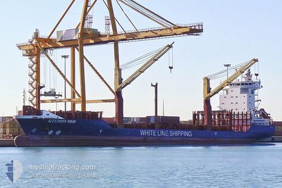
ALEXANDER
Container Ship
Current Trip
| Time Travelled | 2 days |
|---|---|
| Remaining Time | --- |
| Distance Travelled | 730.07 nm |
| Remaining Distance | --- |
| AVG Speed | 12.3 Knopen |
| MAX Speed | 13.6 Knopen |
| AVG Wind | 12.2 knots |
| MAX Wind | 22.8 knots |
| MIN Temp | 2°C / 35.6°F |
| MAX Temp | 18.4°C / 65.12°F |
| Diepgang | 8.1 M |
| Positie ontvangen | 1 d geleden |
Current Position
| Lengtegraad | --- |
|---|---|
| Breedtegraat | --- |
| Status | Under way using engine |
| Snelheid | 12.6 Knopen |
| Koers | 195.9° |
| Gebied | Aegean Sea |
| Station | T-AIS |
| Positie ontvangen | 1 d geleden |
Info
Information
The current position of ALEXANDER is in Aegean Sea with coordinates 36.87619° / 24.02280° as reported on 2026-01-02 00:20 by AIS to our vessel tracker app. The vessel's current speed is 12.6 Knopen and is heading at the port of ALIAGA. The estimated time of arrival as calculated by MyShipTracking vessel tracking app is 2025-12-31 20:00 LT
The vessel ALEXANDER (IMO: 9347798, MMSI: 304979000) is a Container Ship that was built in 2006 ( 20 Jaar oud ). It's sailing under the flag of [AG] Antigua Barbuda.
In this page you can find informations about the vessels current position, last detected port calls, and current voyage information. If the vessels is not in coverage by AIS you will find the latest position.
The current position of ALEXANDER is detected by our AIS receivers and we are not responsible for the reliability of the data. The last position was recorded while the vessel was in Coverage by the Ais receivers of our vessel tracking app.
The current draught of ALEXANDER as reported by AIS is 8.1 meters
Weather
| Temperature | 17.9°C / 64.22°F |
|---|---|
| Wind Speed | 17 knots |
| Direction | 184° S |
| Pressure | 1017.4 hPa |
| Humidity | 47.2 % |
| Cloud Coverage | 2 % |
Featured Company
Last Port Calls
| Port | Arrival | Departure | Time In Port |
|---|---|---|---|
| 2026-01-01 01:25 | 2026-01-01 11:40 | 10 h | |
| 2025-12-30 04:09 | 2025-12-30 20:07 | 15 h | |
| 2025-12-29 14:23 | 2025-12-29 23:08 | 8 h | |
| 2025-12-28 16:56 | 2025-12-29 00:59 | 8 h | |
| 2025-12-19 16:04 | 2025-12-23 15:36 | 3 d | |
| 2025-12-17 20:54 | 2025-12-18 21:14 | 1 d | |
| 2025-12-15 10:02 | 2025-12-16 08:54 | 22 h | |
| 2025-12-11 10:48 | 2025-12-12 03:49 | 17 h | |
| 2025-12-09 23:31 | 2025-12-10 07:29 | 7 h | |
| 2025-12-09 08:43 | 2025-12-09 16:59 | 8 h |
Last Trips
| Origin | Departure | Destination | Arrival | Distance | |
|---|---|---|---|---|---|
| 2025-12-30 20:07 | 2026-01-01 01:25 | 322.31 nm | |||
| 2025-12-29 23:08 | 2025-12-30 04:09 | 60.40 nm | |||
| 2025-12-29 00:59 | 2025-12-29 14:23 | 45.36 nm | |||
| 2025-12-23 15:36 | 2025-12-28 16:56 | 1044.69 nm | |||
| 2025-12-18 21:14 | 2025-12-19 16:04 | 234.74 nm | |||
| 2025-12-16 08:54 | 2025-12-17 20:54 | 74.16 nm | |||
| 2025-12-12 03:49 | 2025-12-15 10:02 | 758.48 nm | |||
| 2025-12-10 07:29 | 2025-12-11 10:48 | 308.77 nm | |||
| 2025-12-09 16:59 | 2025-12-09 23:31 | 72.94 nm | |||
| 2025-12-09 03:27 | 2025-12-09 08:43 | 43.76 nm |
Events
| Tijd | Evenement | Details | Positie / Bestemming | Info |
|---|---|---|---|---|
| 2026-01-02 00:22 | Status Changed | Default Under way using engine |
36.86663 / 24.01930
TRALI
|
Snelheid: 12.6 kn Koers: 195.9° |
| 2026-01-02 00:20 | Status Changed | Under way using engine Default |
36.87619 / 24.02280
TRALI
|
Snelheid: 12.5 kn Koers: 197° |
| 2026-01-02 00:20 | Buitenbereik |
36.87619 / 24.02280
Aegean Sea
|
Snelheid: 12.6 kn Koers: 195.9° |
|
| 2026-01-02 00:06 | Status Changed | Default Under way using engine |
36.92275 / 24.03988
TRALI
|
Snelheid: 12.5 kn Koers: 197.7° |
| 2026-01-01 23:42 | Status Changed | Under way using engine Default |
37.00295 / 24.07045
TRALI
|
Snelheid: 12.6 kn Koers: 198° |
| 2026-01-01 23:31 | Status Changed | Default Under way using engine |
37.03856 / 24.08492
TRALI
|
Snelheid: 12.6 kn Koers: 195.5° |
| 2026-01-01 23:18 | Status Changed | Under way using engine Default |
37.08213 / 24.10030
TRALI
|
Snelheid: 12.9 kn Koers: 200° |
| 2026-01-01 23:02 | Status Changed | Default Under way using engine |
37.13757 / 24.12250
TRALI
|
Snelheid: 12.8 kn Koers: 201.6° |
| 2026-01-01 22:32 | Status Changed | Under way using engine Default |
37.23685 / 24.17067
TRALI
|
Snelheid: 12.7 kn Koers: 208° |
| 2026-01-01 21:31 | Buitenbereik |
37.43369 / 24.28609
Aegean Sea
|
Snelheid: 12.8 kn Koers: 206.1° |