
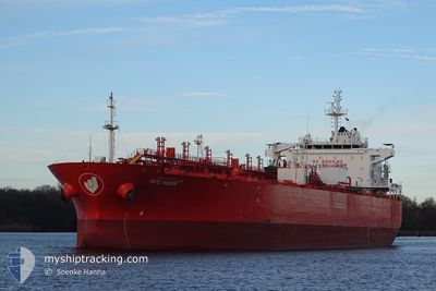
NCC NOOR
Oil/Chemical Tanker
Current Trip
| Time Travelled | 4 days |
|---|---|
| Remaining Time | --- |
| Distance Travelled | 1199.51 nm |
| Remaining Distance | --- |
| AVG Speed | 13 Knopen |
| MAX Speed | 14 Knopen |
| AVG Wind | 11 knots |
| MAX Wind | 19.9 knots |
| MIN Temp | 19.3°C / 66.74°F |
| MAX Temp | 27.3°C / 81.14°F |
| Diepgang | 8.5 M |
| Positie ontvangen | 2 d geleden |
Current Position
| Lengtegraad | -40.46611° |
|---|---|
| Breedtegraat | -22.12206° |
| Status | Under way using engine |
| Snelheid | 13.1 Knopen |
| Koers | 52.1° |
| Gebied | South Atlantic Ocean |
| Station | T-AIS |
| Positie ontvangen | 2 d geleden |
Info
Information
The current position of NCC NOOR is in South Atlantic Ocean with coordinates -22.12206° / -40.46611° as reported on 2024-06-03 11:32 by AIS to our vessel tracker app. The vessel's current speed is 13.1 Knopen and is heading at the port of HOUSTON. The estimated time of arrival as calculated by MyShipTracking vessel tracking app is 2024-06-19 18:59 LT
The vessel NCC NOOR (IMO: 9399260, MMSI: 403512001) is a Oil/Chemical Tanker that was built in 2011 ( 13 Jaar oud ). It's sailing under the flag of [SA] Saudi Arabia.
In this page you can find informations about the vessels current position, last detected port calls, and current voyage information. If the vessels is not in coverage by AIS you will find the latest position.
The current position of NCC NOOR is detected by our AIS receivers and we are not responsible for the reliability of the data. The last position was recorded while the vessel was in Coverage by the Ais receivers of our vessel tracking app.
The current draught of NCC NOOR as reported by AIS is 8.5 meters
Weather
| Temperature | 26.1°C / 78.98°F |
|---|---|
| Wind Speed | 13 knots |
| Direction | 126° SE |
| Pressure | 1015.7 hPa |
| Humidity | 82.8 % |
| Cloud Coverage | 100 % |
Featured Company
Last Port Calls
| Port | Arrival | Departure | Time In Port |
|---|---|---|---|
| 2024-05-30 17:04 | 2024-06-02 03:14 | 2 d | |
| 2024-05-26 05:33 | 2024-05-29 06:48 | 3 d | |
| 2024-05-14 02:05 | 2024-05-15 03:57 | 1 d | |
| 2024-04-23 10:34 | 2024-04-24 01:10 | 14 h | |
| 2024-04-19 16:22 | 2024-04-21 10:46 | 1 d | |
| 2024-04-04 04:15 | 2024-04-06 00:01 | 1 d | |
| 2024-04-01 09:29 | 2024-04-02 16:17 | 1 d |
Most Visited Ports (Last year)
| Port | Arrivals | |
|---|---|---|
| 3 | ||
| 2 | ||
| 2 | ||
| 2 | ||
| 2 | ||
| 1 |
Last Trips
| Origin | Departure | Destination | Arrival | Distance | |
|---|---|---|---|---|---|
| 2024-05-29 06:48 | 2024-05-30 17:04 | 190.94 nm | |||
| 2024-05-15 03:57 | 2024-05-26 05:33 | 1108.31 nm | |||
| 2024-04-24 01:10 | 2024-05-14 02:05 | 4790.89 nm | |||
| 2024-04-21 10:46 | 2024-04-23 10:34 | 558.37 nm | |||
| 2024-04-06 00:01 | 2024-04-19 16:22 | 3804.13 nm | |||
| 2024-04-02 16:17 | 2024-04-04 04:15 | 272.66 nm | |||
| 2024-03-16 18:38 | 2024-04-01 09:29 | 3931.48 nm |
Events
| Tijd | Evenement | Details | Positie / Bestemming | Info |
|---|---|---|---|---|
| 2024-06-03 11:39 | Status Changed | Default Under way using engine |
-22.10498 / -40.44263
USHOU
|
Snelheid: 13.1 kn Koers: 52.1° |
| 2024-06-03 11:32 | Buitenbereik |
-22.12206 / -40.46611
South Atlantic Ocean
USHOU
|
Snelheid: 13.1 kn Koers: 52.1° |
|
| 2024-06-03 09:33 | Status Changed | Under way using engine Default |
-22.39082 / -40.83998
USHOU
|
Snelheid: 13.4 kn Koers: 33° |
| 2024-06-03 09:31 | Binnenbereik |
-22.38432 / -40.83474
South Atlantic Ocean
USHOU
|
Snelheid: 13.4 kn Koers: 38.9° |
|
| 2024-06-03 01:25 | Status Changed | Default Under way using engine |
-23.38455 / -42.37822
USHOU
|
Snelheid: 12 kn Koers: 73.3° |
| 2024-06-03 01:19 | Buitenbereik |
-23.39065 / -42.39959
South Atlantic Ocean
USHOU
|
Snelheid: 12 kn Koers: 73.3° |
|
| 2024-06-03 01:14 | Status Changed | Under way using engine Default |
-23.39539 / -42.41570
USHOU
|
Snelheid: 11.9 kn Koers: 71° |
| 2024-06-03 01:08 | Status Changed | Default Under way using engine |
-23.40178 / -42.43558
USHOU
|
Snelheid: 11.9 kn Koers: 70.3° |
| 2024-06-03 01:02 | Status Changed | Under way using engine Default |
-23.40853 / -42.45653
USHOU
|
Snelheid: 11.9 kn Koers: 71° |
| 2024-06-03 01:02 | Binnenbereik |
-23.40747 / -42.45323
South Atlantic Ocean
USHOU
|
Snelheid: 11.9 kn Koers: 70.3° |