
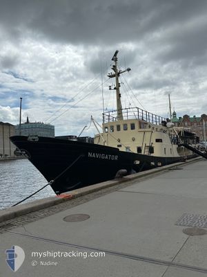
NAVIGATOR
Cargo
Current Trip
| Trip Time | 1 day |
|---|---|
| Trip Distance | 189.41 nm |
| AVG Speed | 7.1 Knopen |
| MAX Speed | 8.9 Knopen |
| Diepgang | 2.7 M |
| AVG Wind | 16.1 knots |
| MAX Wind | 21.9 knots |
| MIN Temp | 13°C / 55.4°F |
| MAX Temp | 18.9°C / 66.02°F |
| Positie ontvangen | 1 m geleden |
Current Position
| Lengtegraad | 12.58823° |
|---|---|
| Breedtegraat | 55.67611° |
| Status | Under way using engine |
| Snelheid | |
| Koers | 61° |
| Gebied | Kattegat |
| Station | T-AIS |
| Positie ontvangen | 1 m geleden |
Info
Information
The current position of NAVIGATOR is in Kattegat with coordinates 55.67611° / 12.58823° as reported on 2024-06-29 22:55 by AIS to our vessel tracker app. The vessel's current speed is 0 Knopen and is currently inside the port of COPENHAGEN.
The vessel NAVIGATOR (IMO: 5248126, MMSI: 219007898) is a Cargo It's sailing under the flag of [DK] Denmark.
In this page you can find informations about the vessels current position, last detected port calls, and current voyage information. If the vessels is not in coverage by AIS you will find the latest position.
The current position of NAVIGATOR is detected by our AIS receivers and we are not responsible for the reliability of the data. The last position was recorded while the vessel was in Coverage by the Ais receivers of our vessel tracking app.
The current draught of NAVIGATOR as reported by AIS is 2.7 meters
Weather
| Temperature | 15.2°C / 59.36°F |
|---|---|
| Wind Speed | 4 knots |
| Direction | 144° SE |
| Pressure | 1013.5 hPa |
| Humidity | 76.6 % |
| Cloud Coverage | 24 % |
Featured Company
Last Port Calls
| Port | Arrival | Departure | Time In Port |
|---|---|---|---|
| 2024-06-29 05:55 | |||
| 2024-06-27 12:29 | 2024-06-28 02:41 | 14 h | |
| 2024-06-26 14:37 | 2024-06-27 09:46 | 19 h | |
| 2024-06-06 11:34 | 2024-06-23 21:53 | 17 d | |
| 2024-06-06 08:50 |
Most Visited Ports (Last year)
| Port | Arrivals | |
|---|---|---|
| 3 | ||
| 1 | ||
| 1 | ||
| 1 |
Last Trips
| Origin | Departure | Destination | Arrival | Distance | |
|---|---|---|---|---|---|
| 2024-06-28 04:41 | 2024-06-29 07:55 | 189.41 nm | |||
| 2024-06-27 11:46 | 2024-06-27 14:29 | 12.20 nm | |||
| 2024-06-23 23:53 | 2024-06-26 16:37 | 213.46 nm | |||
| 2024-06-06 10:50 | 2024-06-06 13:34 | 13.13 nm |
Events
| Tijd | Evenement | Details | Positie / Bestemming | Info |
|---|---|---|---|---|
| 2024-06-29 09:07 | Stop beweging |
55.67594 / 12.58897
[DK] COPENHAGEN
|
Snelheid: 0.2 kn Koers: 316° |
|
| 2024-06-29 08:58 | Start beweging |
55.68142 / 12.59815
[DK] COPENHAGEN
|
Snelheid: 3.1 kn Koers: 202° |
|
| 2024-06-29 06:18 | Stop beweging |
55.68492 / 12.59802
[DK] COPENHAGEN
|
Snelheid: 0.3 kn Koers: 321° |
|
| 2024-06-29 05:55 | Aankomsthaven |
|
55.71408 / 12.62543
[DK] COPENHAGEN
|
Snelheid: 6.6 kn Koers: 238.4° |
| 2024-06-29 01:05 | Wijzig zee gebeid | Danish part of the Kattegat Swedish part of the Kattegat |
56.23539 / 12.30104
Kattegat
KBH
|
Snelheid: 7.4 kn Koers: 151.9° |
| 2024-06-28 23:41 | Wijzig zee gebeid | Swedish part of the Kattegat Danish part of the Kattegat |
56.39245 / 12.12262
Kattegat
KBH
|
Snelheid: 8.2 kn Koers: 150.8° |
| 2024-06-28 11:18 | Destination Changed | KBH SKAGEN |
57.70756 / 10.66369
KBH
|
Snelheid: 7.8 kn Koers: 136.6° |
| 2024-06-28 11:18 | ETA Changed | 2024/06/29 12:00 2024/06/28 13:00 |
57.70756 / 10.66369
KBH
|
Snelheid: 7.8 kn Koers: 136.6° |
| 2024-06-28 10:47 | Start beweging | 2.24 nm, East of SKAGEN |
57.72531 / 10.66174
SKAGEN
|
Snelheid: 3.1 kn Koers: 264° |
| 2024-06-28 10:22 | Stop beweging | 2.14 nm, East of SKAGEN |
57.72302 / 10.65996
SKAGEN
|
Snelheid: 0.3 kn Koers: 267° |