
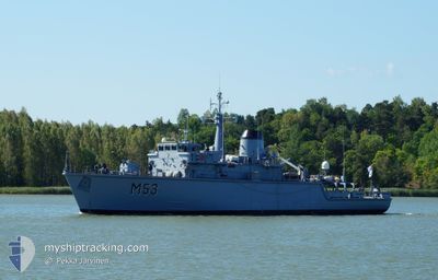
NATO WARSHIP M53
Military ops
Current Trip
Unknown
| Time Travelled | 3 days |
|---|---|
| Remaining Time | --- |
| Distance Travelled | 548.54 nm |
| Remaining Distance | --- |
| AVG Speed | 6.7 Knopen |
| MAX Speed | 15.3 Knopen |
| AVG Wind | 19.4 knots |
| MAX Wind | 32.5 knots |
| MIN Temp | 8.9°C / 48.02°F |
| MAX Temp | 15.9°C / 60.62°F |
| Diepgang | 0 M |
| Positie ontvangen | 1 h, 45 m geleden |
Current Position
| Lengtegraad | --- |
|---|---|
| Breedtegraat | --- |
| Status | Under way using engine |
| Snelheid | 9.5 Knopen |
| Koers | 71.2° |
| Gebied | Kattegat |
| Station | T-AIS |
| Positie ontvangen | 1 h, 45 m geleden |
Info
Information
The current position of NATO WARSHIP M53 is in Kattegat with coordinates 55.52518° / 15.24833° as reported on 2024-10-03 17:38 by AIS to our vessel tracker app. The vessel's current speed is 9.5 Knopen
The vessel NATO WARSHIP M53 (MMSI: 277228000) is a Military ops It's sailing under the flag of [LT] Lithuania.
In this page you can find informations about the vessels current position, last detected port calls, and current voyage information. If the vessels is not in coverage by AIS you will find the latest position.
The current position of NATO WARSHIP M53 is detected by our AIS receivers and we are not responsible for the reliability of the data. The last position was recorded while the vessel was in Coverage by the Ais receivers of our vessel tracking app.
Weather
| Temperature | 12.9°C / 55.22°F |
|---|---|
| Wind Speed | 23 knots |
| Direction | 35° NE |
| Pressure | 1017.9 hPa |
| Humidity | 70.2 % |
| Cloud Coverage | 85 % |
Featured Company
Last Port Calls
| Port | Arrival | Departure | Time In Port |
|---|---|---|---|
| 2024-09-30 12:22 | 2024-09-30 13:23 | 1 h | |
| 2024-09-25 15:30 | 2024-09-30 11:10 | 4 d | |
| 2024-09-20 09:59 | 2024-09-23 10:16 | 3 d | |
| 2024-09-17 09:29 | |||
| 2024-09-06 10:32 | 2024-09-08 22:12 | 2 d | |
| 2024-08-22 09:01 | 2024-09-02 15:14 | 11 d | |
| 2024-08-08 08:15 | 2024-08-12 10:58 | 4 d | |
| 2024-08-02 08:09 | 2024-08-05 10:09 | 3 d |
Last Trips
| Origin | Departure | Destination | Arrival | Distance | |
|---|---|---|---|---|---|
| 2024-09-30 11:10 | 2024-09-30 12:22 | 9.36 nm | |||
| 2024-09-23 10:16 | 2024-09-25 15:30 | 336.32 nm | |||
| 2024-09-08 22:12 | 2024-09-17 09:29 | 1106.30 nm | |||
| 2024-09-02 15:14 | 2024-09-06 10:32 | 688.03 nm | |||
| 2024-08-12 10:58 | 2024-08-22 09:01 | 635.99 nm | |||
| 2024-08-05 10:09 | 2024-08-08 08:15 | 277.49 nm | |||
| 2024-07-29 10:22 | 2024-08-02 08:09 | 253.54 nm |
Events
| Tijd | Evenement | Details | Positie / Bestemming | Info |
|---|---|---|---|---|
| 2024-10-03 17:38 | Buitenbereik |
55.52518 / 15.24833
Kattegat
|
Snelheid: 9.5 kn Koers: 71.2° |
|
| 2024-10-03 10:06 | Start beweging | 5.1 nm, South West of ROENNE |
55.05085 / 14.56323
|
Snelheid: 4.6 kn Koers: 25° |
| 2024-10-03 10:03 | Stop beweging | 5.15 nm, South West of ROENNE |
55.04899 / 14.56355
|
Snelheid: 0.1 kn Koers: 23° |
| 2024-10-03 05:31 | Gevonden in zee | Danish part of the Kattegat |
54.96600 / 14.00273
Kattegat
|
Snelheid: 8.4 kn Koers: 74° |
| 2024-10-03 05:28 | Gevonden in zee | Swedish part of the Baltic Sea |
54.96393 / 13.99038
Baltic Sea
|
Snelheid: 9.2 kn Koers: 70.4° |
| 2024-10-02 22:23 | Wijzig zee gebeid | German part of the Baltic Sea Danish part of the Baltic Sea |
54.58543 / 12.32664
Baltic Sea
|
Snelheid: 8.7 kn Koers: 55.6° |
| 2024-10-02 22:13 | Wijzig zee gebeid | Danish part of the Baltic Sea German part of the Baltic Sea |
54.56839 / 12.29973
Baltic Sea
|
Snelheid: 8.6 kn Koers: 19.7° |
| 2024-10-02 20:46 | Gevonden in zee | German part of the Baltic Sea |
54.40761 / 12.11736
Baltic Sea
|
Snelheid: 8.5 kn Koers: 92.5° |
| 2024-10-02 18:46 | Gevonden in zee | Danish part of the Baltic Sea |
54.41891 / 11.62734
Baltic Sea
|
Snelheid: 9.1 kn Koers: 91.2° |
| 2024-10-02 16:32 | Start beweging | 9.98 nm, South East of PUTTGARDEN |
54.43109 / 11.48591
|
Snelheid: 3.7 kn Koers: 103° |