
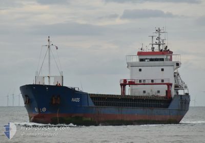
NAOS
General Cargo
Current Trip
| Time Travelled | 5 days |
|---|---|
| Remaining Time | --- |
| Distance Travelled | 383.49 nm |
| Remaining Distance | --- |
| AVG Speed | 9.3 Knopen |
| MAX Speed | 12.2 Knopen |
| AVG Wind | 10 knots |
| MAX Wind | 17.9 knots |
| MIN Temp | -4.3°C / 24.26°F |
| MAX Temp | 4.7°C / 40.46°F |
| Diepgang | 4.1 M |
| Positie ontvangen | 1 m geleden |
Current Position
| Lengtegraad | --- |
|---|---|
| Breedtegraat | --- |
| Status | Moored |
| Snelheid | |
| Koers | 120° |
| Gebied | North Sea |
| Station | T-AIS |
| Positie ontvangen | 1 m geleden |
Info
Information
The current position of NAOS is in North Sea with coordinates 51.62353° / 0.79188° as reported on 2025-02-18 12:28 by AIS to our vessel tracker app. The vessel's current speed is 0 Knopen
The vessel NAOS (IMO: 9136137, MMSI: 305269000) is a General Cargo that was built in 1996 ( 29 Jaar oud ). It's sailing under the flag of [AG] Antigua Barbuda.
In this page you can find informations about the vessels current position, last detected port calls, and current voyage information. If the vessels is not in coverage by AIS you will find the latest position.
The current position of NAOS is detected by our AIS receivers and we are not responsible for the reliability of the data. The last position was recorded while the vessel was in Coverage by the Ais receivers of our vessel tracking app.
The current draught of NAOS as reported by AIS is 4.1 meters
Weather
| Temperature | 4.2°C / 39.56°F |
|---|---|
| Wind Speed | 15 knots |
| Direction | 107° ESE |
| Pressure | 1022.2 hPa |
| Humidity | 65.1 % |
| Cloud Coverage | 58 % |
Featured Company
Last Port Calls
| Port | Arrival | Departure | Time In Port |
|---|---|---|---|
| 2025-02-11 08:16 | 2025-02-12 19:10 | 1 d | |
| 2025-02-09 17:29 | 2025-02-10 20:09 | 1 d | |
| 2025-02-07 05:45 | 2025-02-08 03:08 | 21 h | |
| 2025-02-04 23:11 | 2025-02-05 20:00 | 20 h | |
| 2025-01-24 07:47 | 2025-01-30 17:04 | 6 d | |
| 2025-01-19 16:52 | 2025-01-20 20:55 | 1 d | |
| 2025-01-13 23:09 | 2025-01-15 10:07 | 1 d | |
| 2024-12-31 09:20 | 2025-01-03 21:34 | 3 d | |
| 2024-12-26 20:44 | 2024-12-28 00:05 | 1 d | |
| 2024-12-15 18:16 | 2024-12-23 07:32 | 7 d |
Last Trips
| Origin | Departure | Destination | Arrival | Distance | |
|---|---|---|---|---|---|
| 2025-02-10 21:09 | 2025-02-11 09:16 | 101.85 nm | |||
| 2025-02-08 04:08 | 2025-02-09 18:29 | 321.94 nm | |||
| 2025-02-05 21:00 | 2025-02-07 06:45 | 328.20 nm | |||
| 2025-01-30 17:04 | 2025-02-05 00:11 | 1206.00 nm | |||
| 2025-01-20 20:55 | 2025-01-24 07:47 | 828.30 nm | |||
| 2025-01-15 11:07 | 2025-01-19 16:52 | 979.64 nm | |||
| 2025-01-03 21:34 | 2025-01-14 00:09 | 1061.90 nm | |||
| 2024-12-28 01:05 | 2024-12-31 09:20 | 818.28 nm | |||
| 2024-12-23 07:32 | 2024-12-26 21:44 | 605.26 nm | |||
| 2024-12-15 18:08 | 2024-12-15 18:16 | 0.78 nm |
Events
| Tijd | Evenement | Details | Positie / Bestemming | Info |
|---|---|---|---|---|
| 2025-02-17 11:00 | Draught Changed | 4.1 5.2 |
51.62351 / .79189
GB IPS
|
Snelheid: Koers: 120° |
| 2025-02-17 11:00 | Destination Changed | GB IPS CREEKSEA |
51.62351 / .79189
GB IPS
|
Snelheid: Koers: 120° |
| 2025-02-17 11:00 | ETA Changed | 2025/02/20 02:00 2025/02/14 16:00 |
51.62351 / .79189
GB IPS
|
Snelheid: Koers: 120° |
| 2025-02-15 11:44 | Status Changed | Moored Under way using engine |
51.62350 / .79190
CREEKSEA
|
Snelheid: Koers: 119° |
| 2025-02-15 11:34 | Stop beweging | 0.85 nm, West of BURNHAM ON CROUCH |
51.62423 / .79186
CREEKSEA
|
Snelheid: 0.2 kn Koers: 119° |
| 2025-02-15 08:17 | Start beweging | 8.45 nm, East of F HALLS COMPANY BOAT |
51.84194 / 1.50264
CREEKSEA
|
Snelheid: 3.1 kn Koers: 100° |
| 2025-02-15 07:59 | Status Changed | Under way using engine At anchor |
51.84321 / 1.50632
CREEKSEA
|
Snelheid: 0.8 kn Koers: 172° |
| 2025-02-15 02:22 | Status Changed | At anchor Default |
51.84518 / 1.50812
CREEKSEA
|
Snelheid: 0.3 kn Koers: 185° |
| 2025-02-15 02:16 | Status Changed | Default At anchor |
51.84534 / 1.50762
CREEKSEA
|
Snelheid: 0.1 kn Koers: 186° |
| 2025-02-14 19:30 | Status Changed | At anchor Default |
51.84478 / 1.50568
CREEKSEA
|
Snelheid: 0.1 kn Koers: 131° |