
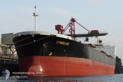
NAN XIN 7
Bulk Carrier
Current Trip
| Trip Time | 25 days |
|---|---|
| Trip Distance | 4772.50 nm |
| AVG Speed | 10.5 Knopen |
| MAX Speed | 15 Knopen |
| Diepgang | 13.8 M |
| AVG Wind | 11.9 knots |
| MAX Wind | 35 knots |
| MIN Temp | -1.8°C / 28.76°F |
| MAX Temp | 29.6°C / 85.28°F |
| Positie ontvangen | 9 d geleden |
Current Position
| Lengtegraad | --- |
|---|---|
| Breedtegraat | --- |
| Status | Under way using engine |
| Snelheid | 13.1 Knopen |
| Koers | 4° |
| Gebied | Eastern China Sea |
| Station | T-AIS |
| Positie ontvangen | 9 d geleden |
Info
Information
The current position of NAN XIN 7 is in Eastern China Sea with coordinates 25.42395° / 122.30674° as reported on 2025-11-30 08:26 by AIS to our vessel tracker app. The vessel's current speed is 13.1 Knopen and is currently inside the port of SHANHAIGUAN.
The vessel NAN XIN 7 (IMO: 9223198, MMSI: 414277000) is a Bulk Carrier that was built in 2001 ( 24 Jaar oud ). It's sailing under the flag of [CN] China.
In this page you can find informations about the vessels current position, last detected port calls, and current voyage information. If the vessels is not in coverage by AIS you will find the latest position.
The current position of NAN XIN 7 is detected by our AIS receivers and we are not responsible for the reliability of the data. The last position was recorded while the vessel was in Coverage by the Ais receivers of our vessel tracking app.
The current draught of NAN XIN 7 as reported by AIS is 13.8 meters
Weather
| Temperature | 5.4°C / 41.72°F |
|---|---|
| Wind Speed | 5 knots |
| Direction | 119° ESE |
| Pressure | 1019 hPa |
| Humidity | 47.1 % |
| Cloud Coverage | 40 % |
Featured Company
Last Port Calls
| Port | Arrival | Departure | Time In Port |
|---|---|---|---|
| 2025-12-07 14:09 | |||
| 2025-11-08 02:48 | 2025-11-11 17:44 | 3 d | |
| 2025-10-20 10:08 | 2025-10-22 10:08 | 1 d | |
| 2025-10-02 12:00 |
Events
| Tijd | Evenement | Details | Positie / Bestemming | Info |
|---|---|---|---|---|
| 2025-12-07 06:09 | Aankomsthaven |
|
39.95899 / 119.83029
[CN] SHANHAIGUAN
|
Snelheid: 4.5 kn Koers: 324° |
| 2025-12-05 14:25 | Start beweging | 8.61 nm, South East of LIANYUNGANG |
34.61122 / 119.56159
LIANYUNGANG CN
|
Snelheid: 3.8 kn Koers: 98° |
| 2025-12-03 08:21 | Stop beweging | 8.67 nm, South East of LIANYUNGANG |
34.60912 / 119.55866
LIANYUNGANG CN
|
Snelheid: Koers: 295° |
| 2025-12-03 04:41 | Start beweging | 20.53 nm, North East of LIANYUNGANG |
34.91862 / 119.84416
LIANYUNGANG CN
|
Snelheid: 5.7 kn Koers: 220° |
| 2025-12-03 01:08 | Stop beweging | 20.96 nm, North East of LIANYUNGANG |
34.92480 / 119.84987
LIANYUNGANG CN
|
Snelheid: 0.1 kn Koers: 18° |
| 2025-11-30 08:27 | Status Changed | Default Under way using engine |
25.42700 / 122.30692
LIANYUNGANG CN
|
Snelheid: 13.1 kn Koers: 4° |
| 2025-11-30 08:26 | Status Changed | Under way using engine Default |
25.42395 / 122.30674
LIANYUNGANG CN
|
Snelheid: 13.2 kn Koers: 8° |
| 2025-11-30 08:26 | Buitenbereik |
25.42395 / 122.30674
Eastern China Sea
LIANYUNGANG CN
|
Snelheid: 13.1 kn Koers: 4° |
|
| 2025-11-30 07:41 | Status Changed | Default Under way using engine |
25.25818 / 122.27986
LIANYUNGANG CN
|
Snelheid: 13.2 kn Koers: 11.2° |
| 2025-11-30 07:19 | Status Changed | Under way using engine Default |
25.17864 / 122.26876
LIANYUNGANG CN
|
Snelheid: 13.7 kn Koers: 6° |