
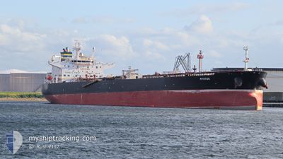
MYRTOS
Crude Oil Tanker
Current Trip
| Time Travelled | 17 days |
|---|---|
| Remaining Time | 4 h, 13 mins |
| Distance Travelled | 2884.74 nm |
| Remaining Distance | 26.54 nm |
| AVG Speed | 11.5 Knopen |
| MAX Speed | 11.5 Knopen |
| AVG Wind | 7.9 knots |
| MAX Wind | 25.3 knots |
| MIN Temp | 24.6°C / 76.28°F |
| MAX Temp | 30.3°C / 86.54°F |
| Diepgang | 12.7 M |
| Positie ontvangen | 7 d geleden |
Current Position
| Lengtegraad | 38.60111° |
|---|---|
| Breedtegraat | 22.56040° |
| Status | Under way using engine |
| Snelheid | 7 Knopen |
| Koers | 296.3° |
| Gebied | Red Sea |
| Station | T-AIS |
| Positie ontvangen | 7 d geleden |
Info
Information
The current position of MYRTOS is in Red Sea with coordinates 22.56040° / 38.60111° as reported on 2024-04-28 22:37 by AIS to our vessel tracker app. The vessel's current speed is 7 Knopen and is heading at the port of RABIGH. The estimated time of arrival as calculated by MyShipTracking vessel tracking app is 2024-05-06 17:04 LT
The vessel MYRTOS (IMO: 9389100, MMSI: 249592000) is a Crude Oil Tanker that was built in 2009 ( 15 Jaar oud ). It's sailing under the flag of [MT] Malta.
In this page you can find informations about the vessels current position, last detected port calls, and current voyage information. If the vessels is not in coverage by AIS you will find the latest position.
The current position of MYRTOS is detected by our AIS receivers and we are not responsible for the reliability of the data. The last position was recorded while the vessel was in Coverage by the Ais receivers of our vessel tracking app.
The current draught of MYRTOS as reported by AIS is 12.7 meters
Weather
| Temperature | 27.8°C / 82.04°F |
|---|---|
| Wind Speed | 13 knots |
| Direction | 309° NW |
| Pressure | 1009.6 hPa |
| Humidity | 67.4 % |
| Cloud Coverage | --- |
Featured Company
Last Port Calls
| Port | Arrival | Departure | Time In Port |
|---|---|---|---|
| 2024-04-18 07:57 | 2024-04-19 07:21 | 23 h | |
| 2024-04-01 05:08 | 2024-04-01 14:50 | 9 h | |
| 2024-03-16 12:42 | 2024-03-19 21:41 | 3 d | |
| 2024-03-08 09:59 | 2024-03-09 15:48 | 1 d |
Most Visited Ports (Last year)
| Port | Arrivals | |
|---|---|---|
| 4 | ||
| 2 | ||
| 2 | ||
| 2 | ||
| 2 | ||
| 1 |
Last Trips
| Origin | Departure | Destination | Arrival | Distance | |
|---|---|---|---|---|---|
| 2024-03-19 22:41 | 2024-04-18 10:57 | 7041.59 nm | |||
| 2024-03-19 22:41 | 2024-04-01 07:08 | 3397.99 nm | |||
| 2024-03-09 16:48 | 2024-03-16 13:42 | 801.13 nm | |||
| 2024-02-17 06:45 | 2024-03-08 10:59 | 5046.71 nm |
Events
| Tijd | Evenement | Details | Positie / Bestemming | Info |
|---|---|---|---|---|
| 2024-05-06 11:44 | Stop beweging |
22.68667 / 38.48333
SA RAB
|
Snelheid: Koers: -1° |
|
| 2024-05-06 09:27 | Start beweging |
22.65344 / 38.61465
SA RAB
|
Snelheid: 3.1 kn Koers: 290° |
|
| 2024-05-06 04:00 | Stop beweging |
22.66849 / 38.56502
SA RAB
|
Snelheid: 0.3 kn Koers: 266° |
|
| 2024-05-06 02:54 | Start beweging |
22.68139 / 38.60592
SA RAB
|
Snelheid: 3.8 kn Koers: 258° |
|
| 2024-05-05 20:20 | Stop beweging |
22.67506 / 38.57020
SA RAB
|
Snelheid: 0.3 kn Koers: 324° |
|
| 2024-05-05 18:54 | Start beweging |
22.64712 / 38.61178
SA RAB
|
Snelheid: 3.1 kn Koers: 300° |
|
| 2024-05-05 13:50 | Stop beweging |
22.67833 / 38.54500
SA RAB
|
Snelheid: Koers: -1° |
|
| 2024-05-05 12:39 | Start beweging |
22.67235 / 38.60355
SA RAB
|
Snelheid: 3.5 kn Koers: 265° |
|
| 2024-05-05 09:26 | Stop beweging |
22.67167 / 38.57834
SA RAB
|
Snelheid: Koers: -1° |
|
| 2024-05-05 06:31 | Start beweging |
22.49735 / 38.61518
SA RAB
|
Snelheid: 3.8 kn Koers: 346° |