
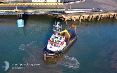
MTS VALOUR
Tug
Current Trip
| Time Travelled | 2 days |
|---|---|
| Remaining Time | 8 h, 58 mins |
| Distance Travelled | 256.36 nm |
| Remaining Distance | 34.74 nm |
| AVG Speed | 5 Knopen |
| MAX Speed | 7.6 Knopen |
| AVG Wind | 8.2 knots |
| MAX Wind | 12.1 knots |
| MIN Temp | 5.6°C / 42.08°F |
| MAX Temp | 8.4°C / 47.12°F |
| Diepgang | 2.4 M |
| Positie ontvangen | 10 h, 1 m geleden |
Current Position
| Lengtegraad | --- |
|---|---|
| Breedtegraat | --- |
| Status | Restricted manoeuverability |
| Snelheid | 3.5 Knopen |
| Koers | 95° |
| Gebied | Bristol Channel |
| Station | T-AIS |
| Positie ontvangen | 10 h, 1 m geleden |
Info
Information
The current position of MTS VALOUR is in Bristol Channel with coordinates 51.45134° / -4.42192° as reported on 2025-03-01 19:44 by AIS to our vessel tracker app. The vessel's current speed is 3.5 Knopen and is heading at the port of BARRY. The estimated time of arrival as calculated by MyShipTracking vessel tracking app is 2025-03-02 14:43 LT
The vessel MTS VALOUR (IMO: 9407299, MMSI: 235040596) is a Tug It's sailing under the flag of [GB] United Kingdom.
In this page you can find informations about the vessels current position, last detected port calls, and current voyage information. If the vessels is not in coverage by AIS you will find the latest position.
The current position of MTS VALOUR is detected by our AIS receivers and we are not responsible for the reliability of the data. The last position was recorded while the vessel was in Coverage by the Ais receivers of our vessel tracking app.
The current draught of MTS VALOUR as reported by AIS is 2.4 meters
Weather
| Temperature | 6.7°C / 44.06°F |
|---|---|
| Wind Speed | 5 knots |
| Direction | 89° E |
| Pressure | 1035.3 hPa |
| Humidity | 80 % |
| Cloud Coverage | 100 % |
Featured Company
Last Port Calls
| Port | Arrival | Departure | Time In Port |
|---|---|---|---|
| 2025-02-17 09:46 | 2025-02-27 11:18 | 10 d | |
| 2025-02-12 18:54 | 2025-02-13 18:09 | 23 h | |
| 2025-02-12 14:51 | 2025-02-12 15:10 | 19 m | |
| 2025-02-11 12:52 | 2025-02-11 12:56 | 3 m | |
| 2025-02-10 13:28 | 2025-02-10 13:53 | 25 m | |
| 2025-02-10 13:08 | 2025-02-10 13:16 | 8 m | |
| 2025-02-10 12:51 | 2025-02-10 13:01 | 9 m | |
| 2025-02-10 12:31 | 2025-02-10 12:39 | 8 m | |
| 2025-02-10 12:04 | 2025-02-10 12:22 | 17 m | |
| 2025-02-10 11:04 | 2025-02-10 11:47 | 43 m |
Last Trips
| Origin | Departure | Destination | Arrival | Distance | |
|---|---|---|---|---|---|
| 2025-02-13 18:09 | 2025-02-17 09:46 | 659.42 nm | |||
| 2025-02-12 15:10 | 2025-02-12 18:54 | 9.94 nm | |||
| 2025-02-11 12:56 | 2025-02-12 14:51 | 42.76 nm | |||
| 2025-02-10 13:53 | 2025-02-11 12:52 | 27.87 nm | |||
| 2025-02-10 13:16 | 2025-02-10 13:28 | 0.21 nm | |||
| 2025-02-10 13:01 | 2025-02-10 13:08 | 0.24 nm | |||
| 2025-02-10 12:39 | 2025-02-10 12:51 | 0.54 nm | |||
| 2025-02-10 12:22 | 2025-02-10 12:31 | 0.32 nm | |||
| 2025-02-10 11:47 | 2025-02-10 12:04 | 0.58 nm | |||
| 2025-02-10 10:07 | 2025-02-10 11:04 | 1.22 nm |
Events
| Tijd | Evenement | Details | Positie / Bestemming | Info |
|---|---|---|---|---|
| 2025-03-01 22:51 | Stop beweging | 7.67 nm, West of PORT TALBOT ANCH |
51.43620 / -4.28554
BARRY TOW >200M
|
Snelheid: 0.3 kn Koers: 79° |
| 2025-03-01 19:52 | Status Changed | Default Restricted manoeuverability |
51.45022 / -4.41003
BARRY TOW >200M
|
Snelheid: 3.5 kn Koers: 95° |
| 2025-03-01 19:44 | Buitenbereik |
51.45134 / -4.42192
Bristol Channel
BARRY TOW >200M
|
Snelheid: 3.5 kn Koers: 100.2° |
|
| 2025-03-01 19:22 | Status Changed | Restricted manoeuverability Default |
51.45503 / -4.45724
BARRY TOW >200M
|
Snelheid: 4 kn Koers: 100° |
| 2025-03-01 19:20 | Status Changed | Default Restricted manoeuverability |
51.45552 / -4.46188
BARRY TOW >200M
|
Snelheid: 3.7 kn Koers: 99° |
| 2025-03-01 18:49 | Status Changed | Restricted manoeuverability Default |
51.46122 / -4.51725
BARRY TOW >200M
|
Snelheid: 4.4 kn Koers: 105° |
| 2025-03-01 18:47 | Status Changed | Default Restricted manoeuverability |
51.46159 / -4.52046
BARRY TOW >200M
|
Snelheid: 4.5 kn Koers: 105° |
| 2025-03-01 18:38 | Status Changed | Restricted manoeuverability Default |
51.46364 / -4.53908
BARRY TOW >200M
|
Snelheid: 4.7 kn Koers: 107° |
| 2025-03-01 18:08 | Status Changed | Default Restricted manoeuverability |
51.47144 / -4.60084
BARRY TOW >200M
|
Snelheid: 5 kn Koers: 93.7° |
| 2025-03-01 17:47 | Wijzig zee gebeid | United Kingdom part of the Bristol Channel United Kingdom part of the Celtic Sea |
51.47305 / -4.64691
Bristol Channel
BARRY TOW >200M
|
Snelheid: 5.2 kn Koers: 91.9° |