
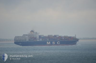
MSC TOMOKO
Container Ship
Current Trip
| Time Travelled | 2 days |
|---|---|
| Remaining Time | 12 h, 51 mins |
| Distance Travelled | 680.53 nm |
| Remaining Distance | 192.80 nm |
| AVG Speed | 13.6 Knopen |
| MAX Speed | 16.8 Knopen |
| AVG Wind | 7.8 knots |
| MAX Wind | 14 knots |
| MIN Temp | 8.4°C / 47.12°F |
| MAX Temp | 23.7°C / 74.66°F |
| Diepgang | 12 M |
| Positie ontvangen | 2 d geleden |
Current Position
| Lengtegraad | --- |
|---|---|
| Breedtegraat | --- |
| Status | Under way using engine |
| Snelheid | 10.2 Knopen |
| Koers | 212° |
| Gebied | Gulf of Mexico |
| Station | T-AIS |
| Positie ontvangen | 2 d geleden |
Info
Information
The current position of MSC TOMOKO is in Gulf of Mexico with coordinates 29.79059° / -90.01342° as reported on 2025-12-10 03:12 by AIS to our vessel tracker app. The vessel's current speed is 10.2 Knopen and is heading at the port of FREEPORT (BS). The estimated time of arrival as calculated by MyShipTracking vessel tracking app is 2025-12-12 17:13 LT
The vessel MSC TOMOKO (IMO: 9309461, MMSI: 354315000) is a Container Ship that was built in 2006 ( 19 Jaar oud ). It's sailing under the flag of [PA] Panama.
In this page you can find informations about the vessels current position, last detected port calls, and current voyage information. If the vessels is not in coverage by AIS you will find the latest position.
The current position of MSC TOMOKO is detected by our AIS receivers and we are not responsible for the reliability of the data. The last position was recorded while the vessel was in Coverage by the Ais receivers of our vessel tracking app.
The current draught of MSC TOMOKO as reported by AIS is 12 meters
Weather
| Temperature | 23.1°C / 73.58°F |
|---|---|
| Wind Speed | 8 knots |
| Direction | 44° NE |
| Pressure | 1018.1 hPa |
| Humidity | 65.5 % |
| Cloud Coverage | 98 % |
Featured Company
Last Port Calls
| Port | Arrival | Departure | Time In Port |
|---|---|---|---|
| 2025-12-08 17:58 | 2025-12-10 03:23 | 1 d | |
| 2025-12-04 12:47 | 2025-12-07 00:35 | 2 d | |
| 2025-11-30 14:36 | 2025-12-01 20:25 | 1 d | |
| 2025-11-23 04:03 | 2025-11-24 06:11 | 1 d | |
| 2025-11-21 18:55 | 2025-11-22 04:42 | 9 h | |
| 2025-11-11 03:50 | 2025-11-11 20:02 | 16 h | |
| 2025-11-08 17:08 | 2025-11-09 06:44 | 13 h | |
| 2025-11-06 20:43 | 2025-11-08 06:52 | 1 d | |
| 2025-11-02 21:16 | 2025-11-04 14:29 | 1 d | |
| 2025-10-31 07:56 | 2025-11-02 15:52 | 2 d |
Most Visited Ports (Last year)
| Port | Arrivals | |
|---|---|---|
| 11 | ||
| 8 | ||
| 6 | ||
| 6 | ||
| 6 | ||
| 6 |
Last Trips
| Origin | Departure | Destination | Arrival | Distance | |
|---|---|---|---|---|---|
| 2025-12-06 18:35 | 2025-12-08 11:58 | 443.47 nm | |||
| 2025-12-01 14:25 | 2025-12-04 06:47 | 524.39 nm | |||
| 2025-11-24 01:11 | 2025-11-30 08:36 | 1390.23 nm | |||
| 2025-11-21 23:42 | 2025-11-22 23:03 | 98.45 nm | |||
| 2025-11-11 20:02 | 2025-11-21 13:55 | 4022.65 nm | |||
| 2025-11-09 07:44 | 2025-11-11 03:50 | 812.92 nm | |||
| 2025-11-08 07:52 | 2025-11-08 18:08 | 175.24 nm | |||
| 2025-11-04 15:29 | 2025-11-06 21:43 | 557.99 nm | |||
| 2025-11-02 16:52 | 2025-11-02 22:16 | 83.59 nm | |||
| 2025-10-27 08:44 | 2025-10-31 08:56 | 463.15 nm |
Events
| Tijd | Evenement | Details | Positie / Bestemming | Info |
|---|---|---|---|---|
| 2025-12-10 03:23 | Vertrekhaven |
|
29.75261 / -90.02286
USMSY>BSFPO
|
Snelheid: 14.2 kn Koers: 190° |
| 2025-12-10 03:15 | Status Changed | Default Under way using engine |
29.78270 / -90.01915
[US] NEW ORLEANS
|
Snelheid: 10.2 kn Koers: 212° |
| 2025-12-10 03:12 | Buitenbereik |
29.79059 / -90.01342
Gulf of Mexico
USMSY>BSFPO
|
Snelheid: 10.2 kn Koers: 211° |
|
| 2025-12-10 01:08 | Draught Changed | 12 11.3 |
29.92106 / -90.06860
[US] NEW ORLEANS
|
Snelheid: 10.8 kn Koers: 49° |
| 2025-12-10 01:08 | Destination Changed | USMSY>BSFPO USHOU>USMSY |
29.92106 / -90.06860
[US] NEW ORLEANS
|
Snelheid: 10.8 kn Koers: 49° |
| 2025-12-10 01:08 | ETA Changed | 2025/12/12 23:00 2025/12/08 00:00 |
29.92106 / -90.06860
[US] NEW ORLEANS
|
Snelheid: 10.8 kn Koers: 49° |
| 2025-12-10 00:54 | Start beweging |
29.90933 / -90.10487
[US] NEW ORLEANS
|
Snelheid: 4.7 kn Koers: 86° |
|
| 2025-12-10 00:38 | Status Changed | Under way using engine Default |
29.91165 / -90.10858
[US] NEW ORLEANS
|
Snelheid: Koers: 271° |
| 2025-12-10 00:38 | Binnenbereik |
29.91160 / -90.10850
Gulf of Mexico
[US] NEW ORLEANS
|
Snelheid: 0.4 kn Koers: 140.1° |
|
| 2025-12-09 09:28 | Buitenbereik |
29.91167 / -90.10860
Gulf of Mexico
[US] NEW ORLEANS
|
Snelheid: Koers: 326.6° |