
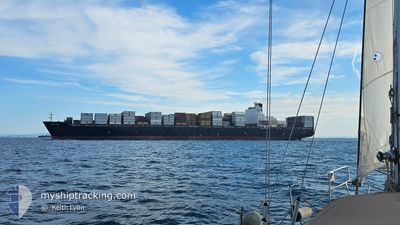
MSC TIANJIN
Container Ship
Current Trip
| Time Travelled | 2 days |
|---|---|
| Remaining Time | 10 mins |
| Distance Travelled | 400.47 nm |
| Remaining Distance | 17.86 nm |
| AVG Speed | 12.8 Knopen |
| MAX Speed | 15.4 Knopen |
| AVG Wind | 6.1 knots |
| MAX Wind | 14 knots |
| MIN Temp | 12.9°C / 55.22°F |
| MAX Temp | 24.3°C / 75.74°F |
| Diepgang | 12.3 M |
| Positie ontvangen | 33 m geleden |
Current Position
| Lengtegraad | --- |
|---|---|
| Breedtegraat | --- |
| Status | Under way using engine |
| Snelheid | 8.3 Knopen |
| Koers | 151° |
| Gebied | North Atlantic Ocean |
| Station | T-AIS |
| Positie ontvangen | 33 m geleden |
Info
Information
The current position of MSC TIANJIN is in North Atlantic Ocean with coordinates 26.54033° / -79.01983° as reported on 2026-01-08 20:13 by AIS to our vessel tracker app. The vessel's current speed is 8.3 Knopen and is heading at the port of FREEPORT (BS). The estimated time of arrival as calculated by MyShipTracking vessel tracking app is 2026-01-08 15:57 LT
The vessel MSC TIANJIN (IMO: 9285471, MMSI: 636019332) is a Container Ship that was built in 2005 ( 21 Jaar oud ). It's sailing under the flag of [LR] Liberia.
In this page you can find informations about the vessels current position, last detected port calls, and current voyage information. If the vessels is not in coverage by AIS you will find the latest position.
The current position of MSC TIANJIN is detected by our AIS receivers and we are not responsible for the reliability of the data. The last position was recorded while the vessel was in Coverage by the Ais receivers of our vessel tracking app.
The current draught of MSC TIANJIN as reported by AIS is 12.3 meters
Weather
| Temperature | 23.9°C / 75.02°F |
|---|---|
| Wind Speed | 11 knots |
| Direction | 110° ESE |
| Pressure | 1019.1 hPa |
| Humidity | 73.3 % |
| Cloud Coverage | 9 % |
Featured Company
Last Port Calls
| Port | Arrival | Departure | Time In Port |
|---|---|---|---|
| 2026-01-04 20:14 | 2026-01-06 00:58 | 1 d | |
| 2025-12-21 22:05 | 2025-12-22 21:11 | 23 h | |
| 2025-12-18 20:33 | 2025-12-20 05:29 | 1 d | |
| 2025-12-16 15:18 | 2025-12-17 14:54 | 23 h | |
| 2025-12-13 13:16 | 2025-12-14 16:13 | 1 d | |
| 2025-12-09 07:46 | 2025-12-10 13:08 | 1 d | |
| 2025-12-06 08:41 | 2025-12-08 08:37 | 1 d | |
| 2025-12-03 22:26 | 2025-12-05 13:24 | 1 d | |
| 2025-11-30 00:40 | 2025-11-30 17:55 | 17 h | |
| 2025-11-16 08:00 | 2025-11-17 04:32 | 20 h |
Most Visited Ports (Last year)
| Port | Arrivals | |
|---|---|---|
| 6 | ||
| 6 | ||
| 5 | ||
| 4 | ||
| 4 | ||
| 4 |
Last Trips
| Origin | Departure | Destination | Arrival | Distance | |
|---|---|---|---|---|---|
| 2025-12-22 21:11 | 2026-01-04 20:14 | 4138.01 nm | |||
| 2025-12-20 05:29 | 2025-12-21 22:05 | 386.43 nm | |||
| 2025-12-17 14:54 | 2025-12-18 20:33 | 174.90 nm | |||
| 2025-12-14 16:13 | 2025-12-16 15:18 | 400.02 nm | |||
| 2025-12-10 13:08 | 2025-12-13 13:16 | 185.43 nm | |||
| 2025-12-08 08:37 | 2025-12-09 07:46 | 310.25 nm | |||
| 2025-12-05 13:24 | 2025-12-06 08:41 | 174.72 nm | |||
| 2025-11-30 17:55 | 2025-12-03 22:26 | 721.35 nm | |||
| 2025-11-17 04:32 | 2025-11-30 00:40 | 4471.33 nm | |||
| 2025-11-14 04:14 | 2025-11-16 08:00 | 894.17 nm |
Events
| Tijd | Evenement | Details | Positie / Bestemming | Info |
|---|---|---|---|---|
| 2026-01-08 19:40 | Status Changed | Under way using engine Under way sailing |
26.60900 / -79.06266
USSAV>BSFPO
|
Snelheid: 10 kn Koers: 150° |
| 2026-01-08 19:29 | Start beweging | 17.7 nm, West of FREEPORT (BS) |
26.63483 / -79.07900
USSAV>BSFPO
|
Snelheid: 9.9 kn Koers: 149° |
| 2026-01-08 19:13 | Status Changed | Under way sailing Default |
26.66533 / -79.09750
USSAV>BSFPO
|
Snelheid: 0.9 kn Koers: 168° |
| 2026-01-08 19:10 | Status Changed | Default Under way sailing |
26.66650 / -79.09734
USSAV>BSFPO
|
Snelheid: 0.7 kn Koers: 174° |
| 2026-01-08 18:48 | Status Changed | Under way sailing Default |
26.66400 / -79.09316
USSAV>BSFPO
|
Snelheid: 0.6 kn Koers: 186° |
| 2026-01-08 18:25 | Status Changed | Default Under way sailing |
26.66150 / -79.08984
USSAV>BSFPO
|
Snelheid: 0.5 kn Koers: 175° |
| 2026-01-08 18:19 | Status Changed | Under way sailing Default |
26.66067 / -79.08916
USSAV>BSFPO
|
Snelheid: 0.5 kn Koers: 175° |
| 2026-01-08 18:15 | Status Changed | Default Under way sailing |
26.66033 / -79.08867
USSAV>BSFPO
|
Snelheid: 0.5 kn Koers: 177° |
| 2026-01-08 18:08 | Status Changed | Under way sailing Default |
26.65967 / -79.08783
USSAV>BSFPO
|
Snelheid: 0.5 kn Koers: 178° |
| 2026-01-08 18:06 | Status Changed | Default Under way sailing |
26.65950 / -79.08750
USSAV>BSFPO
|
Snelheid: 0.5 kn Koers: 178° |