
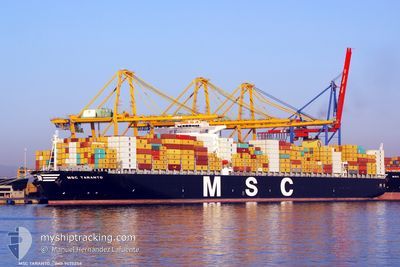
MSC TARANTO
Container Ship
Current Trip
| Time Travelled | 8 days |
|---|---|
| Remaining Time | --- |
| Distance Travelled | 3598.32 nm |
| Remaining Distance | --- |
| AVG Speed | 17.8 Knopen |
| MAX Speed | 20.1 Knopen |
| AVG Wind | 13.3 knots |
| MAX Wind | 22 knots |
| MIN Temp | 15.3°C / 59.54°F |
| MAX Temp | 29.6°C / 85.28°F |
| Diepgang | 14.6 M |
| Positie ontvangen | 2 d geleden |
Current Position
| Lengtegraad | 18.65809° |
|---|---|
| Breedtegraat | -34.56463° |
| Status | Under way using engine |
| Snelheid | 19.1 Knopen |
| Koers | 113.5° |
| Gebied | South Atlantic Ocean |
| Station | T-AIS |
| Positie ontvangen | 2 d geleden |
Info
Information
The current position of MSC TARANTO is in South Atlantic Ocean with coordinates -34.56463° / 18.65809° as reported on 2024-05-07 04:57 by AIS to our vessel tracker app. The vessel's current speed is 19.1 Knopen and is heading at the port of ABU DHABI. The estimated time of arrival as calculated by MyShipTracking vessel tracking app is 2024-05-18 15:00 LT
The vessel MSC TARANTO (IMO: 9475258, MMSI: 636092247) is a Container Ship that was built in 2011 ( 13 Jaar oud ). It's sailing under the flag of [LR] Liberia.
In this page you can find informations about the vessels current position, last detected port calls, and current voyage information. If the vessels is not in coverage by AIS you will find the latest position.
The current position of MSC TARANTO is detected by our AIS receivers and we are not responsible for the reliability of the data. The last position was recorded while the vessel was in Coverage by the Ais receivers of our vessel tracking app.
The current draught of MSC TARANTO as reported by AIS is 14.6 meters
Weather
| Temperature | 23.6°C / 74.48°F |
|---|---|
| Wind Speed | 10 knots |
| Direction | 331° NNW |
| Pressure | 1019.8 hPa |
| Humidity | 76.5 % |
| Cloud Coverage | --- |
Featured Company
Last Port Calls
| Port | Arrival | Departure | Time In Port |
|---|---|---|---|
| 2024-04-29 08:06 | 2024-05-01 01:02 | 1 d | |
| 2024-04-21 15:42 | 2024-04-22 07:43 | 16 h | |
| 2024-04-19 05:41 | 2024-04-19 22:58 | 17 h | |
| 2024-04-17 06:23 | 2024-04-18 04:34 | 22 h | |
| 2024-04-15 00:07 | 2024-04-16 20:06 | 1 d | |
| 2024-04-11 12:10 | 2024-04-12 02:58 | 14 h | |
| 2024-04-08 09:19 | 2024-04-10 17:43 | 2 d | |
| 2024-04-04 21:12 | 2024-04-08 05:27 | 3 d | |
| 2024-03-29 22:33 | 2024-04-02 01:37 | 3 d | |
| 2024-03-18 14:50 | 2024-03-20 07:32 | 1 d |
Last Trips
| Origin | Departure | Destination | Arrival | Distance | |
|---|---|---|---|---|---|
| 2024-04-22 08:43 | 2024-04-29 08:06 | 2700.42 nm | |||
| 2024-04-20 00:58 | 2024-04-21 16:42 | 354.42 nm | |||
| 2024-04-18 06:34 | 2024-04-19 07:41 | 358.64 nm | |||
| 2024-04-16 22:06 | 2024-04-17 08:23 | 161.45 nm | |||
| 2024-04-12 04:58 | 2024-04-15 02:07 | 222.52 nm | |||
| 2024-04-10 19:43 | 2024-04-11 14:10 | 234.97 nm | |||
| 2024-04-08 07:27 | 2024-04-08 11:19 | 52.86 nm | |||
| 2024-04-02 03:37 | 2024-04-04 23:12 | 496.59 nm | |||
| 2024-03-20 07:32 | 2024-03-29 23:33 | 4065.97 nm | |||
| 2024-02-24 19:02 | 2024-03-18 14:50 | 8185.06 nm |
Events
| Tijd | Evenement | Details | Positie / Bestemming | Info |
|---|---|---|---|---|
| 2024-05-07 05:02 | Status Changed | Default Under way using engine |
-34.57601 / 18.68771
AEAUH
|
Snelheid: 19.1 kn Koers: 113.5° |
| 2024-05-07 04:57 | Buitenbereik |
-34.56463 / 18.65809
South Atlantic Ocean
AEAUH
|
Snelheid: 19.1 kn Koers: 113.5° |
|
| 2024-05-07 03:26 | Status Changed | Under way using engine Default |
-34.33266 / 18.16471
AEAUH
|
Snelheid: 18.3 kn Koers: 138° |
| 2024-05-07 03:19 | Status Changed | Default Under way using engine |
-34.30667 / 18.13500
AEAUH
|
Snelheid: 18.5 kn Koers: 138° |
| 2024-05-07 01:37 | Draught Changed | 14.6 15.4 |
-33.89353 / 17.73204
AEAUH
|
Snelheid: 18.8 kn Koers: 138.8° |
| 2024-05-07 01:37 | Destination Changed | AEAUH CIABJ |
-33.89353 / 17.73204
AEAUH
|
Snelheid: 18.8 kn Koers: 138.8° |
| 2024-05-07 01:37 | ETA Changed | 2024/05/18 15:00 2024/04/29 06:00 |
-33.89353 / 17.73204
AEAUH
|
Snelheid: 18.8 kn Koers: 138.8° |
| 2024-05-07 01:25 | Status Changed | Under way using engine Default |
-33.84595 / 17.68491
CIABJ
|
Snelheid: 18.6 kn Koers: 140° |
| 2024-05-07 01:23 | Status Changed | Default Under way using engine |
-33.83676 / 17.67580
CIABJ
|
Snelheid: 18.8 kn Koers: 140.8° |
| 2024-05-07 01:08 | Wijzig zee gebeid | South African part of the South Atlantic Ocean Spanish (Canary Islands) part of the North Atlantic Ocean |
-33.77790 / 17.61722
South Atlantic Ocean
|
Snelheid: 18.5 kn Koers: 140.1° |